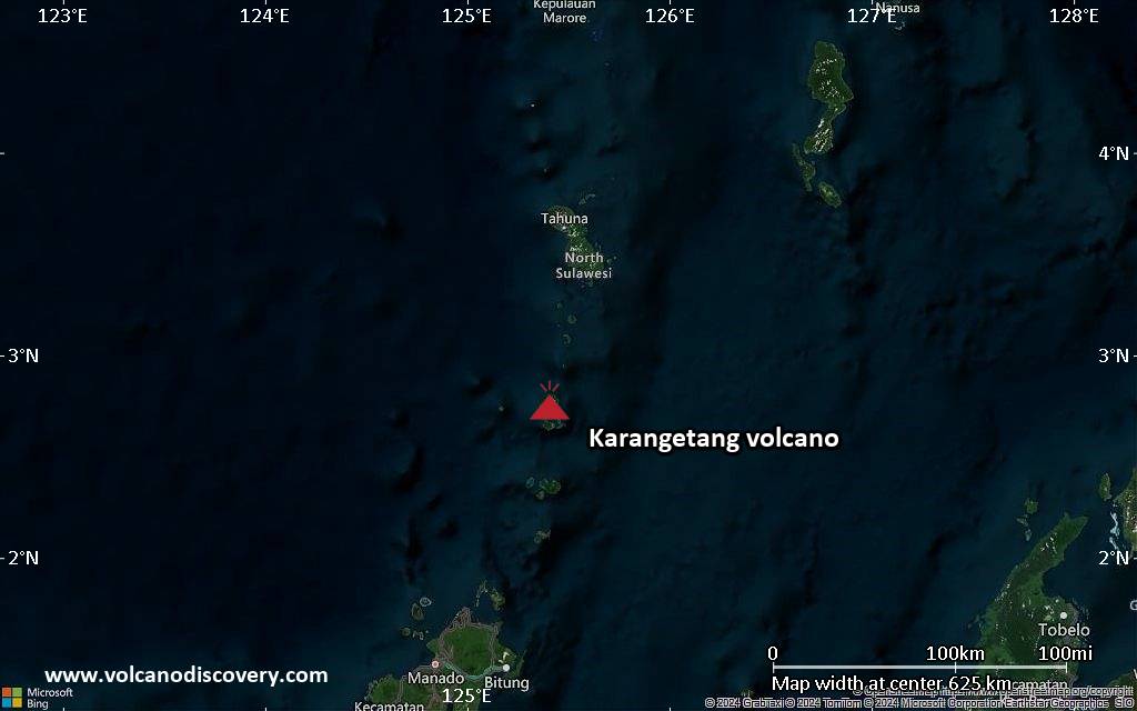
Karangetang Volcanic Ash Advisory: ash plume to 7,000 ft (2,100 m) as of Oct 26, 14:20 UTC

Explosive activity continues. The Volcanic Ash Advisory Center (VAAC) Darwin warned of a volcanic ash plume rising to an estimated 7000 ft (2100 m), or flight level 070.
Original VAAC bulletin:

FVAU05 at 14:44 UTC, 26/10/26 from ADRM
VA ADVISORY
DTG: 20261026/1445Z
VAAC: DARWIN
VOLCANO: KARANGETANG 267020
PSN: N0247 E12524
AREA: INDONESIA
SOURCE ELEV: 1797M AMSL
ADVISORY NR: 2026/20
INFO SOURCE: HIMAWARI-9, CVGHM
ERUPTION DETAILS: VA TO FL070 OBS AT 26/1420Z MOV W
OBS VA DTG: 26/1420Z
OBS VA CLD: SFC/FL070 N0245 E12527 - N0245 E12517 - N0251
E12517 - N0249 E12527 MOV W 05KT
FCST VA CLD +6 HR: 26/2020Z SFC/FL070 N0245 E12527 - N0231
E12509 - N0256 E12503 - N0249 E12527
FCST VA CLD +12 HR: 27/0220Z SFC/FL070 N0245 E12526 - N0231
E12509 - N0256 E12503 - N0249 E12527
FCST VA CLD +18 HR: 27/0820Z SFC/FL070 N0245 E12527 - N0237
E12520 - N0241 E12502 - N0306 E12513 - N0250 E12526
RMK: DISCRETE VA EMISSION IDENTIFIABLE ON SATELLITE IMAGERY.
REGULAR GROUND REPORTS INDICATE INTERMITTENT ERUPTIONS ARE
ONGOING. HEIGHT AND MOVEMENT BASED ON SATELLITE IMAGERY AND
MODEL GUIDANCE.
NXT ADVISORY: NO LATER THAN 20261026/1930Z=
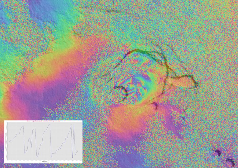
Kilauea volcano (Hawai’i): localised summit deformation at Kīlauea detected in a 12-day Sentinel-1D interferogram

Wrapped interferometric phase at Kīlauea, Hawaiʻi, from a Sentinel-1D VV pair spanning 24 September – 6 October 2026 (12-day temporal baseline). Inset: wrapped phase along a profile across the fringe pattern; the sawtooth shows three full phase wraps over the readable section, giving a total phase difference of 22.2 rad, equivalent to 9.8 cm of relative line-of-sight displacement. (image: Sentinel-1, processed by Martin Kelko)

The interferometric Sentinel-1D pair in VV polarisation of the volcano, acquired on 24 September and 6 October 2026, shows a compact set of concentric fringes confined to the summit caldera, superimposed on broad, long-wavelength phase gradients across the wider scene.

The displacement corresponds to 9.8 cm of relative displacement in the satellite line of sight over the 12-day interval. One full colour cycle corresponds to 2.77 cm of displacement in the satellite line of sight. Concentric fringes within the summit caldera indicate a localised deformation source. The broad, long-wavelength colour gradients elsewhere in the scene are consistent with tropospheric delay rather than ground motion, and the speckled areas are decorrelated, mainly over vegetated terrain

Sangay Volcanic Ash Advisory: ash plume to 20,000 ft (6,100 m) as of Oct 26, 05:00 UTC

Explosive activity continues. The Volcanic Ash Advisory Center (VAAC) Washington warned of a volcanic ash plume rising to an estimated 20000 ft (6100 m), or flight level 200.
Original VAAC bulletin:

FVXX24 at 05:29 UTC, 26/10/26 from KNES
VA ADVISORY
DTG: 20261026/0526Z

VAAC: WASHINGTON

VOLCANO: SANGAY 352090
PSN: S0200 W07820

AREA: ECUADOR

SOURCE ELEV: 17342 FT AMSL

ADVISORY NR: 2026/717

INFO SOURCE: GOES-19. VONA. WEBCAM. NWP MODELS.

ERUPTION DETAILS: ONGOING VA EMS

OBS VA DTG: 26/0500Z

OBS VA CLD: SFC/FL200 S0200 W07820 - S0201 W07820
- S0213 W07826 - S0208 W07832 - S0200 W07820 MOV
SW 10KT

FCST VA CLD +6HR: 26/1100Z SFC/FL200 S0200 W07820
- S0201 W07820 - S0219 W07829 - S0211 W07838 -
S0200 W07820

FCST VA CLD +12HR: 26/1700Z SFC/FL200 S0201 W07820 -
S0219 W07829 - S0211 W07838 - S0201 W07821 -
S0201 W07820

FCST VA CLD +18HR: 26/2300Z SFC/FL200 S0201
W07820 - S0219 W07829 - S0211 W07839 - S0201
W07820 - S0201 W07820

RMK: VA DETECTED ON STLT MOVG SW OF SUMMIT. STG
HOTSPOT ON SWIR. VONA INDICATES VA EMS. NO CHG
FCST TO MDL WINDS AT FL NXT 18 HR. ...KONON

NXT ADVISORY: WILL BE ISSUED BY 20261026/1130Z

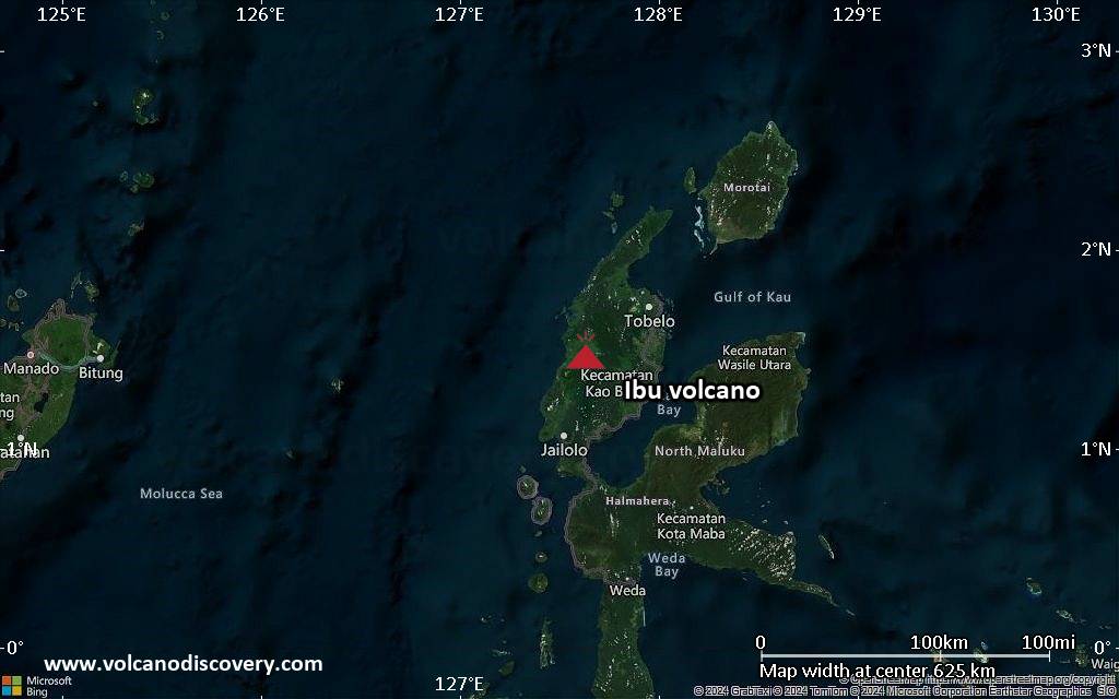
Ibu Volcanic Ash Advisory: ash plume to 7,000 ft (2,100 m) as of Oct 25, 21:26 UTC

Explosive activity continues. The Volcanic Ash Advisory Center (VAAC) Darwin warned of a volcanic ash plume rising to an estimated 7000 ft (2100 m), or flight level 070, and moving at 05 kts in SW direction.
Original VAAC bulletin:

FVAU03 at 21:26 UTC, 25/10/26 from ADRM
VA ADVISORY
DTG: 20261025/2130Z
VAAC: DARWIN
VOLCANO: IBU 268030
PSN: N0129 E12738
AREA: INDONESIA
SOURCE ELEV: 1325M AMSL
ADVISORY NR: 2026/1214
INFO SOURCE: HIMAWARI-9, CVGHM
ERUPTION DETAILS: VA TO FL070 REPORTED 25/1839Z
EST VA DTG: 25/2110Z
EST VA CLD: SFC/FL070 N0133 E12741 - N0128 E12743 - N0108
E12740 - N0113 E12718 - N0134 E12717 MOV SW 05KT
FCST VA CLD +6 HR: 26/0310Z SFC/FL070 N0133 E12741 - N0128
E12743 - N0113 E12725 - N0122 E12715 - N0137 E12718
FCST VA CLD +12 HR: 26/0910Z SFC/FL070 N0128 E12743 - N0114
E12725 - N0134 E12717 - N0149 E12729 - N0148 E12750
FCST VA CLD +18 HR: 26/1510Z SFC/FL070 N0124 E12741 - N0121
E12716 - N0144 E12717 - N0151 E12737 - N0132 E12745
RMK: VA NOT IDENTIFIABLE ON SATELLITE IMAGERY DUE TO MET
CLOUD. REGULAR GROUND REPORTS INDICATE INTERMITTENT
ERUPTIONS ARE ONGOING. VA HEIGHT AND MOVEMENT BASED ON
SATELLITE IMAGERY, GROUND REPORTS AND MODEL GUIDANCE.
NXT ADVISORY: NO LATER THAN 20261026/0330Z=

Dukono Volcanic Ash Advisory: ash plume to 9,000 ft (2,700 m) as of Oct 25, 16:10 UTC

Explosive activity continues. The Volcanic Ash Advisory Center (VAAC) Darwin warned of a volcanic ash plume rising to an estimated 9000 ft (2700 m), or flight level 090.
Original VAAC bulletin:

FVAU01 at 16:25 UTC, 25/10/26 from ADRM
VA ADVISORY
DTG: 20261025/1630Z
VAAC: DARWIN
VOLCANO: DUKONO 268010
PSN: N0142 E12754
AREA: INDONESIA
SOURCE ELEV: 1229M AMSL
ADVISORY NR: 2026/921
INFO SOURCE: HIMAWARI-9
ERUPTION DETAILS: VA TO FL090 OBS AT 25/1610Z MOV SW
OBS VA DTG: 25/1610Z
OBS VA CLD: SFC/FL090 N0149 E12754 - N0141 E12801 - N0127
E12759 - N0125 E12740 - N0143 E12737 MOV SW 05KT
FCST VA CLD +6 HR: 25/2210Z SFC/FL090 N0148 E12755 - N0140
E12801 - N0111 E12739 - N0129 E12715 - N0159 E12723
FCST VA CLD +12 HR: 26/0410Z SFC/FL090 N0153 E12804 - N0127
E12759 - N0126 E12732 - N0151 E12721 - N0206 E12743
FCST VA CLD +18 HR: 26/1010Z SFC/FL090 N0153 E12804 - N0127
E12759 - N0126 E12732 - N0151 E12722 - N0206 E12742
RMK: VA IDENTIFIABLE ON SATELLITE IMAGERY, PARTIALLY
OBSCURED BY MET CLOUD. VA HEIGHT AND MOVEMENT BASED ON
SATELLITE IMAGERY AND MODEL GUIDANCE. LOW CONFIDENCE IN FCST
DUE TO VARIABLE WINDS IN THE AREA.
NXT ADVISORY: NO LATER THAN 20261025/2230Z=