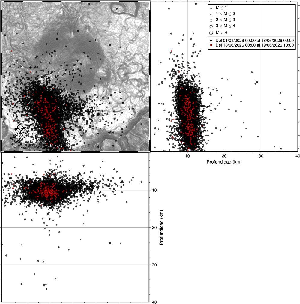
Since June 18, 2026, the Canary Islands Seismic Network (INVOLCAN) has detected an increased seismic activity beneath Tenerife, with more than 200 low-magnitude volcano-tectonic microearthquakes recorded over the last 48 hours at depths of approximately 10 km beneath the southwestern sector of the Las Cañadas caldera. The strongest event reached M 1.1.
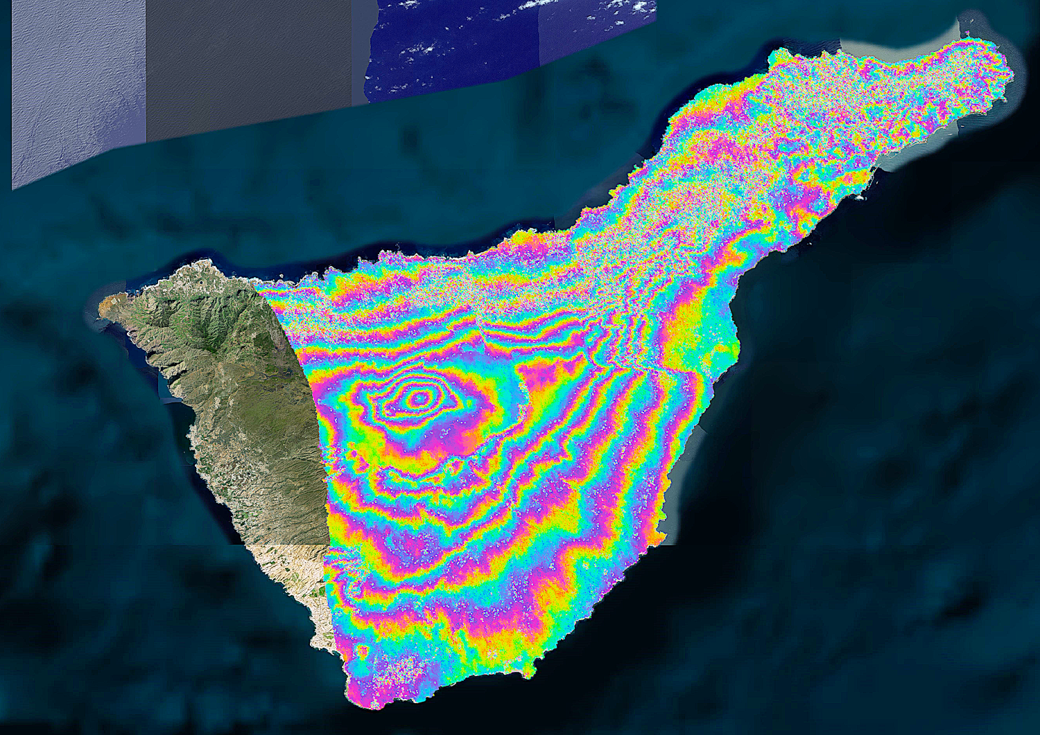
This activity is consistent with the recurrent seismic unrest observed since 2016–2017 and is interpreted as the result of pressurization of the volcanic-hydrothermal system caused by the injection of magmatic fluids. Supporting evidence includes elevated diffuse CO₂ emissions in the Teide area and minor ground deformation detected since 2024.
According to current observations, there is no indication of an increased likelihood of a volcanic eruption in the short or medium term.