Canlaon (Central Philippines): The Philippine Institute of Volcanology and Seismology (PHIVOLCS) reported that the eruption continued at Kanlaon on 18 February 2026 (local). Plume(s) rose to a maximum of 150 m (492 ft) above the vent. The alert level remained at „2 – Moderate Level of Volcanic Unrest“ (on a 0–5 level scale).
Source: Philippine Institute of Volcanology and Seismology (PHIVOLCS)
… [read more]
Taal (Luzon, Philippines): The Philippine Institute of Volcanology and Seismology (PHIVOLCS) reported that the eruption continued at Taal on 18 February 2026 (local). Plume(s) were reported. An episode of tremor lasting 775 minutes was recorded. The alert level remained at „1 – Low-Level Unrest“ (on a 0–5 level scale).
Source: Philippine Institute of Volcanology and Seismology (PHIVOLCS)
… [read more]
Mayon (Luzon Island, Philippines): Volcanic Ash Advisory Center Tokyo (VAAC) issued the following report: ERUPTION AT 20260219/1930Z VA CLD UNKNOWN REPORTED OBS VA DTG:19/1940Z
…19 Feb:
The Philippine Institute of Volcanology and Seismology (PHIVOLCS) reported that the eruption continued at Mayon on 18 February 2026 (local). Lava effusion continued from the summit crater. As of 18 February, lava flow lengths remained at radial distances of 3.8 km in the Basud gully, 1.6 km in the Bonga gully, and 1.3 km in the Mi-isi gully. Seismicity related to pyroclastic density currents was recorded 6 times. There were 568 seismically detected rockfalls. Volcanic seismicity was recorded 3 times. Crater glow was visible to the naked eye. Plume(s) were reported. Sulfur dioxide (SO₂) emissions averaged 4,841 tonnes per day on 18 February. The alert level remained at „3 – Increased Tendency Towards Hazardous Eruption“ (on a 0–5 level scale). Activity also included: seismically detected pyroclastic density current(s) (PDCs), volcanic seismicity.
Source: Philippine Institute of Volcanology and Seismology (PHIVOLCS)
… [read more]
Telong (northern Sumatra, Indonesia): The Center for Volcanology and Geological Hazard/Pusat Vulkanologi dan Mitigasi Bencana Geologi (CVGHM/PVMBG) reported that unrest continued at Telong, Bur ni on 18 February 2026 (local). The alert level remained at „Level 2 – Alert“ (on a 4-level scale).
Source: Center for Volcanology and Geological Hazard/Pusat Vulkanologi dan Mitigasi Bencana Geologi (CVGHM/PVMBG)
… [read more]
Karangetang (Siau Island, Sangihe Islands, Indonesia): The Center for Volcanology and Geological Hazard/Pusat Vulkanologi dan Mitigasi Bencana Geologi (CVGHM/PVMBG) reported that unrest continued at Karangetang on 18 February 2026 (local). The alert level remained at „Level 2 – Alert“ (on a 4-level scale).
Source: Center for Volcanology and Geological Hazard/Pusat Vulkanologi dan Mitigasi Bencana Geologi (CVGHM/PVMBG)
… [read more]
Raung (East Java): The Center for Volcanology and Geological Hazard/Pusat Vulkanologi dan Mitigasi Bencana Geologi (CVGHM/PVMBG) reported that unrest continued at Raung on 18 February 2026 (local). The alert level remained at „Level 2 – Alert“ (on a 4-level scale).
Source: Center for Volcanology and Geological Hazard/Pusat Vulkanologi dan Mitigasi Bencana Geologi (CVGHM/PVMBG)
… [read more]
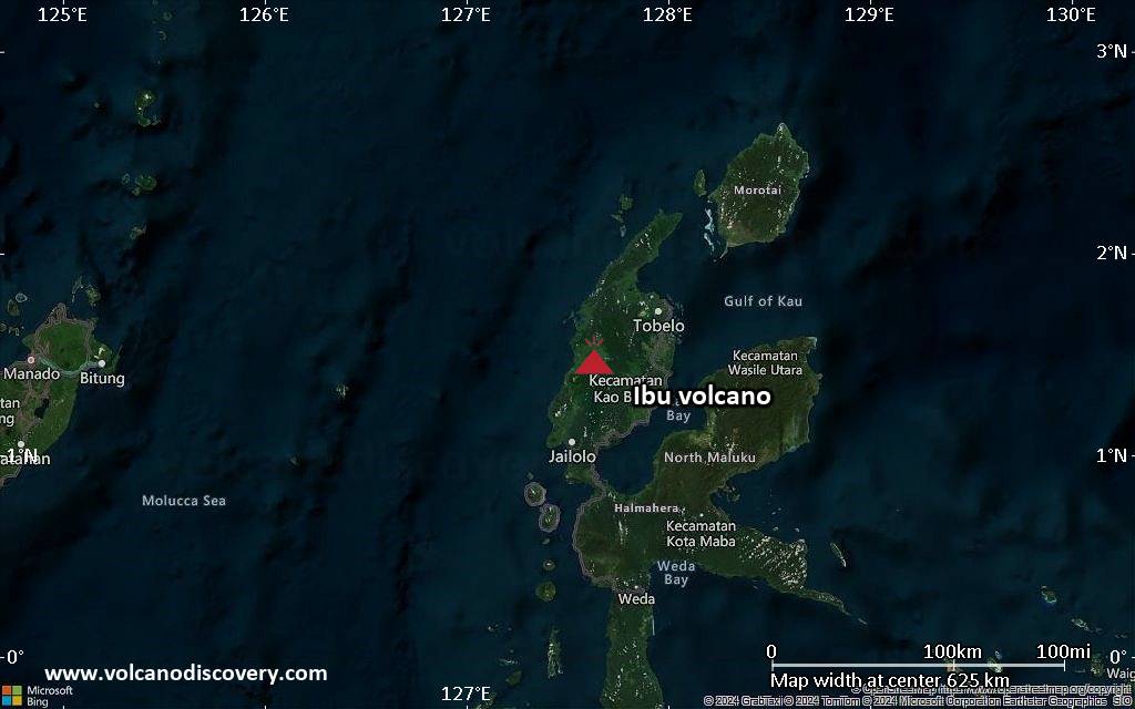
Ibu (Halmahera, Indonesia): Volcanic Ash Advisory Center Darwin (VAAC) issued the following report: VA ERUPTION LAST REPORTED AT 19/1231Z EST VA DTG:19/1520Z
…19 Feb:
The Center for Volcanology and Geological Hazard/Pusat Vulkanologi dan Mitigasi Bencana Geologi (CVGHM/PVMBG) reported that the eruption continued at Ibu on 18 February 2026 (local). Gas and vapor plume(s) rose to a maximum of 200 m (656 ft) above the vent. There were 124 seismically detected explosions reported. Ash and gas plume(s) rose to a maximum of 500 m (1,640 ft) above the vent. The alert level remained at „Level 2 – Alert“ (on a 4-level scale).
Source: Center for Volcanology and Geological Hazard/Pusat Vulkanologi dan Mitigasi Bencana Geologi (CVGHM/PVMBG)
… [read more]
Tangkubanparahu (West Java): The Center for Volcanology and Geological Hazard/Pusat Vulkanologi dan Mitigasi Bencana Geologi (CVGHM/PVMBG) issued a report for Tangkuban Parahu on 18 February 2026 (local). The alert level remained at „Level 1 – Normal“ (on a 4-level scale).
Source: Center for Volcanology and Geological Hazard/Pusat Vulkanologi dan Mitigasi Bencana Geologi (CVGHM/PVMBG)
… [read more]
Sangeang Api (Flores Sea, Indonesia): The Center for Volcanology and Geological Hazard/Pusat Vulkanologi dan Mitigasi Bencana Geologi (CVGHM/PVMBG) reported on activity at Sangeang Api on 18 February 2026 (local). Seismic activity was not recorded due to issues with the monitoring equipment. The alert level remained at „Level 2 – Alert“ (on a 4-level scale).
Source: Center for Volcanology and Geological Hazard/Pusat Vulkanologi dan Mitigasi Bencana Geologi (CVGHM/PVMBG)
… [read more]
Lewotobi (Flores): The Center for Volcanology and Geological Hazard/Pusat Vulkanologi dan Mitigasi Bencana Geologi (CVGHM/PVMBG) reported that unrest continued at Lewotobi (Laki-Laki) on 18 February 2026 (local). The alert level remained at „Level 3 – Standby“ (on a 4-level scale).
Source: Center for Volcanology and Geological Hazard/Pusat Vulkanologi dan Mitigasi Bencana Geologi (CVGHM/PVMBG)
… [read more]
Soputan (North Sulawesi, Indonesia): The Center for Volcanology and Geological Hazard/Pusat Vulkanologi dan Mitigasi Bencana Geologi (CVGHM/PVMBG) reported that unrest continued at Soputan on 18 February 2026 (local). The alert level remained at „Level 2 – Alert“ (on a 4-level scale).
Source: Center for Volcanology and Geological Hazard/Pusat Vulkanologi dan Mitigasi Bencana Geologi (CVGHM/PVMBG)
… [read more]
Lewotolo (Lesser Sunda Islands): The Center for Volcanology and Geological Hazard/Pusat Vulkanologi dan Mitigasi Bencana Geologi (CVGHM/PVMBG) reported that the eruption continued at Lewotolok on 18 February 2026 (local). There were 67 seismically detected explosions reported. The alert level remained at „Level 3 – Standby“ (on a 4-level scale).
Source: Center for Volcanology and Geological Hazard/Pusat Vulkanologi dan Mitigasi Bencana Geologi (CVGHM/PVMBG)
… [read more]
Merapi (Central Java, Indonesia): The Center for Volcanology and Geological Hazard/Pusat Vulkanologi dan Mitigasi Bencana Geologi (CVGHM/PVMBG) reported that the eruption continued at Merapi on 18 February 2026 (local). Gas and vapor plume(s) rose to a maximum of 50 m (164 ft) above the vent. There were 30 hot rockfalls, traveling up to 2,000 m. There were 127 seismically detected rockfalls. The alert level remained at „Level 3 – Standby“ (on a 4-level scale).
Source: Center for Volcanology and Geological Hazard/Pusat Vulkanologi dan Mitigasi Bencana Geologi (CVGHM/PVMBG)
… [read more]
Semeru (East Java, Indonesia): The Center for Volcanology and Geological Hazard/Pusat Vulkanologi dan Mitigasi Bencana Geologi (CVGHM/PVMBG) reported that the eruption continued at Semeru on 18 February 2026 (local). There were 91 seismically detected explosions reported. Ash and gas plume(s) rose to a maximum of 800 m (2,625 ft) above the vent. Seismically detected flowage events were recorded 1 times. The alert level remained at „Level 3 – Standby“ (on a 4-level scale). Activity also included: seismically detected flowage event(s).
Source: Center for Volcanology and Geological Hazard/Pusat Vulkanologi dan Mitigasi Bencana Geologi (CVGHM/PVMBG)
… [read more]
Marapi (Western Sumatra, Indonesia): Explosive activity continues. Volcanic Ash Advisory Center (VAAC) Darwin warned about a volcanic ash plume that rose up to estimated 11000 ft (3400 m) altitude or flight level 110 .
The full report is as follows: VA TO FL110 REP AT 19/1223Z EST VA DTG:19/1240Z to 11000 ft (3400 m)
…19 Feb:
The Center for Volcanology and Geological Hazard/Pusat Vulkanologi dan Mitigasi Bencana Geologi (CVGHM/PVMBG) reported that the eruption continued at Marapi on 18 February 2026 (local). There was 1 seismically detected explosion reported. The alert level remained at „Level 2 – Alert“ (on a 4-level scale).
Source: Center for Volcanology and Geological Hazard/Pusat Vulkanologi dan Mitigasi Bencana Geologi (CVGHM/PVMBG)
… [read more]
…19 Feb:
A spectacular eruption took place from the volcano yesterday.
At about 10:53 local time yesterday, a powerful explosion generated a dense dark ash column. The towering pillar of gas, ash emissions and lava bombs rose about 500 meters above the summit in the eastern direction.
… [read more]
Dukono (Halmahera): The Center for Volcanology and Geological Hazard/Pusat Vulkanologi dan Mitigasi Bencana Geologi (CVGHM/PVMBG) reported that the eruption continued at Dukono on 18 February 2026 (local). The alert level remained at „Level 2 – Alert“ (on a 4-level scale).
Source: Center for Volcanology and Geological Hazard/Pusat Vulkanologi dan Mitigasi Bencana Geologi (CVGHM/PVMBG)
… [read more]
Awu (Sulawesi & Sangihe Islands): The Center for Volcanology and Geological Hazard/Pusat Vulkanologi dan Mitigasi Bencana Geologi (CVGHM/PVMBG) reported that unrest continued at Awu on 18 February 2026 (local). The alert level remained at „Level 2 – Alert“ (on a 4-level scale).
Source: Center for Volcanology and Geological Hazard/Pusat Vulkanologi dan Mitigasi Bencana Geologi (CVGHM/PVMBG)
… [read more]
Kerinci (Sumatra): The Center for Volcanology and Geological Hazard/Pusat Vulkanologi dan Mitigasi Bencana Geologi (CVGHM/PVMBG) reported that unrest continued at Kerinci on 18 February 2026 (local). The alert level remained at „Level 2 – Alert“ (on a 4-level scale).
Source: Center for Volcanology and Geological Hazard/Pusat Vulkanologi dan Mitigasi Bencana Geologi (CVGHM/PVMBG)
… [read more]
Lokon-Empung (North Sulawesi, Indonesia): The Center for Volcanology and Geological Hazard/Pusat Vulkanologi dan Mitigasi Bencana Geologi (CVGHM/PVMBG) reported that unrest continued at Lokon-Empung on 18 February 2026 (local). Gas and vapor plume(s) rose to a maximum of 25 m (82 ft) above the vent. The alert level remained at „Level 2 – Alert“ (on a 4-level scale).
Source: Center for Volcanology and Geological Hazard/Pusat Vulkanologi dan Mitigasi Bencana Geologi (CVGHM/PVMBG)
… [read more]
Kilauea (Hawai’i): The United States Geological Survey – Hawaiian Volcano Observatory (USGS-HVO) reported that there was a pause in eruptive activity at Kilauea between 17 February 2026 (local) and 18 February 2026 (local). Voluminous plumes continued from the north and south vents. Lava that was emplaced around and above the vents continued to advance downslope onto the crater floor at a significantly reduced rate. Seismic tremor persisted during the pause, with intermittent stronger bursts of tremor that occasionally coincided with increased glow from one or both vents. Moderate to bright glow was observed overnight. Incandescence on the floor of the Halemaʻumaʻu Crater appeared significantly reduced compared to the previous night. The alert level remained at „Watch“ (level 3 on a 4-level scale). The aviation alert level remained at „Orange“ (level 3 on a 4-level scale).
Source: United States Geological Survey – Hawaiian Volcano Observatory (USGS-HVO)
… [read more]
Shishaldin (Aleutian Islands, Alaska): The United States Geological Survey – Alaska Volcano Observatory (USGS-AVO) reported that unrest continued at Shishaldin between 17 February 2026 (local) and 18 February 2026 (local). Seismicity remained elevated. Gas and vapor plume(s) were reported. The alert level remained at „Advisory“ (level 2 on a 4-level scale). The aviation alert level remained at „Yellow“ (level 2 on a 4-level scale). Activity also included: tremor.
Source: United States Geological Survey – Alaska Volcano Observatory (USGS-AVO)
… [read more]
Great Sitkin (United States, Aleutian Islands): The United States Geological Survey – Alaska Volcano Observatory (USGS-AVO) reported that the eruption continued at Great Sitkin between 17 February 2026 (local) and 18 February 2026 (local). Lava continued to slowly erupt in the summit crater. Slightly elevated surface temperatures were detected at the summit in satellite images on the afternoon of 16 February. The alert level remained at „Watch“ (level 3 on a 4-level scale). The aviation alert level remained at „Orange“ (level 3 on a 4-level scale).
Source: United States Geological Survey – Alaska Volcano Observatory (USGS-AVO)
… [read more]
Aniakchak (United States, Alaska Peninsula): The United States Geological Survey – Alaska Volcano Observatory (USGS-AVO) issued a report for Aniakchak on 18 February 2026 (local). A data collection gap followed a power outage at the Port Heiden Receive Facility that occurred on 23 December 2025. Preliminary power repairs were completed, and AVO resumed data collection on 5 February. The data remained stable after resumption, but more permanent repairs are necessary to ensure reliable connectivity. The alert level remained at „Unassigned“ (on a 4-level scale). The aviation alert level remained at „Unassigned“ (on a 4-level scale).
Source: United States Geological Survey – Alaska Volcano Observatory (USGS-AVO)
… [read more]
Popocatépetl (Central Mexico): Explosive activity continues. Volcanic Ash Advisory Center (VAAC) Washington warned about a volcanic ash plume that rose up to estimated 19000 ft (5800 m) altitude or flight level 190 .
The full report is as follows: NEW VA EMS to 19000 ft (5800 m)
…19 Feb:
The Centro Nacional de Prevención de Desastres (CENAPRED) reported that the eruption continued at Popocatépetl between 17 February 2026 (local) and 18 February 2026 (local). Ash, gas, and vapor plume(s) were reported. The alert level remained at „Yellow Alert – Phase 2“ (level 4 on a 7-level scale).
Source: Centro Nacional de Prevención de Desastres (CENAPRED)
… [read more]
Santiaguito (Guatemala): The Instituto Nacional de Sismología, Vulcanología, Meteorología e Hidrología (INSIVUMEH) reported that the eruption continued at Santa María between 17 February 2026 (local) and 18 February 2026 (local). Gas and vapor plume(s) rose to a maximum of 400 m (1,312 ft) above the vent. There were explosions reported, with plumes rising to a maximum of 800 m (2,625 ft) above the vent. There were avalanche/rockfall/small pyroclastic flows.
Source: Instituto Nacional de Sismología, Vulcanología, Meteorología e Hidrología (INSIVUMEH)
… [read more]
Pacaya (Guatemala): The Instituto Nacional de Sismología, Vulcanología, Meteorología e Hidrología (INSIVUMEH) reported that unrest continued at Pacaya between 17 February 2026 (local) and 18 February 2026 (local). Gas and vapor plume(s) were reported.
Source: Instituto Nacional de Sismología, Vulcanología, Meteorología e Hidrología (INSIVUMEH)
… [read more]
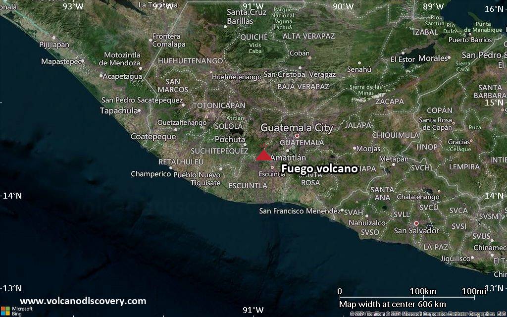
Fuego (Guatemala): Explosive activity continues. Volcanic Ash Advisory Center (VAAC) Washington warned about a volcanic ash plume that rose up to estimated 14000 ft (4300 m) altitude or flight level 140 .
The full report is as follows: VA EMS ONGOING to 14000 ft (4300 m)
…19 Feb:
The Instituto Nacional de Sismología, Vulcanología, Meteorología e Hidrología (INSIVUMEH) reported that the eruption continued at Fuego between 17 February 2026 (local) and 18 February 2026 (local). Weak, moderate, and strong Strombolian explosions were recorded at a rate of 5–7 per hour, generating ash and gas plumes that reached as high as 4,800 m above sea level. Explosions ejected ballistics. There were incandescent rockfalls. Fine ash fell on communities on the SW and W flanks. Gas and vapor plume(s) rose to a maximum of 600 m (1,969 ft) above the vent. Activity also included: audible sounds (e.g., booms, rumbling), shockwave.
Source: Instituto Nacional de Sismología, Vulcanología, Meteorología e Hidrología (INSIVUMEH)
… [read more]
Sangay (Ecuador): The Instituto Geofísico-Escuela Politécnica Nacional (IG-EPN) reported that the eruption continued at Sangay between 17 February 2026 (local) and 18 February 2026 (local). There were 385 seismically detected explosions reported. Ash and gas plume(s) rose to a maximum of 1,000 m (3,281 ft) above the vent. Crater glow was observed during the night of 17 February. The alert level remained at „2 – Yellow“ (on a 4-level scale). Activity also included: thermal anomaly(ies).
Source: Instituto Geofísico-Escuela Politécnica Nacional (IG-EPN)
… [read more]
Reventador (Ecuador): Volcanic Ash Advisory Center Washington (VAAC) issued the following report: ONGOING VA EMS
…19 Feb:
The Instituto Geofísico-Escuela Politécnica Nacional (IG-EPN) reported that the eruption continued at Reventador between 17 February 2026 (local) and 18 February 2026 (local). There were 65 seismically detected explosions reported. Ash and gas plume(s) rose to a maximum of 700 m (2,297 ft) above the vent. The alert level remained at „3 – Orange“ (on a 4-level scale).
Source: Instituto Geofísico-Escuela Politécnica Nacional (IG-EPN)
… [read more]
Sabancaya (Peru): Volcanic Ash Advisory Center Buenos Aires (VAAC) issued the following report: NO VA EMISSION
…19 Feb:
The Centro Vulcanológico Nacional del Instituto Geofísico del Perú (CENVUL-IGP) reported that the eruption continued at Sabancaya between 17 February 2026 (local) and 18 February 2026 (local). Ash, gas, and vapor plume(s) rose to a maximum of 700 m (2,297 ft) above the vent. A total of 12 earthquakes related to the movement of magma and gases were recorded. The alert level remained at „Orange“ (level 3 on a 4-level scale).
Source: Centro Vulcanológico Nacional del Instituto Geofísico del Perú (CENVUL-IGP)
… [read more]
Piton de la Fournaise (La Réunion): The Institut de Physique du Globe de Paris – Observatoire volcanologique du Piton de la Fournaise (IPGP-OVPF) reported that the eruption continued at Fournaise, Piton de la on 18 February 2026 (local). The alert level remained at „Alert 2-1“ (level 2 on a 0–4 level scale).
Source: Institut de Physique du Globe de Paris – Observatoire volcanologique du Piton de la Fournaise (IPGP-OVPF)
… [read more]