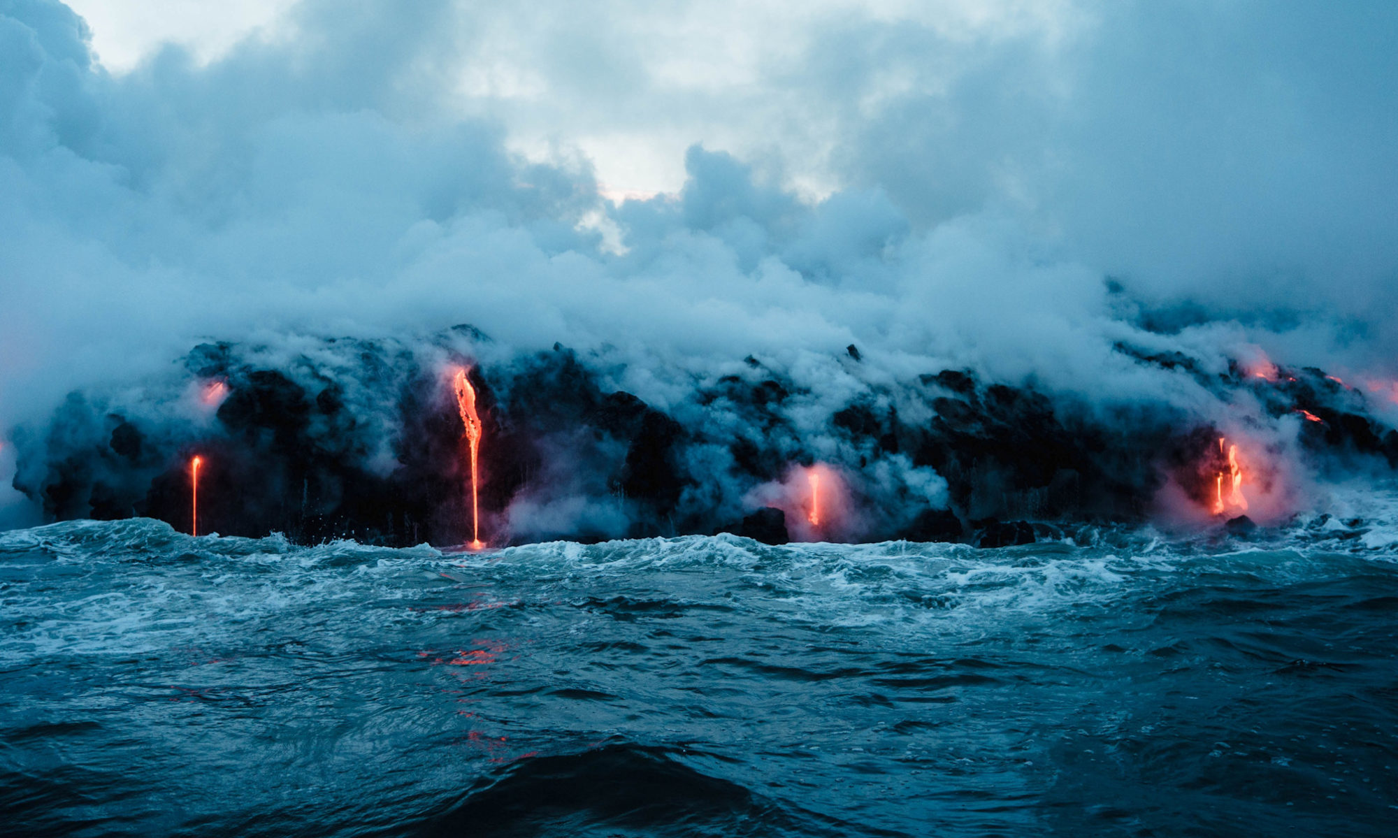

Based on the latest data, scientists from the Icelandic Meteorological Office (IMO) and the University of Iceland concluded that a new eruption in the Svartsengi region on the southern peninsula is becoming more and more likely.
According to their data, approximately 6.5 million cubic meters of magma has accumulated beneath the area as of Feb 1st, 2024, and the volume of magma will soon reach the same level as during the January 2024 eruption. „Therefore, the timescale for the next eruption could be within two weeks or possibly days. This means that the likelihood of a magma intrusion, and a volcanic eruption, have increased.“
It would be the 3rd eruption in the same area within only about 2 months, and the 6th since Iceland’s southern rift zone awakened in early 2021. It is believed that after about 800 years of dormancy, the volcanic rift of the Reykjanes peninsula is now in a new phase of activity, characterized by possibly many consecutive volcanic eruptions along various sections of the rift during the years and possibly few decades to come.
(from the latest update of IMO🙂
„There is no absolute certainty that the warning time ahead of the next intrusion or eruption will be the same as 14 January, which was about a five-hours‘ notice from the beginning of the earthquake swarm until the eruption began just south of Hagafell. The warning period for the eruption between Stóra-Skógfell and Sundhnúkur on 18 December last year was about 90 minutes, and that eruption occurred approximately at the mid-point of the (now solidified) magma intrusion beneath the Sundhnúksgígar crater row. With repeated lateral magma intrusions, it is likely that the pathway for magma propagation to the surface will be easier, resulting in less seismicity. However, rapid movements of magma are always accompanied by increased micro-seismicity. We assess that the minimum warning time would be one-hour ahead of a volcanic eruption, and that the most likely pathway would be along the fissures from the magma intrusion on 10 November last year.
„Seismic activity has been similar over the past week. Nearly 200 earthquakes have been measured in the area between Stóra-Skógfell and south of Hagafell in the past seven days. Most of these earthquakes were minor, under 1.0 in magnitude, at a depth of 2 to 5 km. The largest earthquake registered magnitude 1.8, and it was located about a kilometre south of Hagafell.
„The Icelandic Meteorological Office has issued an updated hazard assessment map. The main changes are that zone 3 (Sýlingarfell – Hagafell) has been upgraded to red (high hazard), and zones 2 and 6 have been upgraded to amber (considerable hazard). Grindavík (zone 4) remains unchanged at a considerable level of hazard.“