Explosive activity continues. Volcanic Ash Advisory Center (VAAC) Darwin warned about a volcanic ash plume that rose up to estimated 15000 ft (4600 m) altitude or flight level 150 and is moving at 10 kts in NE direction. The full report is as follows:
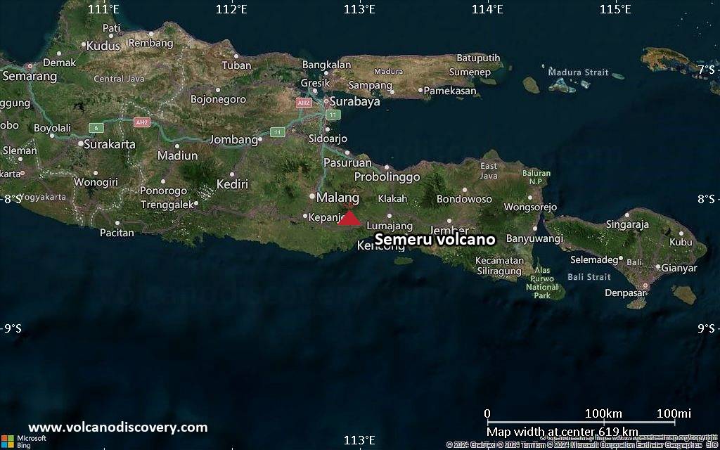
FVAU02 at 22:57 UTC, 13/02/26 from ADRM VA ADVISORY DTG: 20260213/2300Z VAAC: DARWIN VOLCANO: SEMERU 263300 PSN: S0806 E11255 AREA: INDONESIA SOURCE ELEV: 3657M AMSL ADVISORY NR: 2026/180 INFO SOURCE: CVGHM, HIMAWARI-9 ERUPTION DETAILS: VA TO FL150 LAST REPORTED 13/1346Z EST VA DTG: 13/2240Z EST VA CLD: SFC/FL150 S0808 E11253 – S0804 E11251 – S0744 E11311 – S0759 E11320 MOV NE 10KT FCST VA CLD +6 HR: 14/0440Z SFC/FL150 S0809 E11254 – S0805 E11250 – S0744 E11309 – S0801 E11323 FCST VA CLD +12 HR: 14/1040Z SFC/FL150 S0809 E11254 – S0804 E11250 – S0742 E11308 – S0801 E11321 FCST VA CLD +18 HR: 14/1640Z SFC/FL150 S0809 E11253 – S0805 E11250 – S0744 E11306 – S0801 E11319 RMK: VA NOT IDENTIFIABLE ON SATELLITE IMAGERY DUE TO MET CLOUD COVER. RECENT GROUND REPORTS INDICATE ONGOING INTERMITTENT VA EMISSIONS. VA HEIGHT AND MOVEMENT BASED ON GROUND REPORTS AND MODEL GUIDANCE. NXT ADVISORY: NO LATER THAN 20260214/0500Z=
Tenerife (Canary Islands (Spain)): The Instituto Volcanológico de Canarias (INVOLCAN) issued a report for Tenerife on 12 February 2026 (local). The low-magnitude, low-frequency (LF) volcanic earthquake swarm that began on 7 February continued, with more than 300 small earthquakes recorded as of 12 February. The events are located in the SW sector of the Las Cañadas caldera, at depths between 8 and 12 km. The largest recorded earthquake to date had a local magnitude of 1.4. The alert level remained at „Green – Early warning“ (level 1 on a 4-level scale). Source: Instituto Volcanológico de Canarias (INVOLCAN) … [read more] … [show less] Current Alerts: Observatory alert level: „Green – Early warning“ (level 1 on a 4-level scale)
Canlaon (Central Philippines): The Philippine Institute of Volcanology and Seismology (PHIVOLCS) reported that the eruption continued at Kanlaon on 12 February 2026 (local). Plume(s) rose to a maximum of 75 m (246 ft) above the vent. The alert level remained at „2 – Moderate Level of Volcanic Unrest“ (on a 0–5 level scale). Source: Philippine Institute of Volcanology and Seismology (PHIVOLCS) … [read more] … [show less] Current Alerts: Observatory alert level: „2 – Moderate Level of Volcanic Unrest“ (on a 0–5 level scale)
Taal (Luzon, Philippines): The Philippine Institute of Volcanology and Seismology (PHIVOLCS) reported that the eruption continued at Taal on 12 February 2026 (local). Plume(s) were reported. An episode of tremor lasting 690 minutes was recorded. The alert level remained at „1 – Low-Level Unrest“ (on a 0–5 level scale). Source: Philippine Institute of Volcanology and Seismology (PHIVOLCS) … [read more] … [show less] Current Alerts: Observatory alert level: „1 – Low-Level Unrest“ (on a 0–5 level scale)
Mayon (Luzon Island, Philippines): Volcanic Ash Advisory Center Tokyo (VAAC) issued the following report: ERUPTION AT 20260213/1459Z VA CLD UNKNOWN REPORTED OBS VA DTG:13/1500Z …13 Feb: The Philippine Institute of Volcanology and Seismology (PHIVOLCS) reported that the eruption continued at Mayon on 12 February 2026 (local). Lava effusion continued from the summit crater. As of 12 February, lava flow lengths remained at radial distances of 3.8 km in the Basud gully, 1.6 km in the Bonga gully, and 1.3 km in the Mi-isi gully. Crater glow was visible to the naked eye. The alert level remained at „3 – Increased Tendency Towards Hazardous Eruption“ (on a 0–5 level scale). Activity also included: seismically detected pyroclastic density current(s) (PDCs). Source: Philippine Institute of Volcanology and Seismology (PHIVOLCS) … [read more] … [show less] Current Alerts: Observatory alert level: „3 – Increased Tendency Towards Hazardous Eruption“ (on a 0–5 level scale)
Telong (northern Sumatra, Indonesia): The Center for Volcanology and Geological Hazard/Pusat Vulkanologi dan Mitigasi Bencana Geologi (CVGHM/PVMBG) reported that unrest continued at Telong, Bur ni on 12 February 2026 (local). The alert level remained at „Level 2 – Alert“ (on a 4-level scale). Source: Center for Volcanology and Geological Hazard/Pusat Vulkanologi dan Mitigasi Bencana Geologi (CVGHM/PVMBG) … [read more] … [show less] Current Alerts: Observatory alert level: „Level 2 – Alert“ (on a 4-level scale)
Karangetang (Siau Island, Sangihe Islands, Indonesia): The Center for Volcanology and Geological Hazard/Pusat Vulkanologi dan Mitigasi Bencana Geologi (CVGHM/PVMBG) reported that unrest continued at Karangetang on 12 February 2026 (local). Gas and vapor plume(s) rose to a maximum of 50 m (164 ft) above the vent. The alert level remained at „Level 2 – Alert“ (on a 4-level scale). Source: Center for Volcanology and Geological Hazard/Pusat Vulkanologi dan Mitigasi Bencana Geologi (CVGHM/PVMBG) … [read more] … [show less] Current Alerts: Observatory alert level: „Level 2 – Alert“ (on a 4-level scale)
Raung (East Java): The Center for Volcanology and Geological Hazard/Pusat Vulkanologi dan Mitigasi Bencana Geologi (CVGHM/PVMBG) reported that unrest continued at Raung on 12 February 2026 (local). Gas and vapor plume(s) rose to a maximum of 200 m (656 ft) above the vent. The alert level remained at „Level 2 – Alert“ (on a 4-level scale). Source: Center for Volcanology and Geological Hazard/Pusat Vulkanologi dan Mitigasi Bencana Geologi (CVGHM/PVMBG) … [read more] … [show less] Current Alerts: Observatory alert level: „Level 2 – Alert“ (on a 4-level scale)
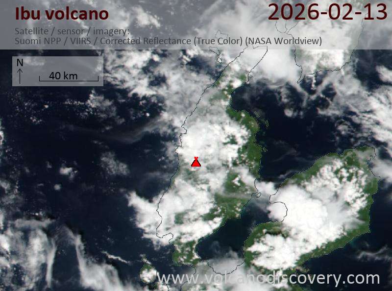
Ibu (Halmahera, Indonesia): Explosive activity continues. Volcanic Ash Advisory Center (VAAC) Darwin warned about a volcanic ash plume that rose up to estimated 7000 ft (2100 m) altitude or flight level 070 . The full report is as follows: VA TO FL070 OBS 13/1500Z MOV SW EST VA DTG:13/1600Z to 7000 ft (2100 m) …13 Feb: The Center for Volcanology and Geological Hazard/Pusat Vulkanologi dan Mitigasi Bencana Geologi (CVGHM/PVMBG) reported that the eruption continued at Ibu on 12 February 2026 (local). Gas and vapor plume(s) rose to a maximum of 200 m (656 ft) above the vent. There were 115 seismically detected explosions reported. Ash and gas plume(s) rose to a maximum of 500 m (1,640 ft) above the vent. The alert level remained at „Level 2 – Alert“ (on a 4-level scale). Source: Center for Volcanology and Geological Hazard/Pusat Vulkanologi dan Mitigasi Bencana Geologi (CVGHM/PVMBG) … [read more] … [show less] Current Alerts: Observatory alert level: „Level 2 – Alert“ (on a 4-level scale)
Tangkubanparahu (West Java): The Center for Volcanology and Geological Hazard/Pusat Vulkanologi dan Mitigasi Bencana Geologi (CVGHM/PVMBG) issued a report for Tangkuban Parahu on 12 February 2026 (local). Gas and vapor plume(s) rose to a maximum of 100 m (328 ft) above the vent. The alert level remained at „Level 1 – Normal“ (on a 4-level scale). Source: Center for Volcanology and Geological Hazard/Pusat Vulkanologi dan Mitigasi Bencana Geologi (CVGHM/PVMBG) … [read more] … [show less] Current Alerts: Observatory alert level: „Level 1 – Normal“ (on a 4-level scale)
Sangeang Api (Flores Sea, Indonesia): The Center for Volcanology and Geological Hazard/Pusat Vulkanologi dan Mitigasi Bencana Geologi (CVGHM/PVMBG) reported that unrest continued at Sangeang Api on 12 February 2026 (local). The alert level remained at „Level 2 – Alert“ (on a 4-level scale). Source: Center for Volcanology and Geological Hazard/Pusat Vulkanologi dan Mitigasi Bencana Geologi (CVGHM/PVMBG) … [read more] … [show less] Current Alerts: Observatory alert level: „Level 2 – Alert“ (on a 4-level scale)
Lewotobi (Flores): The Center for Volcanology and Geological Hazard/Pusat Vulkanologi dan Mitigasi Bencana Geologi (CVGHM/PVMBG) reported that unrest continued at Lewotobi (Laki-Laki) on 12 February 2026 (local). Gas and vapor plume(s) rose to a maximum of 100 m (328 ft) above the vent. The alert level remained at „Level 3 – Standby“ (on a 4-level scale). Source: Center for Volcanology and Geological Hazard/Pusat Vulkanologi dan Mitigasi Bencana Geologi (CVGHM/PVMBG) … [read more] … [show less] Current Alerts: Observatory alert level: „Level 3 – Standby“ (on a 4-level scale)
Soputan (North Sulawesi, Indonesia): The Center for Volcanology and Geological Hazard/Pusat Vulkanologi dan Mitigasi Bencana Geologi (CVGHM/PVMBG) reported that unrest continued at Soputan on 12 February 2026 (local). The alert level remained at „Level 2 – Alert“ (on a 4-level scale). Source: Center for Volcanology and Geological Hazard/Pusat Vulkanologi dan Mitigasi Bencana Geologi (CVGHM/PVMBG) … [read more] … [show less] Current Alerts: Observatory alert level: „Level 2 – Alert“ (on a 4-level scale)
Lewotolo (Lesser Sunda Islands): The Center for Volcanology and Geological Hazard/Pusat Vulkanologi dan Mitigasi Bencana Geologi (CVGHM/PVMBG) reported that the eruption continued at Lewotolok on 12 February 2026 (local). Gas and vapor plume(s) rose to a maximum of 50 m (164 ft) above the vent. There were 66 seismically detected explosions reported. The alert level remained at „Level 3 – Standby“ (on a 4-level scale). Source: Center for Volcanology and Geological Hazard/Pusat Vulkanologi dan Mitigasi Bencana Geologi (CVGHM/PVMBG) … [read more] … [show less] Current Alerts: Observatory alert level: „Level 3 – Standby“ (on a 4-level scale)
Merapi (Central Java, Indonesia): The Center for Volcanology and Geological Hazard/Pusat Vulkanologi dan Mitigasi Bencana Geologi (CVGHM/PVMBG) reported that the eruption continued at Merapi on 12 February 2026 (local). There was 1 hot rockfall, traveling up to 1,800 m. The alert level remained at „Level 3 – Standby“ (on a 4-level scale). Source: Center for Volcanology and Geological Hazard/Pusat Vulkanologi dan Mitigasi Bencana Geologi (CVGHM/PVMBG) … [read more] … [show less] Current Alerts: Observatory alert level: „Level 3 – Standby“ (on a 4-level scale)
Semeru (East Java, Indonesia): The Center for Volcanology and Geological Hazard/Pusat Vulkanologi dan Mitigasi Bencana Geologi (CVGHM/PVMBG) reported that the eruption continued at Semeru on 12 February 2026 (local). There were 60 seismically detected explosions reported. Ash and gas plume(s) rose to a maximum of 900 m (2,953 ft) above the vent. There were 8 seismically detected rockfalls. The alert level remained at „Level 3 – Standby“ (on a 4-level scale). Activity also included: seismically detected flowage event(s), seismically detected pyroclastic density current(s) (PDCs). Source: Center for Volcanology and Geological Hazard/Pusat Vulkanologi dan Mitigasi Bencana Geologi (CVGHM/PVMBG) … [read more] … [show less] Current Alerts: Observatory alert level: „Level 3 – Standby“ (on a 4-level scale)
Marapi (Western Sumatra, Indonesia): The Center for Volcanology and Geological Hazard/Pusat Vulkanologi dan Mitigasi Bencana Geologi (CVGHM/PVMBG) reported that the eruption continued at Marapi on 12 February 2026 (local). Gas and vapor plume(s) rose to a maximum of 100 m (328 ft) above the vent. The alert level remained at „Level 2 – Alert“ (on a 4-level scale). Source: Center for Volcanology and Geological Hazard/Pusat Vulkanologi dan Mitigasi Bencana Geologi (CVGHM/PVMBG) … [read more] … [show less] Current Alerts: Observatory alert level: „Level 2 – Alert“ (on a 4-level scale)
Dukono (Halmahera): The Center for Volcanology and Geological Hazard/Pusat Vulkanologi dan Mitigasi Bencana Geologi (CVGHM/PVMBG) reported that the eruption continued at Dukono on 12 February 2026 (local). Gas and vapor plume(s) rose to a maximum of 300 m (984 ft) above the vent. The alert level remained at „Level 2 – Alert“ (on a 4-level scale). Source: Center for Volcanology and Geological Hazard/Pusat Vulkanologi dan Mitigasi Bencana Geologi (CVGHM/PVMBG) … [read more] … [show less] Current Alerts: Observatory alert level: „Level 2 – Alert“ (on a 4-level scale)
Awu (Sulawesi & Sangihe Islands): The Center for Volcanology and Geological Hazard/Pusat Vulkanologi dan Mitigasi Bencana Geologi (CVGHM/PVMBG) reported that unrest continued at Awu on 12 February 2026 (local). Gas and vapor plume(s) rose to a maximum of 50 m (164 ft) above the vent. The alert level remained at „Level 2 – Alert“ (on a 4-level scale). Source: Center for Volcanology and Geological Hazard/Pusat Vulkanologi dan Mitigasi Bencana Geologi (CVGHM/PVMBG) … [read more] … [show less] Current Alerts: Observatory alert level: „Level 2 – Alert“ (on a 4-level scale)
Kerinci (Sumatra): The Center for Volcanology and Geological Hazard/Pusat Vulkanologi dan Mitigasi Bencana Geologi (CVGHM/PVMBG) reported that unrest continued at Kerinci on 12 February 2026 (local). Gas and vapor plume(s) rose to a maximum of 50 m (164 ft) above the vent. The alert level remained at „Level 2 – Alert“ (on a 4-level scale). Source: Center for Volcanology and Geological Hazard/Pusat Vulkanologi dan Mitigasi Bencana Geologi (CVGHM/PVMBG) … [read more] … [show less] Current Alerts: Observatory alert level: „Level 2 – Alert“ (on a 4-level scale)
Lokon-Empung (North Sulawesi, Indonesia): The Center for Volcanology and Geological Hazard/Pusat Vulkanologi dan Mitigasi Bencana Geologi (CVGHM/PVMBG) reported that unrest continued at Lokon-Empung on 12 February 2026 (local). Gas and vapor plume(s) rose to a maximum of 15 m (49 ft) above the vent. The alert level remained at „Level 2 – Alert“ (on a 4-level scale). Source: Center for Volcanology and Geological Hazard/Pusat Vulkanologi dan Mitigasi Bencana Geologi (CVGHM/PVMBG) … [read more] … [show less] Current Alerts: Observatory alert level: „Level 2 – Alert“ (on a 4-level scale)
Kilauea (Hawai’i): The United States Geological Survey – Hawaiian Volcano Observatory (USGS-HVO) reported that there was a pause in eruptive activity at Kilauea between 11 February 2026 (local) and 12 February 2026 (local). Moderate glow was observed from the north and south vents overnight in webcam images, with the south vent appearing slightly brighter. The alert level remained at „Watch“ (level 3 on a 4-level scale). The aviation alert level remained at „Orange“ (level 3 on a 4-level scale). Source: United States Geological Survey – Hawaiian Volcano Observatory (USGS-HVO) … [read more] … [show less] Current Alerts: Observatory alert level: „Watch“ (level 3 on a 4-level scale)
Shishaldin (Aleutian Islands, Alaska): The United States Geological Survey – Alaska Volcano Observatory (USGS-AVO) reported that unrest continued at Shishaldin between 11 February 2026 (local) and 12 February 2026 (local). The alert level remained at „Advisory“ (level 2 on a 4-level scale). The aviation alert level remained at „Yellow“ (level 2 on a 4-level scale). Source: United States Geological Survey – Alaska Volcano Observatory (USGS-AVO) … [read more] … [show less] Current Alerts: Observatory alert level: „Advisory“ (level 2 on a 4-level scale)
Great Sitkin (United States, Aleutian Islands): The United States Geological Survey – Alaska Volcano Observatory (USGS-AVO) reported that the eruption continued at Great Sitkin between 11 February 2026 (local) and 12 February 2026 (local). Lava continued to slowly erupt in the summit crater. Slightly elevated surface temperatures were detected at the summit in satellite images during 11–12 February. The alert level remained at „Watch“ (level 3 on a 4-level scale). The aviation alert level remained at „Orange“ (level 3 on a 4-level scale). Source: United States Geological Survey – Alaska Volcano Observatory (USGS-AVO) … [read more] … [show less] Current Alerts: Observatory alert level: „Watch“ (level 3 on a 4-level scale)
Popocatépetl (Central Mexico): The Centro Nacional de Prevención de Desastres (CENAPRED) reported that the eruption continued at Popocatépetl between 11 February 2026 (local) and 12 February 2026 (local). Gas and vapor plume(s) were reported. The alert level remained at „Yellow Alert – Phase 2“ (level 4 on a 7-level scale). Source: Centro Nacional de Prevención de Desastres (CENAPRED) … [read more] … [show less] Current Alerts: Observatory alert level: „Yellow Alert – Phase 2“ (level 4 on a 7-level scale)
Santiaguito (Guatemala): Explosive activity continues. Volcanic Ash Advisory Center (VAAC) Washington warned about a volcanic ash plume that rose up to estimated 14000 ft (4300 m) altitude or flight level 140 . The full report is as follows: VA EMS OBS to 14000 ft (4300 m) …13 Feb: The Instituto Nacional de Sismología, Vulcanología, Meteorología e Hidrología (INSIVUMEH) reported that the eruption continued at Santa María between 11 February 2026 (local) and 12 February 2026 (local). There were explosions reported, occurring at a rate of up to 2 per hour. Glow was observed from the crater of El Caliente Dome. There were incandescent rockfalls. Gas and vapor plume(s) rose to a maximum of 400 m (1,312 ft) above the vent. Source: Instituto Nacional de Sismología, Vulcanología, Meteorología e Hidrología (INSIVUMEH) … [read more] … [show less] Current Alerts: Observatory alert level: unavailable or not collected
Pacaya (Guatemala): The Instituto Nacional de Sismología, Vulcanología, Meteorología e Hidrología (INSIVUMEH) reported that unrest continued at Pacaya between 11 February 2026 (local) and 12 February 2026 (local). Gas and vapor plume(s) rose to a maximum of 100 m (328 ft) above the vent. Source: Instituto Nacional de Sismología, Vulcanología, Meteorología e Hidrología (INSIVUMEH) … [read more] … [show less] Current Alerts: Observatory alert level: unavailable or not collected
Fuego (Guatemala): Explosive activity continues. Volcanic Ash Advisory Center (VAAC) Washington warned about a volcanic ash plume that rose up to estimated 17000 ft (5200 m) altitude or flight level 170 and is moving at 20 kts in SW direction. The full report is as follows: FQNT VA EMS OBS to 17000 ft (5200 m) …13 Feb: The Instituto Nacional de Sismología, Vulcanología, Meteorología e Hidrología (INSIVUMEH) reported that the eruption continued at Fuego between 11 February 2026 (local) and 12 February 2026 (local). There were explosions reported, with plumes rising to a maximum of 737 m (2,418 ft) above the vent. Ash fall was reported in Panimaché Uno and Panimaché Dos, Morelia, and Santa Sofía. There were rockfalls. Activity also included: audible sounds (e.g., booms, rumbling), shockwave. Source: Instituto Nacional de Sismología, Vulcanología, Meteorología e Hidrología (INSIVUMEH) … [read more] … [show less] Current Alerts: Observatory alert level: unavailable or not collected
Masaya (Nicaragua): Explosive activity continues. Volcanic Ash Advisory Center (VAAC) Washington warned about a volcanic ash plume that rose up to estimated 5500 ft (1700 m) altitude or flight level 055 . The full report is as follows: LGT VA EMS OBS to 5500 ft (1700 m)
Turrialba (Costa Rica): The Observatorio Vulcanológico y Sismológico de Costa Rica – Universidad Nacional (OVSICORI-UNA) reported that unrest continued at Turrialba between 11 February 2026 (local) and 12 February 2026 (local). The alert level remained at „Level 2 – Warning“ (on a 0–4 level scale). Source: Observatorio Vulcanológico y Sismológico de Costa Rica – Universidad Nacional (OVSICORI-UNA) … [read more] … [show less] Current Alerts: Observatory alert level: „Level 2 – Warning“ (on a 0–4 level scale)
Rincón de la Vieja (Costa Rica): The Observatorio Vulcanológico y Sismológico de Costa Rica – Universidad Nacional (OVSICORI-UNA) reported that unrest continued at Rincón de la Vieja between 11 February 2026 (local) and 12 February 2026 (local). The alert level remained at „Level 2 – Warning“ (on a 0–4 level scale). The aviation alert level remained at „Yellow“ (level 2 on a 4-level scale). Source: Observatorio Vulcanológico y Sismológico de Costa Rica – Universidad Nacional (OVSICORI-UNA) … [read more] … [show less] Current Alerts: Observatory alert level: „Level 2 – Warning“ (on a 0–4 level scale)
Poas (Costa Rica): The Observatorio Vulcanológico y Sismológico de Costa Rica – Universidad Nacional (OVSICORI-UNA) reported that the eruption continued at Poás between 11 February 2026 (local) and 12 February 2026 (local). The alert level remained at „Level 2 – Warning“ (on a 0–4 level scale). The aviation alert level remained at „Yellow“ (level 2 on a 4-level scale). Source: Observatorio Vulcanológico y Sismológico de Costa Rica – Universidad Nacional (OVSICORI-UNA) … [read more] … [show less] Current Alerts: Observatory alert level: „Level 2 – Warning“ (on a 0–4 level scale)
Sangay (Ecuador): Explosive activity continues. Volcanic Ash Advisory Center (VAAC) Washington warned about a volcanic ash plume that rose up to estimated 20000 ft (6100 m) altitude or flight level 200 . The full report is as follows: VA EMS OBS to 20000 ft (6100 m) …13 Feb: The Instituto Geofísico-Escuela Politécnica Nacional (IG-EPN) reported that the eruption continued at Sangay between 11 February 2026 (local) and 12 February 2026 (local). There were 180 seismically detected explosions reported. Ash and gas plume(s) rose to a maximum of 1,200 m (3,937 ft) above the vent. The alert level remained at „2 – Yellow“ (on a 4-level scale). Activity also included: thermal anomaly(ies). Source: Instituto Geofísico-Escuela Politécnica Nacional (IG-EPN) … [read more] … [show less] Current Alerts: Observatory alert level: „2 – Yellow“ (on a 4-level scale)
Reventador (Ecuador): The Instituto Geofísico-Escuela Politécnica Nacional (IG-EPN) reported that the eruption continued at Reventador between 11 February 2026 (local) and 12 February 2026 (local). On the night of 12 February, IG-EPN personnel observed a lava flow descending the upper flank. There were 73 seismically detected explosions reported. The alert level remained at „3 – Orange“ (on a 4-level scale). Source: Instituto Geofísico-Escuela Politécnica Nacional (IG-EPN) … [read more] … [show less] Current Alerts: Observatory alert level: „3 – Orange“ (on a 4-level scale)
Sabancaya (Peru): Explosive activity continues. Volcanic Ash Advisory Center (VAAC) Buenos Aires warned about a volcanic ash plume that rose up to estimated 24000 ft (7300 m) altitude or flight level 240 and is moving at 10 kts in SW direction. The full report is as follows: PUFF EMISSIONS to 24000 ft (7300 m) …13 Feb: The Centro Vulcanológico Nacional del Instituto Geofísico del Perú (CENVUL-IGP) reported that the eruption continued at Sabancaya between 11 February 2026 (local) and 12 February 2026 (local). A total of 2 small explosions were recorded; the larger of the 2 occurred at 0040 on 12 February, producing a plume that rose 2,000 m above the vent. A total of 15 earthquakes related to the movement of magma and gases were recorded. The alert level remained at „Orange“ (level 3 on a 4-level scale). Source: Centro Vulcanológico Nacional del Instituto Geofísico del Perú (CENVUL-IGP) … [read more] … [show less] Current Alerts: Observatory alert level: „Orange“ (level 3 on a 4-level scale)
Lascar (Northern Chile): (13 Feb) According to the National Disaster Prevention and Response Service (SENAPRED) and the Argentine Geological and Mining Service (SEGEMAR), a new eruptive activity was observed at the volcano on 8 February. The seismic monitoring network detected an increase in volcano-tectonic earthquakes related to rock fracturing. A tremor signal, associated with the movement of fluids, was also recorded, along with a gas-and-ash plume that rose approximately 1.1 km above the crater rim and drifted toward the northeast. The Alert Level remained at Green, the lowest level in the four-tier alert system.
Piton de la Fournaise (La Réunion): The effusive eruption at the volcano continues. Two to three lava flows remain active, currently emerging from several fractures at two different locations on the eastern slopes. The current activity is available to watch here. …13 Feb: The second eruption at the volcano this year commenced a few hours ago from a cluster of vents. A new eruptive fissure is generating small lava fountains and lava flow spreading along the fissure.
Piton de la Fournaise has erupted again (2nd time this year) a little after 10 a.m. local time (06 a.m. UTC). Réunion island pic.twitter.com/97yBjaisb7
Explosive activity continues. Volcanic Ash Advisory Center (VAAC) Darwin warned about a volcanic ash plume that rose up to estimated 7000 ft (2100 m) altitude or flight level 070 . The full report is as follows:
FVAU01 at 16:19 UTC, 13/02/26 from ADRM VA ADVISORY DTG: 20260213/1620Z VAAC: DARWIN VOLCANO: IBU 268030 PSN: N0129 E12738 AREA: INDONESIA SOURCE ELEV: 1325M AMSL ADVISORY NR: 2026/180 INFO SOURCE: HIMAWARI-9, CVGHM ERUPTION DETAILS: VA TO FL070 OBS 13/1500Z MOV SW EST VA DTG: 13/1600Z EST VA CLD: SFC/FL070 N0128 E12740 – N0113 E12722 – N0120 E12712 – N0132 E12715 – N0131 E12739 MOV SW 10KT FCST VA CLD +6 HR: 13/2200Z SFC/FL070 N0128 E12740 – N0115 E12720 – N0122 E12710 – N0133 E12713 – N0131 E12739 FCST VA CLD +12 HR: 14/0400Z SFC/FL070 N0131 E12739 – N0127 E12739 – N0114 E12720 – N0121 E12709 – N0133 E12714 FCST VA CLD +18 HR: 14/1000Z SFC/FL070 N0128 E12740 – N0109 E12728 – N0111 E12712 – N0126 E12713 – N0131 E12738 RMK: VA IDENTIFIABLE ON RECENT RGB SATELLITE IMAGERY. VA HEIGHT AND MOVEMENT BASED ON SAT IMAGERY, GND REPOTS AND MODEL GUIDANCE. NXT ADVISORY: NO LATER THAN 20260213/2220Z=
The Center for Volcanology and Geological Hazard/Pusat Vulkanologi dan Mitigasi Bencana Geologi (CVGHM/PVMBG) reported that the eruption continued at Dukono on 12 February 2026 (local). Gas and vapor plume(s) rose to a maximum of 300 m (984 ft) above the vent. The alert level remained at „Level 2 – Alert“ (on a 4-level scale). Source: Center for Volcanology and Geological Hazard/Pusat Vulkanologi dan Mitigasi Bencana Geologi (CVGHM/PVMBG)
Current Alerts: Observatory alert level: „Level 2 – Alert“ (on a 4-level scale) Aviation Alert Level: unavailable or not collected
Volcanic Ash Advisory Center Toulouse (VAAC) issued the following report:
FVXX01 at 07:08 UTC, 13/02/26 from LFPW VA ADVISORY DTG: 20260213/0708Z VAAC: TOULOUSE VOLCANO: PITON DE LA FOURNAISE 233020 PSN: S2114 E05542 AREA: REUNION HOTSPOT VOLCANO GROUP SOURCE ELEV: 2632M ADVISORY NR: 2026/1 INFO SOURCE: OVPF, SAT IMAGERY AVIATION COLOUR CODE: RED ERUPTION DETAILS: ERUPTION AT 20260213/0600Z ERUPTION AT 20260213/0600Z ONGOING OBS VA DTG: 13/0644Z OBS VA CLD: VA NOT IDENTIFIABLE FM SATELLITE DATA WIND FL100 120/10KT FCST VA CLD +6 HR: 13/1244Z NO VA EXP FCST VA CLD +12 HR: 13/1844Z NO VA EXP FCST VA CLD +18 HR: 14/0044Z NO VA EXP RMK: NO VA CLOUD IS PRODUCED. STEAM AND SO2 VISIBLE IN THE VICINITY OF THE VOLCANO. NXT ADVISORY: NO FURTHER ADVISORIES=