Volcanic Ash Advisory Center Tokyo (VAAC) issued the following report:
FVFE01 at 12:30 UTC, 15/02/26 from RJTD VA ADVISORY DTG: 20260215/1230Z VAAC: TOKYO VOLCANO: MAYON 273030 PSN: N1315 E12341 AREA: PHILIPPINES SOURCE ELEV: 2462M AMSL ADVISORY NR: 2026/177 INFO SOURCE: HIMAWARI-9 PHIVOLCS ERUPTION DETAILS: ERUPTION AT 20260215/1217Z VA CLD UNKNOWN REPORTED OBS VA DTG: 15/1210Z OBS VA CLD: VA NOT IDENTIFIABLE FM SATELLITE DATA WIND FL180 100/20KT
FCST VA CLD +6 HR: NOT AVBL FCST VA CLD +12 HR: NOT AVBL FCST VA CLD +18 HR: NOT AVBL RMK: WE WILL ISSUE FURTHER ADVISORY IF VA IS DETECTED IN SATELLITE IMAGERY. NXT ADVISORY: NO FURTHER ADVISORIES=
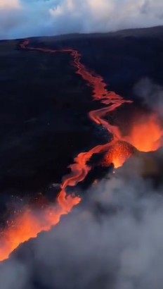
Aerial view into the eruptive fissure and lava flow at Piton de la Fournaise volcano (image: lareunion_dimz/x.com)
Tre di queste fratture hanno smesso di eruttare nel giro di poche ore, mentre la quarta è ancora attiva e sta alimentando una colata di lava molto fluida che sta avanzando in direzione dell’RN2, una delle poche strade che attraversano la caldera. Video di DroneCopters pic.twitter.com/5cOEoO8LBs
???????? Ieri è iniziata la seconda eruzione dell’anno del Piton de la Fournaise, sull’Isola della Riunione! Dopo una breve crisi sismica e una rapida deformazione, si sono aperte quattro fratture eruttive sul fianco sud-orientale del cratere Dolomieu. Video di lareunion_dimz pic.twitter.com/NISWshH5WK
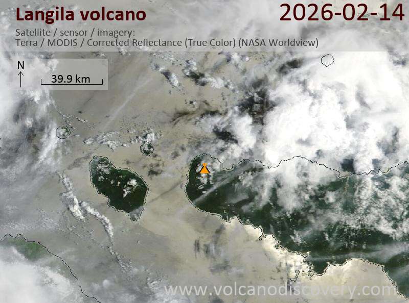
Explosive activity continues. Volcanic Ash Advisory Center (VAAC) Darwin warned about a volcanic ash plume that rose up to estimated 9000 ft (2700 m) altitude or flight level 090 . The full report is as follows:
FVAU03 at 22:23 UTC, 14/02/26 from ADRM VA ADVISORY DTG: 20260214/2223Z VAAC: DARWIN VOLCANO: LANGILA 252010 PSN: S0532 E14825 AREA: PAPUA NEW GUINEA SOURCE ELEV: 1330M AMSL ADVISORY NR: 2026/1 INFO SOURCE: HIMAWARI-9 ERUPTION DETAILS: VA TO FL090 MOV SW OBS AT 14/2210Z OBS VA DTG: 14/2210Z OBS VA CLD: SFC/FL090 S0530 E14826 – S0532 E14827 – S0537 E14819 – S0531 E14817 MOV SW 10KT FCST VA CLD +6 HR: 15/0410Z SFC/FL090 S0530 E14826 – S0532 E14828 – S0547 E14807 – S0529 E14803 FCST VA CLD +12 HR: 15/1010Z NO VA EXP FCST VA CLD +18 HR: 15/1610Z NO VA EXP RMK: DISCRETE VA EMISSION OBS ON LATEST SATELLITE IMAGERY. VA EXPECTED TO DISSIPATE IN 6-9 HOURS. HEIGHT AND FORECAST BASED ON SATELLITE IMAGERY AND MODEL GUIDANCE. NXT ADVISORY: NO LATER THAN 20260215/0423Z=
Sakurajima (Kyushu, Japan): The Japan Meteorological Agency (JMA) reported that the eruption continued at Aira between 9 February 2026 (local) and 13 February 2026 (local). A high-sensitivity surveillance camera recorded incandescence at Minamidake Crater at night. The alert level remained at „Level 3 – Restriction on proximity to the volcano“ (on a 5-level scale). Source: Japan Meteorological Agency (JMA) … [read more] … [show less] Current Alerts: Observatory alert level: „Level 3 – Restriction on proximity to the volcano“ (on a 5-level scale)
Suwanose-jima (Ryukyu Islands): The Japan Meteorological Agency (JMA) reported that the eruption continued at Suwanosejima between 6 February 2026 (local) and 13 February 2026 (local). Gas and vapor plume(s) rose to a maximum of 700 m (2,297 ft) above the vent. The alert level remained at „Level 2 – Restriction on proximity to the crater“ (on a 5-level scale). Source: Japan Meteorological Agency (JMA) … [read more] … [show less] Current Alerts: Observatory alert level: „Level 2 – Restriction on proximity to the crater“ (on a 5-level scale)
Canlaon (Central Philippines): The Philippine Institute of Volcanology and Seismology (PHIVOLCS) reported that the eruption continued at Kanlaon on 13 February 2026 (local). A total of 1 ash emission event occurred, lasting 17 minutes. The alert level remained at „2 – Moderate Level of Volcanic Unrest“ (on a 0–5 level scale). Source: Philippine Institute of Volcanology and Seismology (PHIVOLCS) … [read more] … [show less] Current Alerts: Observatory alert level: „2 – Moderate Level of Volcanic Unrest“ (on a 0–5 level scale)
Taal (Luzon, Philippines): The Philippine Institute of Volcanology and Seismology (PHIVOLCS) reported that the eruption continued at Taal on 13 February 2026 (local). The alert level remained at „1 – Low-Level Unrest“ (on a 0–5 level scale). Source: Philippine Institute of Volcanology and Seismology (PHIVOLCS) … [read more] … [show less] Current Alerts: Observatory alert level: „1 – Low-Level Unrest“ (on a 0–5 level scale)
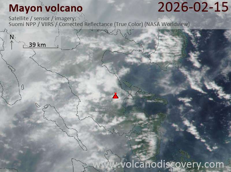
Mayon (Luzon Island, Philippines): Volcanic Ash Advisory Center Tokyo (VAAC) issued the following report: ERUPTION AT 20260214/2009Z VA CLD UNKNOWN REPORTED OBS VA DTG:14/2010Z …14 Feb: The Philippine Institute of Volcanology and Seismology (PHIVOLCS) reported that the eruption continued at Mayon on 13 February 2026 (local). Lava effusion continued from the summit crater. As of 13 February, lava flow lengths remained at radial distances of 3.8 km in the Basud gully, 1.6 km in the Bonga gully, and 1.3 km in the Mi-isi gully. There were 378 seismically detected rockfalls. Crater glow was visible to the naked eye. Plume(s) rose to a maximum of 250 m (820 ft) above the vent. Sulfur dioxide (SO₂) emissions averaged 3,788 tonnes per day on 13 February. The alert level remained at „3 – Increased Tendency Towards Hazardous Eruption“ (on a 0–5 level scale). Activity also included: seismically detected pyroclastic density current(s) (PDCs). Source: Philippine Institute of Volcanology and Seismology (PHIVOLCS) … [read more] … [show less] Current Alerts: Observatory alert level: „3 – Increased Tendency Towards Hazardous Eruption“ (on a 0–5 level scale)
Telong (northern Sumatra, Indonesia): The Center for Volcanology and Geological Hazard/Pusat Vulkanologi dan Mitigasi Bencana Geologi (CVGHM/PVMBG) reported that unrest continued at Telong, Bur ni on 13 February 2026 (local). The alert level remained at „Level 2 – Alert“ (on a 4-level scale). Source: Center for Volcanology and Geological Hazard/Pusat Vulkanologi dan Mitigasi Bencana Geologi (CVGHM/PVMBG) … [read more] … [show less] Current Alerts: Observatory alert level: „Level 2 – Alert“ (on a 4-level scale)
Karangetang (Siau Island, Sangihe Islands, Indonesia): The Center for Volcanology and Geological Hazard/Pusat Vulkanologi dan Mitigasi Bencana Geologi (CVGHM/PVMBG) reported that unrest continued at Karangetang on 13 February 2026 (local). The alert level remained at „Level 2 – Alert“ (on a 4-level scale). Source: Center for Volcanology and Geological Hazard/Pusat Vulkanologi dan Mitigasi Bencana Geologi (CVGHM/PVMBG) … [read more] … [show less] Current Alerts: Observatory alert level: „Level 2 – Alert“ (on a 4-level scale)
Raung (East Java): The Center for Volcanology and Geological Hazard/Pusat Vulkanologi dan Mitigasi Bencana Geologi (CVGHM/PVMBG) reported that unrest continued at Raung on 13 February 2026 (local). Gas and vapor plume(s) rose to a maximum of 200 m (656 ft) above the vent. The alert level remained at „Level 2 – Alert“ (on a 4-level scale). Source: Center for Volcanology and Geological Hazard/Pusat Vulkanologi dan Mitigasi Bencana Geologi (CVGHM/PVMBG) … [read more] … [show less] Current Alerts: Observatory alert level: „Level 2 – Alert“ (on a 4-level scale)
Ibu (Halmahera, Indonesia): Volcanic Ash Advisory Center Darwin (VAAC) issued the following report: VA EMISSION TO FL070 LAST REP FM GND AT 14/1333Z …14 Feb: The Center for Volcanology and Geological Hazard/Pusat Vulkanologi dan Mitigasi Bencana Geologi (CVGHM/PVMBG) reported that the eruption continued at Ibu on 13 February 2026 (local). Gas and vapor plume(s) rose to a maximum of 200 m (656 ft) above the vent. There were 124 seismically detected explosions reported. Ash and gas plume(s) rose to a maximum of 600 m (1,969 ft) above the vent. The alert level remained at „Level 2 – Alert“ (on a 4-level scale). Source: Center for Volcanology and Geological Hazard/Pusat Vulkanologi dan Mitigasi Bencana Geologi (CVGHM/PVMBG) … [read more] … [show less] Current Alerts: Observatory alert level: „Level 2 – Alert“ (on a 4-level scale)
Tangkubanparahu (West Java): The Center for Volcanology and Geological Hazard/Pusat Vulkanologi dan Mitigasi Bencana Geologi (CVGHM/PVMBG) issued a report for Tangkuban Parahu on 13 February 2026 (local). The alert level remained at „Level 1 – Normal“ (on a 4-level scale). Source: Center for Volcanology and Geological Hazard/Pusat Vulkanologi dan Mitigasi Bencana Geologi (CVGHM/PVMBG) … [read more] … [show less] Current Alerts: Observatory alert level: „Level 1 – Normal“ (on a 4-level scale)
Sangeang Api (Flores Sea, Indonesia): The Center for Volcanology and Geological Hazard/Pusat Vulkanologi dan Mitigasi Bencana Geologi (CVGHM/PVMBG) reported that unrest continued at Sangeang Api on 13 February 2026 (local). The alert level remained at „Level 2 – Alert“ (on a 4-level scale). Source: Center for Volcanology and Geological Hazard/Pusat Vulkanologi dan Mitigasi Bencana Geologi (CVGHM/PVMBG) … [read more] … [show less] Current Alerts: Observatory alert level: „Level 2 – Alert“ (on a 4-level scale)
Lewotobi (Flores): The Center for Volcanology and Geological Hazard/Pusat Vulkanologi dan Mitigasi Bencana Geologi (CVGHM/PVMBG) reported that unrest continued at Lewotobi (Laki-Laki) on 13 February 2026 (local). The alert level remained at „Level 3 – Standby“ (on a 4-level scale). Activity also included: seismically detected flowage event(s). Source: Center for Volcanology and Geological Hazard/Pusat Vulkanologi dan Mitigasi Bencana Geologi (CVGHM/PVMBG) … [read more] … [show less] Current Alerts: Observatory alert level: „Level 3 – Standby“ (on a 4-level scale)
Soputan (North Sulawesi, Indonesia): The Center for Volcanology and Geological Hazard/Pusat Vulkanologi dan Mitigasi Bencana Geologi (CVGHM/PVMBG) reported that unrest continued at Soputan on 13 February 2026 (local). The alert level remained at „Level 2 – Alert“ (on a 4-level scale). Source: Center for Volcanology and Geological Hazard/Pusat Vulkanologi dan Mitigasi Bencana Geologi (CVGHM/PVMBG) … [read more] … [show less] Current Alerts: Observatory alert level: „Level 2 – Alert“ (on a 4-level scale)
Lewotolo (Lesser Sunda Islands): The Center for Volcanology and Geological Hazard/Pusat Vulkanologi dan Mitigasi Bencana Geologi (CVGHM/PVMBG) reported that the eruption continued at Lewotolok on 13 February 2026 (local). There were 56 seismically detected explosions reported. The alert level remained at „Level 3 – Standby“ (on a 4-level scale). Source: Center for Volcanology and Geological Hazard/Pusat Vulkanologi dan Mitigasi Bencana Geologi (CVGHM/PVMBG) … [read more] … [show less] Current Alerts: Observatory alert level: „Level 3 – Standby“ (on a 4-level scale)
Merapi (Central Java, Indonesia): The Center for Volcanology and Geological Hazard/Pusat Vulkanologi dan Mitigasi Bencana Geologi (CVGHM/PVMBG) reported that the eruption continued at Merapi on 13 February 2026 (local). Gas and vapor plume(s) rose to a maximum of 20 m (66 ft) above the vent. There were 6 hot rockfalls, traveling up to 1,500 m. The alert level remained at „Level 3 – Standby“ (on a 4-level scale). Source: Center for Volcanology and Geological Hazard/Pusat Vulkanologi dan Mitigasi Bencana Geologi (CVGHM/PVMBG) … [read more] … [show less] Current Alerts: Observatory alert level: „Level 3 – Standby“ (on a 4-level scale)
Semeru (East Java, Indonesia): Explosive activity continues. Volcanic Ash Advisory Center (VAAC) Darwin warned about a volcanic ash plume that rose up to estimated 18000 ft (5500 m) altitude or flight level 180 . The full report is as follows: VA TO FL180 REPORTED AT 14/0208Z MOV NE. to 18000 ft (5500 m) …14 Feb: The Center for Volcanology and Geological Hazard/Pusat Vulkanologi dan Mitigasi Bencana Geologi (CVGHM/PVMBG) reported that the eruption continued at Semeru on 13 February 2026 (local). There were 58 seismically detected explosions reported. Ash and gas plume(s) were reported. A total of 5 pyroclastic density currents (PDCs), or pyroclastic flows, accompanied eruptions at 1056, 1246, 1422, 1431, and 2002 on 13 February. The PDCs traveled distances ranging from 2,500 m to 4,000 m toward Besuk Kobokan (SE flank), with the longest run-out length recorded at 2002. There were 7 seismically detected rockfalls. The alert level remained at „Level 3 – Standby“ (on a 4-level scale). Source: Center for Volcanology and Geological Hazard/Pusat Vulkanologi dan Mitigasi Bencana Geologi (CVGHM/PVMBG) … [read more] … [show less] Current Alerts: Observatory alert level: „Level 3 – Standby“ (on a 4-level scale)
Marapi (Western Sumatra, Indonesia): The Center for Volcanology and Geological Hazard/Pusat Vulkanologi dan Mitigasi Bencana Geologi (CVGHM/PVMBG) reported that the eruption continued at Marapi on 13 February 2026 (local). The alert level remained at „Level 2 – Alert“ (on a 4-level scale). Source: Center for Volcanology and Geological Hazard/Pusat Vulkanologi dan Mitigasi Bencana Geologi (CVGHM/PVMBG) … [read more] … [show less] Current Alerts: Observatory alert level: „Level 2 – Alert“ (on a 4-level scale)
Dukono (Halmahera): The Center for Volcanology and Geological Hazard/Pusat Vulkanologi dan Mitigasi Bencana Geologi (CVGHM/PVMBG) reported that the eruption continued at Dukono on 13 February 2026 (local). Gas and vapor plume(s) rose to a maximum of 600 m (1,969 ft) above the vent. The alert level remained at „Level 2 – Alert“ (on a 4-level scale). Source: Center for Volcanology and Geological Hazard/Pusat Vulkanologi dan Mitigasi Bencana Geologi (CVGHM/PVMBG) … [read more] … [show less] Current Alerts: Observatory alert level: „Level 2 – Alert“ (on a 4-level scale)
Awu (Sulawesi & Sangihe Islands): The Center for Volcanology and Geological Hazard/Pusat Vulkanologi dan Mitigasi Bencana Geologi (CVGHM/PVMBG) reported that unrest continued at Awu on 13 February 2026 (local). The alert level remained at „Level 2 – Alert“ (on a 4-level scale). Source: Center for Volcanology and Geological Hazard/Pusat Vulkanologi dan Mitigasi Bencana Geologi (CVGHM/PVMBG) … [read more] … [show less] Current Alerts: Observatory alert level: „Level 2 – Alert“ (on a 4-level scale)
Kerinci (Sumatra): The Center for Volcanology and Geological Hazard/Pusat Vulkanologi dan Mitigasi Bencana Geologi (CVGHM/PVMBG) reported that unrest continued at Kerinci on 13 February 2026 (local). The alert level remained at „Level 2 – Alert“ (on a 4-level scale). Source: Center for Volcanology and Geological Hazard/Pusat Vulkanologi dan Mitigasi Bencana Geologi (CVGHM/PVMBG) … [read more] … [show less] Current Alerts: Observatory alert level: „Level 2 – Alert“ (on a 4-level scale)
Lokon-Empung (North Sulawesi, Indonesia): The Center for Volcanology and Geological Hazard/Pusat Vulkanologi dan Mitigasi Bencana Geologi (CVGHM/PVMBG) reported that unrest continued at Lokon-Empung on 13 February 2026 (local). Gas and vapor plume(s) rose to a maximum of 25 m (82 ft) above the vent. The alert level remained at „Level 2 – Alert“ (on a 4-level scale). Source: Center for Volcanology and Geological Hazard/Pusat Vulkanologi dan Mitigasi Bencana Geologi (CVGHM/PVMBG) … [read more] … [show less] Current Alerts: Observatory alert level: „Level 2 – Alert“ (on a 4-level scale)
Kilauea (Hawai’i): The United States Geological Survey – Hawaiian Volcano Observatory (USGS-HVO) reported that there was a pause in eruptive activity at Kilauea between 12 February 2026 (local) and 13 February 2026 (local). Moderate glow was observed from the north and south vents overnight in webcam images, with the south vent appearing slightly brighter. Minor lava spattering activity was observed at the south vent briefly before midnight on 12 February. The alert level remained at „Watch“ (level 3 on a 4-level scale). The aviation alert level remained at „Orange“ (level 3 on a 4-level scale). Source: United States Geological Survey – Hawaiian Volcano Observatory (USGS-HVO) … [read more] … [show less] Current Alerts: Observatory alert level: „Watch“ (level 3 on a 4-level scale)
Shishaldin (Aleutian Islands, Alaska): The United States Geological Survey – Alaska Volcano Observatory (USGS-AVO) reported that unrest continued at Shishaldin between 12 February 2026 (local) and 13 February 2026 (local). The alert level remained at „Advisory“ (level 2 on a 4-level scale). The aviation alert level remained at „Yellow“ (level 2 on a 4-level scale). Source: United States Geological Survey – Alaska Volcano Observatory (USGS-AVO) … [read more] … [show less] Current Alerts: Observatory alert level: „Advisory“ (level 2 on a 4-level scale)
Great Sitkin (United States, Aleutian Islands): The United States Geological Survey – Alaska Volcano Observatory (USGS-AVO) reported that the eruption continued at Great Sitkin between 12 February 2026 (local) and 13 February 2026 (local). Lava continued to slowly erupt in the summit crater. The alert level remained at „Watch“ (level 3 on a 4-level scale). The aviation alert level remained at „Orange“ (level 3 on a 4-level scale). Source: United States Geological Survey – Alaska Volcano Observatory (USGS-AVO) … [read more] … [show less] Current Alerts: Observatory alert level: „Watch“ (level 3 on a 4-level scale)
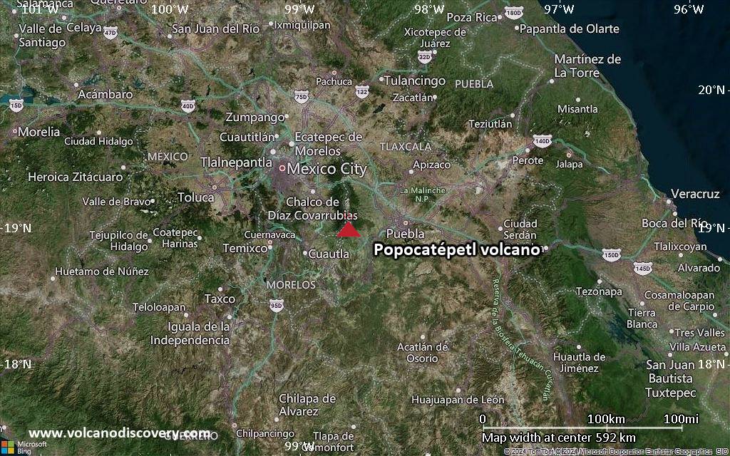
Popocatépetl (Central Mexico): The Centro Nacional de Prevención de Desastres (CENAPRED) reported that the eruption continued at Popocatépetl between 12 February 2026 (local) and 13 February 2026 (local). Gas and vapor plume(s) were reported. The alert level remained at „Yellow Alert – Phase 2“ (level 4 on a 7-level scale). Source: Centro Nacional de Prevención de Desastres (CENAPRED) … [read more] … [show less] Current Alerts: Observatory alert level: „Yellow Alert – Phase 2“ (level 4 on a 7-level scale)
Santiaguito (Guatemala): The Instituto Nacional de Sismología, Vulcanología, Meteorología e Hidrología (INSIVUMEH) reported that the eruption continued at Santa María between 12 February 2026 (local) and 13 February 2026 (local). There were explosions reported, occurring at a rate of up to 2 per hour with plumes rising to a maximum of 3,400 m (11,155 ft) above sea level. There were incandescent rockfalls. Gas and vapor plume(s) rose to a maximum of 400 m (1,312 ft) above the vent. Source: Instituto Nacional de Sismología, Vulcanología, Meteorología e Hidrología (INSIVUMEH) … [read more] … [show less] Current Alerts: Observatory alert level: unavailable or not collected
Pacaya (Guatemala): The Instituto Nacional de Sismología, Vulcanología, Meteorología e Hidrología (INSIVUMEH) reported that unrest continued at Pacaya between 12 February 2026 (local) and 13 February 2026 (local). Gas and vapor plume(s) were reported. Source: Instituto Nacional de Sismología, Vulcanología, Meteorología e Hidrología (INSIVUMEH) … [read more] … [show less] Current Alerts: Observatory alert level: unavailable or not collected
Fuego (Guatemala): Explosive activity continues. Volcanic Ash Advisory Center (VAAC) Washington warned about a volcanic ash plume that rose up to estimated 16000 ft (4900 m) altitude or flight level 160 . The full report is as follows: FRQT LGT VA EMS to 16000 ft (4900 m) …14 Feb: The Instituto Nacional de Sismología, Vulcanología, Meteorología e Hidrología (INSIVUMEH) reported that the eruption continued at Fuego between 12 February 2026 (local) and 13 February 2026 (local). There were explosions reported, occurring at a rate of up to 12 per hour, with plumes rising to a maximum of 1,037 m (3,402 ft) above the vent. Fine ash fall was reported in Panimaché Uno, Finca Asunción, La Rochela, Ceylán, and El Zapote. Incandescent material was ejected in pulses above the crater. Gas and vapor plume(s) rose to a maximum of 537 m (1,762 ft) above the vent. Activity also included: audible sounds (e.g., booms, rumbling), shockwave. Source: Instituto Nacional de Sismología, Vulcanología, Meteorología e Hidrología (INSIVUMEH) … [read more] … [show less] Current Alerts: Observatory alert level: unavailable or not collected
Sangay (Ecuador): Explosive activity continues. Volcanic Ash Advisory Center (VAAC) Washington warned about a volcanic ash plume that rose up to estimated 20000 ft (6100 m) altitude or flight level 200 . The full report is as follows: ONGOING VA EMS to 20000 ft (6100 m) …14 Feb: The Instituto Geofísico-Escuela Politécnica Nacional (IG-EPN) reported that the eruption continued at Sangay between 12 February 2026 (local) and 13 February 2026 (local). There were 150 seismically detected explosions reported. The alert level remained at „2 – Yellow“ (on a 4-level scale). Source: Instituto Geofísico-Escuela Politécnica Nacional (IG-EPN) … [read more] … [show less] Current Alerts: Observatory alert level: „2 – Yellow“ (on a 4-level scale)
Reventador (Ecuador): The Instituto Geofísico-Escuela Politécnica Nacional (IG-EPN) reported that the eruption continued at Reventador between 12 February 2026 (local) and 13 February 2026 (local). There were 83 seismically detected explosions reported. On the of 12 February, several episodes of crater incandescence were observed. Incandescent blocks were ejected from the crater. There were incandescent rockfalls. A lava flow was observed descending the SE flank. The alert level remained at „3 – Orange“ (on a 4-level scale). Source: Instituto Geofísico-Escuela Politécnica Nacional (IG-EPN) … [read more] … [show less] Current Alerts: Observatory alert level: „3 – Orange“ (on a 4-level scale)
Sabancaya (Peru): Explosive activity continues. Volcanic Ash Advisory Center (VAAC) Buenos Aires warned about a volcanic ash plume that rose up to estimated 24000 ft (7300 m) altitude or flight level 240 . The full report is as follows: VA PUFF to 24000 ft (7300 m) …14 Feb: The Centro Vulcanológico Nacional del Instituto Geofísico del Perú (CENVUL-IGP) reported that the eruption continued at Sabancaya between 12 February 2026 (local) and 13 February 2026 (local). Ash, gas, and vapor plume(s) rose to a maximum of 700 m (2,297 ft) above the vent. A total of 11 earthquakes related to the movement of magma and gases were recorded. The alert level remained at „Orange“ (level 3 on a 4-level scale). Source: Centro Vulcanológico Nacional del Instituto Geofísico del Perú (CENVUL-IGP) … [read more] … [show less] Current Alerts: Observatory alert level: „Orange“ (level 3 on a 4-level scale)
Piton de la Fournaise (La Réunion): The effusive eruption at the volcano continues. The Volcanological Observatory of Piton de la Fournaise reported that only one eruptive fissure has remained active, located near Piton Morgabim on the south-southeast flank. The lava flow field has been advancing at a quick pace, currently about 3 km from the RN2 highway.