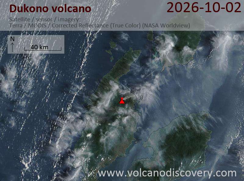
Explosive activity continues. The Volcanic Ash Advisory Center (VAAC) Darwin warned of a volcanic ash plume rising to an estimated 7000 ft (2100 m), or flight level 070. Original VAAC bulletin:
FVAU01 at 04:29 UTC, 02/10/26 from ADRM
VA ADVISORY
DTG: 20261002/0430Z
VAAC: DARWIN
VOLCANO: DUKONO 268010
PSN: N0142 E12754
AREA: INDONESIA
SOURCE ELEV: 1229M AMSL
ADVISORY NR: 2026/823
INFO SOURCE: HIMAWARI-9
ERUPTION DETAILS: VA TO FL070 OBS EXTD NE
OBS VA DTG: 02/0400Z
OBS VA CLD: SFC/FL070 N0139 E12752 - N0144 E12750 - N0213
 E12848 - N0205 E12900 - N0133 E12851 - N0129 E12822 MOV NE
 05KT
FCST VA CLD +6 HR: 02/1000Z SFC/FL070 N0144 E12752 - N0215
 E12821 - N0220 E12849 - N0207 E12914 - N0125 E12853 - N0139
 E12753
FCST VA CLD +12 HR: 02/1600Z SFC/FL070 N0139 E12752 - N0145
 E12751 - N0215 E12850 - N0129 E12903
FCST VA CLD +18 HR: 02/2200Z SFC/FL070 N0139 E12754 - N0145
 E12752 - N0214 E12850 - N0130 E12903
RMK: CONTINUOUS VA ERUPTION IDENTIFIABLE ON SATELLITE
 IMAGERY. HEIGHT AND MOVEMENT BASED ON SATELLITE IMAGERY AND
 MODEL GUIDANCE.
NXT ADVISORY: NO LATER THAN 20261002/1030Z=
Explosive activity continues. The Volcanic Ash Advisory Center (VAAC) Washington warned of a volcanic ash plume rising to an estimated 22000 ft (6700 m), or flight level 220. Original VAAC bulletin:
FVXX25 at 23:41 UTC, 01/10/26 from KNES VA ADVISORY DTG: 20261001/2338Z
RMK: VONA RCVD FR VA EMS. VA EMS OBS IN WEBCAM AND STLT IMG EXT APRX 10NM SW FM SUMMIT. SW MVMT EXP THRU T+18. FCST BASED ON VONA, STLT AND MDL WINDS. ...GATLING
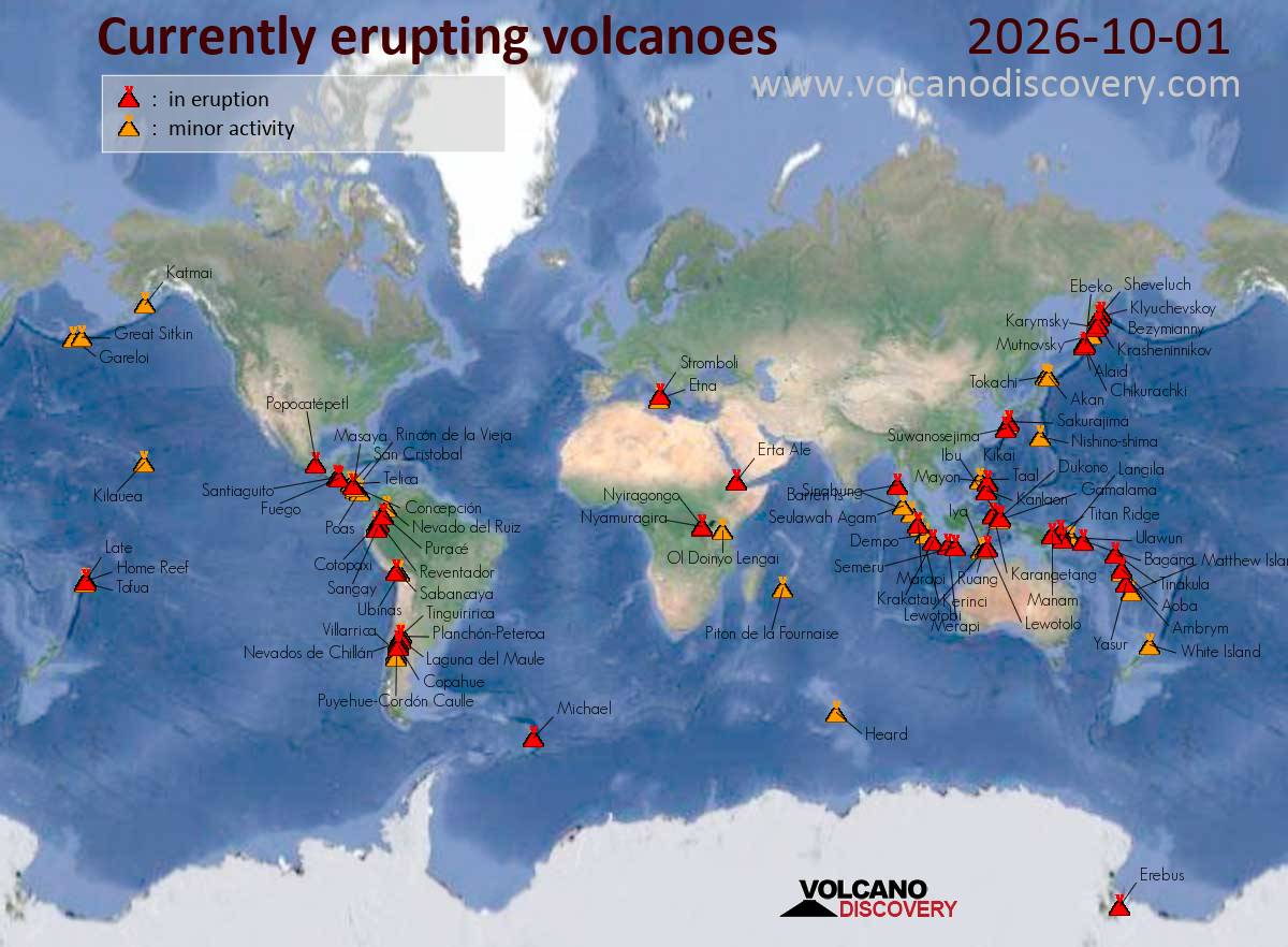
Sheveluch (Kamchatka): (30 Sep) An eruption was reported at Sheveluch at 21:23 UTC on 30 September 2026, with ash estimated at FL170. As of 22:20 UTC, volcanic ash was not identifiable in satellite data. Original VAAC bulletin:Sheveluch Volcanic Ash Advisory
Sakurajima (Kyushu, Japan): An eruption was reported at Sakurajima at 09:24 UTC on 1 October 2026, but volcanic ash was not identifiable in satellite data as of 09:30 UTC. No forecast information is available. Original VAAC bulletin:Sakurajima Volcanic Ash Advisory
Karangetang (Siau Island, Sangihe Islands, Indonesia): Explosive activity continues. The Volcanic Ash Advisory Center (VAAC) Darwin warned of a volcanic ash plume rising to an estimated 9000 ft (2700 m), or flight level 090, and moving at 10 kts in E direction. Original VAAC bulletin:ash plume to 9,000 ft (2,700 m) as of Oct 1, 16:58 UTC
Ibu (Halmahera, Indonesia): (30 Sep) Explosive activity continues. The Volcanic Ash Advisory Center (VAAC) Darwin warned of a volcanic ash plume rising to an estimated 7000 ft (2100 m), or flight level 070. Original VAAC bulletin:ash plume to 7,000 ft (2,100 m) as of Sep 30, 21:50 UTC
Lewotolo (Lesser Sunda Islands): (1 Oct) Explosive activity continues. The Volcanic Ash Advisory Center (VAAC) Darwin warned of a volcanic ash plume rising to an estimated 7000 ft (2100 m), or flight level 070. Original VAAC bulletin:ash plume to 7,000 ft (2,100 m) as of Oct 1, 07:50 UTC
Semeru (East Java, Indonesia): Explosive activity continues. The Volcanic Ash Advisory Center (VAAC) Darwin warned of a volcanic ash plume rising to an estimated 15000 ft (4600 m), or flight level 150. Original VAAC bulletin:ash plume to 15,000 ft (4,600 m) as of Oct 1, 11:20 UTC
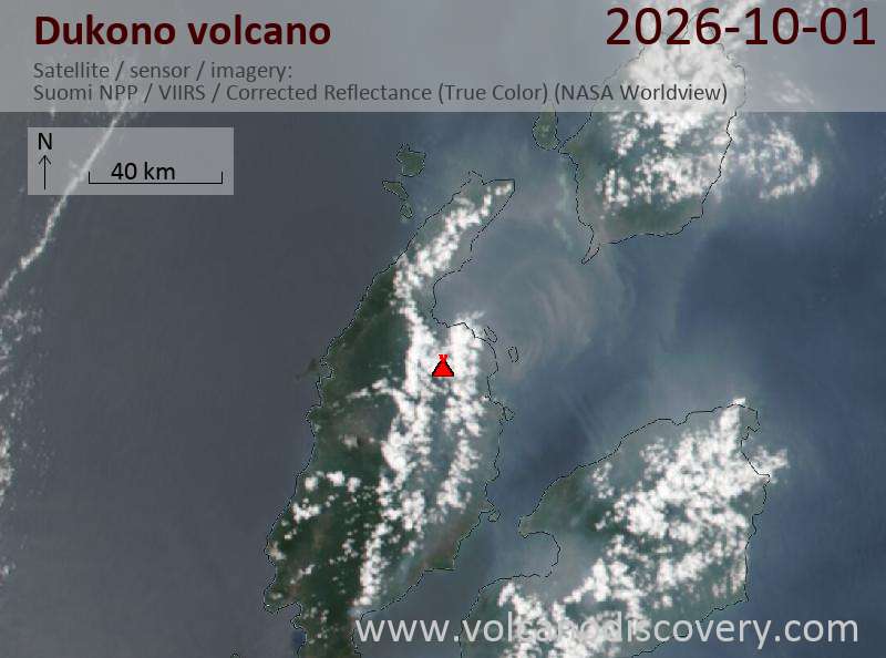
Dukono (Halmahera): Explosive activity continues. The Volcanic Ash Advisory Center (VAAC) Darwin warned of a volcanic ash plume rising to an estimated 7000 ft (2100 m), or flight level 070. Original VAAC bulletin:ash plume to 7,000 ft (2,100 m) as of Oct 1, 16:10 UTC
Kilauea (Hawai’i): A shallow intrusion of magma is occurring within the summit region near the existing eruption location in Hawai’i Volcanoes National Park, the Hawaiian Volcano Observatory reported a short time ago: „Earthquake activity has increased in the summit region of Kīlauea beneath Halemaʻumaʻu crater and the south caldera region. Ground deformation patterns recorded by summit tiltmeters suggest that magma is intruding beneath the ground in this area, in an east-west orientation, near the western or southern part of Halemaʻumaʻu crater. … [read more] … [show less] Increased earthquake activity began this afternoon, September 30, 2026, at approximately 2 p.m. HST, underneath Halemaʻumaʻu. Since then, about 40 earthquakes have been detected and activity is still on-going. The largest event so far, a magnitude 3.4 earthquake, occurred at 9:52 p.m. HST, 1.4 km (0.9 miles) beneath the surface in the northeast part of Halemaʻumaʻu. Starting around 8 p.m. HST, summit tiltmeters began to show extremely rapid changes consistent with crack growth in an east-west orientation, possibly near the current vent area, suggesting that magma is intruding in this region. Historically, east-west-trending fissures have erupted in the southeastern part of Halemaʻumaʻu and extended through the Keanakākoʻi crater area all the way to Chain of Craters Road near Lua Manu. The last east-west fissure in this area erupted in September 2023 and extended from the middle of Halemaʻumaʻu to the eastern wall just beneath the Keanakākoʻi overlook. An event of this type is also possible under current conditions.
Gareloi (United States, Aleutian Islands): A single brief explosion was detected in geophysical data at 07:27 AM AKDT (15:27 UTC), the Alaska Volcano Observatory reported.
As a result, AVO is raising the Aviation Color Code to YELLOW and the Volcano Alert Level to ADVISORY. It is unknown if a volcanic ash cloud was produced as cloud cover up to about 20,000 feet above sea level is obscuring the volcano.
If an ash cloud were produced, the amount of ash would be minor due to the short duration (less than 1 min) of the explosion. Infrasound data indicates the explosion likely occurred from the south crater of Mount Gareloi.
Fuego (Guatemala): Intermittent volcanic ash emissions from Fuego were observed by webcam but not detected by satellite due to heavy meteorological cloud cover as of October 1, 2026, 16:30 UTC. Forecasts indicate possible ash movement towards the east-northeast through the next 18 hours. Original VAAC bulletin:Fuego Volcanic Ash Advisory
Telica (Nicaragua): Explosive activity continues. The Volcanic Ash Advisory Center (VAAC) Washington warned of a volcanic ash plume rising to an estimated 5000 ft (1500 m), or flight level 050. Original VAAC bulletin:ash plume to 5,000 ft (1,500 m) as of Oct 1, 14:30 UTC
Puracé (Colombia): The Volcanic Ash Advisory Center (VAAC) Washington issued the following bulletin. Original VAAC bulletin:PSBL VA EMS
Sangay (Ecuador): Possible volcanic ash emissions were reported for Sangay. Weather clouds obscured satellite and webcam views; forecasts indicate southwest movement of ash through the next 18 hours. Original VAAC bulletin:Sangay Volcanic Ash Advisory
Reventador (Ecuador): The Volcanic Ash Advisory Center (VAAC) Washington issued the following bulletin. Original VAAC bulletin:VA EMS SEEN ON WEBCAM
Explosive activity continues. The Volcanic Ash Advisory Center (VAAC) Darwin warned of a volcanic ash plume rising to an estimated 7000 ft (2100 m), or flight level 070. Original VAAC bulletin:
FVAU01 at 16:27 UTC, 01/10/26 from ADRM
VA ADVISORY
DTG: 20261001/1630Z
VAAC: DARWIN
VOLCANO: DUKONO 268010
PSN: N0142 E12754
AREA: INDONESIA
SOURCE ELEV: 1229M AMSL
ADVISORY NR: 2026/821
INFO SOURCE: HIMAWARI-9
ERUPTION DETAILS: VA TO FL070 OBS AT 01/1610Z EXTD NE
OBS VA DTG: 01/1610Z
OBS VA CLD: SFC/FL070 N0144 E12747 - N0227 E12807 - N0221
 E12849 - N0158 E12856 - N0136 E12844 - N0135 E12751 MOV NE
 10KT
FCST VA CLD +6 HR: 01/2210Z SFC/FL070 N0136 E12752 - N0142
 E12747 - N0218 E12756 - N0219 E12815 - N0210 E12842 - N0142
 E12849
FCST VA CLD +12 HR: 02/0410Z SFC/FL070 N0135 E12752 - N0145
 E12746 - N0220 E12836 - N0200 E12907 - N0133 E12853
FCST VA CLD +18 HR: 02/1010Z SFC/FL070 N0138 E12747 - N0146
 E12747 - N0217 E12834 - N0203 E12859 - N0137 E12908 - N0122
 E12850
RMK: VA IDENTIFIABLE ON CURRENT SATELLITE RGB IMAGE. HEIGHT
 AND MOVEMENT BASED ON SATELLITE IMAGERY AND MODEL GUIDANCE.
NXT ADVISORY: NO LATER THAN 20261001/2230Z=
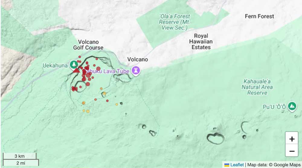
Earthquakes under Kilauea volcano's summit caldera
A shallow intrusion of magma is occurring within the summit region near the existing eruption location in Hawai’i Volcanoes National Park, the Hawaiian Volcano Observatory reported a short time ago: „Earthquake activity has increased in the summit region of Kīlauea beneath Halemaʻumaʻu crater and the south caldera region. Ground deformation patterns recorded by summit tiltmeters suggest that magma is intruding beneath the ground in this area, in an east-west orientation, near the western or southern part of Halemaʻumaʻu crater.
Increased earthquake activity began this afternoon, September 30, 2026, at approximately 2 p.m. HST, underneath Halemaʻumaʻu. Since then, about 40 earthquakes have been detected and activity is still on-going. The largest event so far, a magnitude 3.4 earthquake, occurred at 9:52 p.m. HST, 1.4 km (0.9 miles) beneath the surface in the northeast part of Halemaʻumaʻu. Starting around 8 p.m. HST, summit tiltmeters began to show extremely rapid changes consistent with crack growth in an east-west orientation, possibly near the current vent area, suggesting that magma is intruding in this region.
Historically, east-west-trending fissures have erupted in the southeastern part of Halemaʻumaʻu and extended through the Keanakākoʻi crater area all the way to Chain of Craters Road near Lua Manu. The last east-west fissure in this area erupted in September 2023 and extended from the middle of Halemaʻumaʻu to the eastern wall just beneath the Keanakākoʻi overlook. An event of this type is also possible under current conditions.
Currently, there are no signs of a change at the surface as the existing eruptive vent complex in Halemaʻumaʻu, including the north and south vents, continues to intermittently spatter with strong glow and flames; however, conditions could change quickly. It is possible that this event ends without reaching the surface or it produces a fissure eruption in a new location within the summit caldera region.
Current activity is restricted to the summit region of Kīlauea. No anomalous activity has been detected in the East Rift Zone or Southwest Rift Zone.
The USGS Hawaiian Volcano Observatory is monitoring the situation closely and will issue additional messages as needed.“