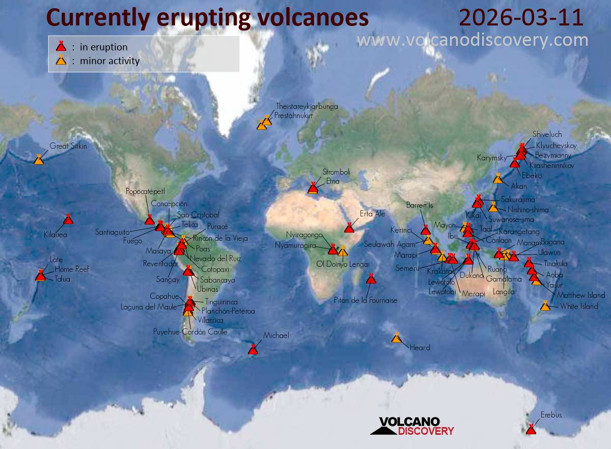
Canlaon (Central Philippines): (11 Mar) The Philippine Institute of Volcanology and Seismology (PHIVOLCS) reported that the eruption continued at Kanlaon on 10 March 2026 (local). Plume(s) rose to a maximum of 150 m (492 ft) above the vent. The alert level remained at „2 – Moderate Level of Volcanic Unrest“ (on a 0–5 level scale).
Source: Philippine Institute of Volcanology and Seismology (PHIVOLCS)
… [read more]
Taal (Luzon, Philippines): (11 Mar) The Philippine Institute of Volcanology and Seismology (PHIVOLCS) reported that the eruption continued at Taal on 10 March 2026 (local). Plume(s) were reported. The alert level remained at „1 – Low-Level Unrest“ (on a 0–5 level scale).
Source: Philippine Institute of Volcanology and Seismology (PHIVOLCS)
… [read more]
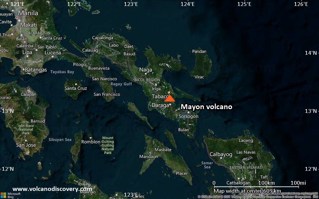
Mayon (Luzon Island, Philippines): Volcanic Ash Advisory Center Tokyo (VAAC) issued the following report: ERUPTION AT 20260311/1225Z FL100 EXTD ENE REPORTED OBS VA DTG:11/1340Z
…11 Mar:
The Philippine Institute of Volcanology and Seismology (PHIVOLCS) reported that the eruption continued at Mayon on 10 March 2026 (local). Lava effusion continued from the summit crater. As of 10 March, lava flow lengths remained at 3.8 km in the Basud Gully (E flank), 3.1 km in the Bonga Gully (SE flank), and 1.3 km in the Mi-isi Gully (S flank). Minor episodic Strombolian activity was observed. There were 361 seismically detected rockfalls. Crater glow was visible to the naked eye. Sulfur dioxide (SO₂) emissions averaged 3,551 tonnes per day on 10 March. Plume(s) rose to a maximum of 750 m (2,461 ft) above the vent. The alert level remained at „3 – Increased Tendency Towards Hazardous Eruption“ (on a 0–5 level scale). Activity also included: inflationary deformation, seismically detected pyroclastic density current(s) (PDCs), volcanic seismicity.
Source: Philippine Institute of Volcanology and Seismology (PHIVOLCS)
… [read more]
Telong (northern Sumatra, Indonesia): (11 Mar) The Center for Volcanology and Geological Hazard/Pusat Vulkanologi dan Mitigasi Bencana Geologi (CVGHM/PVMBG) reported that unrest continued at Telong, Bur ni on 10 March 2026 (local). The alert level remained at „Level 2 – Alert“ (on a 4-level scale).
Source: Center for Volcanology and Geological Hazard/Pusat Vulkanologi dan Mitigasi Bencana Geologi (CVGHM/PVMBG)
… [read more]
Karangetang (Siau Island, Sangihe Islands, Indonesia): (11 Mar) The Center for Volcanology and Geological Hazard/Pusat Vulkanologi dan Mitigasi Bencana Geologi (CVGHM/PVMBG) reported that unrest continued at Karangetang on 10 March 2026 (local). The alert level remained at „Level 2 – Alert“ (on a 4-level scale).
Source: Center for Volcanology and Geological Hazard/Pusat Vulkanologi dan Mitigasi Bencana Geologi (CVGHM/PVMBG)
… [read more]
Raung (East Java): (11 Mar) The Center for Volcanology and Geological Hazard/Pusat Vulkanologi dan Mitigasi Bencana Geologi (CVGHM/PVMBG) reported that unrest continued at Raung on 10 March 2026 (local). The alert level remained at „Level 2 – Alert“ (on a 4-level scale).
Source: Center for Volcanology and Geological Hazard/Pusat Vulkanologi dan Mitigasi Bencana Geologi (CVGHM/PVMBG)
… [read more]
Ibu (Halmahera, Indonesia): Volcanic Ash Advisory Center Darwin (VAAC) issued the following report: ERUPTION LAST REPORTED AT 11/1221Z EST VA DTG:11/1240Z
Tangkubanparahu (West Java): (11 Mar) The Center for Volcanology and Geological Hazard/Pusat Vulkanologi dan Mitigasi Bencana Geologi (CVGHM/PVMBG) issued a report for Tangkuban Parahu on 10 March 2026 (local). The alert level remained at „Level 1 – Normal“ (on a 4-level scale).
Source: Center for Volcanology and Geological Hazard/Pusat Vulkanologi dan Mitigasi Bencana Geologi (CVGHM/PVMBG)
… [read more]
Tambora (Sumbawa): (11 Mar) The Center for Volcanology and Geological Hazard/Pusat Vulkanologi dan Mitigasi Bencana Geologi (CVGHM/PVMBG) reported that unrest continued at Tambora on 10 March 2026 (local). The alert level was raised to „Level 2 – Alert“ (on a 4-level scale) on 10 March 2026 at 1000 by CVGHM/PVMBG due to an increase in the number of deep volcanic earthquakes. The public was advised to maintain a minimum distance of 3 km from Tambora and to avoid descending to the base of the caldera. Additionally, individuals should refrain from approaching the Doro Afi Toi and Doro Afi Bou cones. Activity also included: tectonic seismicity, deep volcanic seismicity (Type A/vulkanik dalam), volcano-tectonic (VT) seismicity.
Source: Center for Volcanology and Geological Hazard/Pusat Vulkanologi dan Mitigasi Bencana Geologi (CVGHM/PVMBG)
… [read more]
Lewotobi (Flores): (11 Mar) The Center for Volcanology and Geological Hazard/Pusat Vulkanologi dan Mitigasi Bencana Geologi (CVGHM/PVMBG) reported that the eruption continued at Lewotobi (Laki-Laki) on 10 March 2026 (local). The alert level remained at „Level 2 – Alert“ (on a 4-level scale).
Source: Center for Volcanology and Geological Hazard/Pusat Vulkanologi dan Mitigasi Bencana Geologi (CVGHM/PVMBG)
… [read more]
Soputan (North Sulawesi, Indonesia): (11 Mar) The Center for Volcanology and Geological Hazard/Pusat Vulkanologi dan Mitigasi Bencana Geologi (CVGHM/PVMBG) reported that unrest continued at Soputan on 10 March 2026 (local). The alert level remained at „Level 2 – Alert“ (on a 4-level scale).
Source: Center for Volcanology and Geological Hazard/Pusat Vulkanologi dan Mitigasi Bencana Geologi (CVGHM/PVMBG)
… [read more]
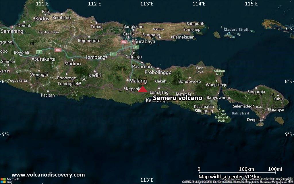
Semeru (East Java, Indonesia): Volcanic Ash Advisory Center Darwin (VAAC) issued the following report: ERUPTION LAST REPORTED AT 11/1147Z EST VA DTG:11/1500Z
Awu (Sulawesi & Sangihe Islands): (11 Mar) The Center for Volcanology and Geological Hazard/Pusat Vulkanologi dan Mitigasi Bencana Geologi (CVGHM/PVMBG) reported that unrest continued at Awu on 10 March 2026 (local). The alert level remained at „Level 2 – Alert“ (on a 4-level scale).
Source: Center for Volcanology and Geological Hazard/Pusat Vulkanologi dan Mitigasi Bencana Geologi (CVGHM/PVMBG)
… [read more]
Kerinci (Sumatra): (11 Mar) The Center for Volcanology and Geological Hazard/Pusat Vulkanologi dan Mitigasi Bencana Geologi (CVGHM/PVMBG) reported that unrest continued at Kerinci on 10 March 2026 (local). The alert level remained at „Level 2 – Alert“ (on a 4-level scale).
Source: Center for Volcanology and Geological Hazard/Pusat Vulkanologi dan Mitigasi Bencana Geologi (CVGHM/PVMBG)
… [read more]
Lokon-Empung (North Sulawesi, Indonesia): (11 Mar) The Center for Volcanology and Geological Hazard/Pusat Vulkanologi dan Mitigasi Bencana Geologi (CVGHM/PVMBG) reported that unrest continued at Lokon-Empung on 10 March 2026 (local). The alert level remained at „Level 2 – Alert“ (on a 4-level scale).
Source: Center for Volcanology and Geological Hazard/Pusat Vulkanologi dan Mitigasi Bencana Geologi (CVGHM/PVMBG)
… [read more]
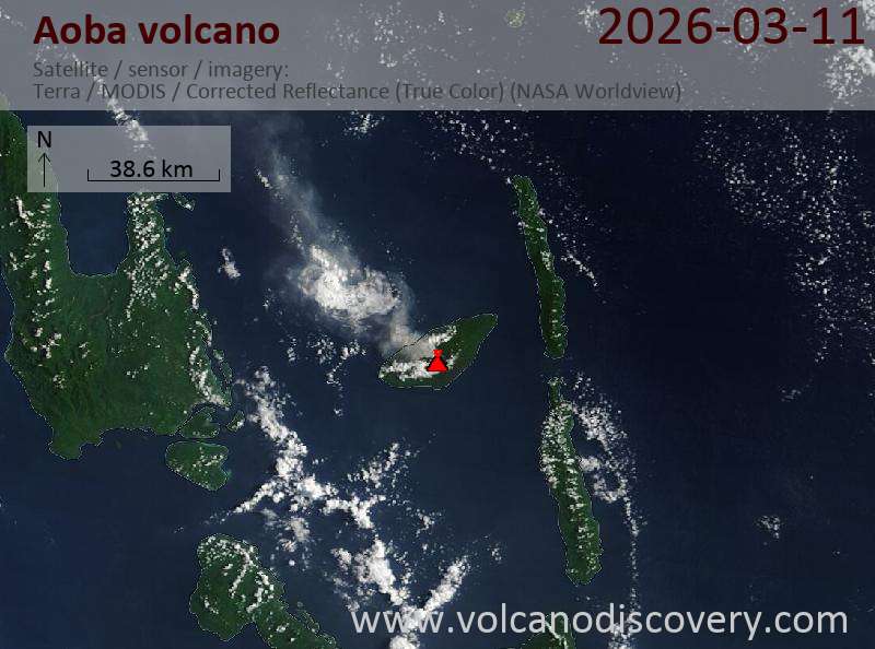
Aoba (Vanuatu): Explosive activity continues. Volcanic Ash Advisory Center (VAAC) Wellington warned about a volcanic ash plume that rose up to estimated 10000 ft (3000 m) altitude or flight level 100 and is moving at 05 kts in SW direction.
The full report is as follows: ERUPTION AT 20260309/2120Z CONTINUOUS LOW-LEVEL ERUPTION to 10000 ft (3000 m)
…11 Mar:
The Vanuatu Meteorology and Geo-Hazards Department-Vanuatu Geohazards Observatory (VMGD-VGO) reported that the eruption continued at Ambae between 7 March 2026 (local) and 10 March 2026 (local). The alert level remained at „3 – Minor Eruption“ (on a 0–5 level scale).
Source: Vanuatu Meteorology and Geo-Hazards Department-Vanuatu Geohazards Observatory (VMGD-VGO)
… [read more]
White Island (New Zealand): (11 Mar) Volcanic Ash Advisory Center Wellington (VAAC) issued the following report: ERUPTION AT 20260311/0255Z LOW LEVEL ERUPTION.
Kilauea (Hawai’i): (11 Mar) The newest (43rd) lava fountaining episode started yesterday at 09:17 AM local time at the Halemaʻumaʻu crater.
The USGS-HVO added: „Currently the south fountain is 1150 feet (350 meters) high and the north vent is 1000 feet (300 meters) high. Maximum fountain heights for both vents were over 1300 feet (400 meters). Lava flows are have covered about one third of the floor of Halemaʻumaʻu crater.“
… [read more]
Magnificent!! #kilauea pic.twitter.com/I7Z0MjuWfG
— Volcaholic (@volcaholic1) March 10, 2026
…11 Mar:
The United States Geological Survey (USGS) and United States Geological Survey – Hawaiian Volcano Observatory (USGS-HVO) reported that the eruption continued at Kilauea between 9 March 2026 (local) and 10 March 2026 (local). The alert level was raised to „Warning“ (level 4 on a 4-level scale) on 10 March 2026 at 1054 by USGS following the observation of tephra fragments, some as large as footballs, falling at viewpoints within Hawai‘i Volcanoes National Park. The aviation alert level was raised to „Red“ (level 4 on a 4-level scale) on 10 March 2026 at 1054 by USGS. The alert level remained at „Watch“ (level 3 on a 4-level scale). The aviation alert level remained at „Orange“ (level 3 on a 4-level scale).
Source: United States Geological Survey (USGS); United States Geological Survey – Hawaiian Volcano Observatory (USGS-HVO)
… [read more]
Popocatépetl (Central Mexico): (11 Mar) The Centro Nacional de Prevención de Desastres (CENAPRED) reported that the eruption continued at Popocatépetl between 9 March 2026 (local) and 10 March 2026 (local). The alert level remained at „Yellow Alert – Phase 2“ (level 4 on a 7-level scale).
Source: Centro Nacional de Prevención de Desastres (CENAPRED)
… [read more]
Fuego (Guatemala): Explosive activity continues. Volcanic Ash Advisory Center (VAAC) Washington warned about a volcanic ash plume that rose up to estimated 15000 ft (4600 m) altitude or flight level 150 .
The full report is as follows: VA EMS ONGOING to 15000 ft (4600 m)
…11 Mar:
The Instituto Nacional de Sismología, Vulcanología, Meteorología e Hidrología (INSIVUMEH) reported that the eruption continued at Fuego between 9 March 2026 (local) and 10 March 2026 (local). Some explosions ejected incandescent material up to 200 m above the vent. There were explosions reported, occurring at a rate of up to 12 per hour, with plumes rising to a maximum of 1,037 m (3,402 ft) above the vent.
Source: Instituto Nacional de Sismología, Vulcanología, Meteorología e Hidrología (INSIVUMEH)
… [read more]
Turrialba (Costa Rica): (11 Mar) The Observatorio Vulcanológico y Sismológico de Costa Rica – Universidad Nacional (OVSICORI-UNA) reported that unrest continued at Turrialba between 9 March 2026 (local) and 10 March 2026 (local). The alert level remained at „Level 2 – Warning“ (on a 0–4 level scale).
Source: Observatorio Vulcanológico y Sismológico de Costa Rica – Universidad Nacional (OVSICORI-UNA)
… [read more]
Rincón de la Vieja (Costa Rica): (11 Mar) The Observatorio Vulcanológico y Sismológico de Costa Rica – Universidad Nacional (OVSICORI-UNA) reported that unrest continued at Rincón de la Vieja between 9 March 2026 (local) and 10 March 2026 (local). The alert level remained at „Level 2 – Warning“ (on a 0–4 level scale). The aviation alert level remained at „Yellow“ (level 2 on a 4-level scale).
Source: Observatorio Vulcanológico y Sismológico de Costa Rica – Universidad Nacional (OVSICORI-UNA)
… [read more]
Poas (Costa Rica): (11 Mar) The Observatorio Vulcanológico y Sismológico de Costa Rica – Universidad Nacional (OVSICORI-UNA) reported that the eruption continued at Poás between 9 March 2026 (local) and 10 March 2026 (local). The alert level remained at „Level 2 – Warning“ (on a 0–4 level scale). The aviation alert level remained at „Yellow“ (level 2 on a 4-level scale).
Source: Observatorio Vulcanológico y Sismológico de Costa Rica – Universidad Nacional (OVSICORI-UNA)
… [read more]
Sangay (Ecuador): (11 Mar) The Instituto Geofísico-Escuela Politécnica Nacional (IG-EPN) reported that the eruption continued at Sangay between 9 March 2026 (local) and 10 March 2026 (local). The alert level remained at „2 – Yellow“ (on a 4-level scale).
Source: Instituto Geofísico-Escuela Politécnica Nacional (IG-EPN)
… [read more]
Reventador (Ecuador): (11 Mar) The Instituto Geofísico-Escuela Politécnica Nacional (IG-EPN) reported that the eruption continued at Reventador between 9 March 2026 (local) and 10 March 2026 (local). The alert level remained at „3 – Orange“ (on a 4-level scale).
Source: Instituto Geofísico-Escuela Politécnica Nacional (IG-EPN)
… [read more]
Sabancaya (Peru): Volcanic Ash Advisory Center Buenos Aires (VAAC) issued the following report: ONLY STEAN AND GASES
…11 Mar:
The Centro Vulcanológico Nacional del Instituto Geofísico del Perú (CENVUL-IGP) reported that the eruption continued at Sabancaya between 9 March 2026 (local) and 10 March 2026 (local). Gas and vapor plume(s) rose to a maximum of 300 m (984 ft) above the vent. A total of 16 earthquakes related to the movement of magma and gases were recorded. The alert level remained at „Orange“ (level 3 on a 4-level scale).
Source: Centro Vulcanológico Nacional del Instituto Geofísico del Perú (CENVUL-IGP)
… [read more]
Piton de la Fournaise (La Réunion): (11 Mar) The Institut de Physique du Globe de Paris – Observatoire volcanologique du Piton de la Fournaise (IPGP-OVPF) reported that the eruption continued at Fournaise, Piton de la on 10 March 2026 (local). The alert level remained at „Alert 2-1“ (level 2 on a 0–4 level scale).
Source: Institut de Physique du Globe de Paris – Observatoire volcanologique du Piton de la Fournaise (IPGP-OVPF)
… [read more]