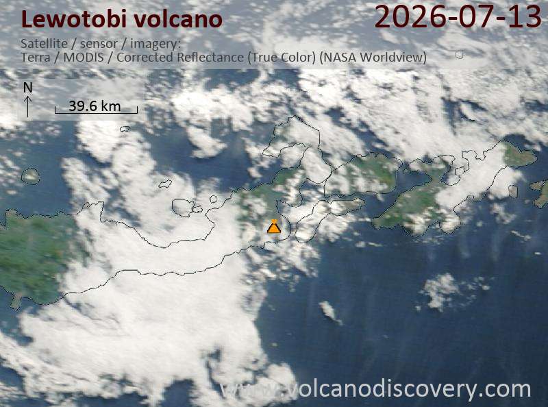
Satellite image of Lewotobi volcano on 13 Jul 2026
Explosive activity continues. Volcanic Ash Advisory Center (VAAC) Darwin warned about a volcanic ash plume that rose up to estimated 900 ft (300 m) altitude or flight level 09O . The full report is as follows:
FVAU04 at 07:58 UTC, 13/07/26 from ADRM VA ADVISORY DTG: 20260713/0800Z VAAC: DARWIN VOLCANO: LEWOTOBI 264180 PSN: S0833 E12246 AREA: INDONESIA SOURCE ELEV: 1703M AMSL ADVISORY NR: 2026/246 INFO SOURCE: HIMAWARI-9, CVGHM ERUPTION DETAILS: VA TO FL09O LAST REP AT 13/0324Z, MOV SE EST VA DTG: 13/0740Z EST VA CLD: SFC/FL090 S0826 E12237 – S0820 E12247 – S0839 E12317 – S0901 E12304 – S0900 E12237 MOV SE 05KT FCST VA CLD +6 HR: 13/1340Z SFC/FL090 S0826 E12248 – S0839 E12318 – S0902 E12310 – S0904 E12240 – S0830 E12238 FCST VA CLD +12 HR: 13/1940Z SFC/FL090 S0831 E12240 – S0826 E12247 – S0841 E12316 – S0901 E12307 – S0902 E12244 FCST VA CLD +18 HR: 14/0140Z SFC/FL090 S0831 E12241 – S0831 E12241 – S0827 E12246 – S0845 E12316 – S0902 E12309 – S0904 E12251 RMK: VA NOT IDENTIFIABLE ON CURRENT SATELLITE IMAGERY. GROUND REPORTS INDICATE CONTINUOUS ERUPTIONS ARE ONGOING. VA HEIGHT AND MOVEMENT BASED GROUND REPORTS AND MODEL GUIDANCE. NXT ADVISORY: NO LATER THAN 20260713/1400Z=
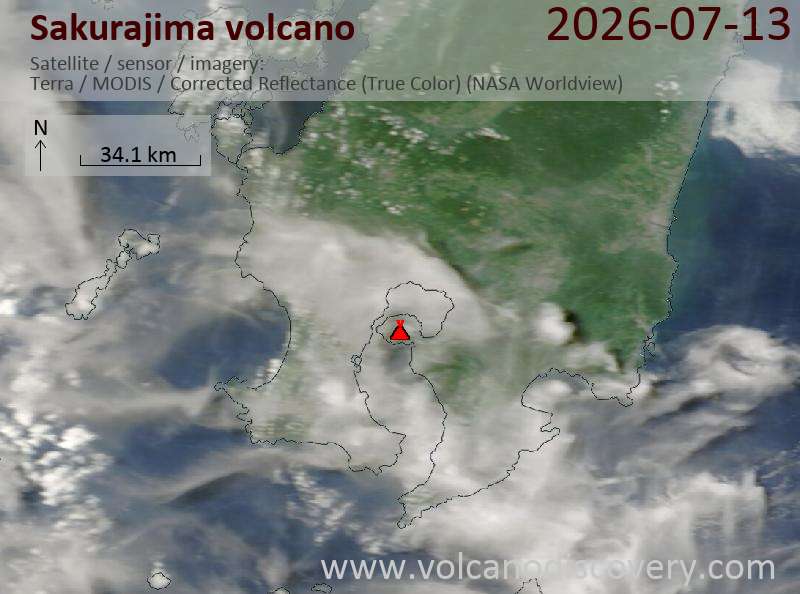
Satellite image of Sakurajima volcano on 13 Jul 2026
Volcanic Ash Advisory Center Tokyo (VAAC) issued the following report:
FVFE01 at 02:10 UTC, 13/07/26 from RJTD VA ADVISORY DTG: 20260713/0210Z VAAC: TOKYO VOLCANO: SAKURAJIMA [AIRA CALDERA] 282080 PSN: N3136 E13039 AREA: JAPAN SOURCE ELEV: 1117M AMSL ADVISORY NR: 2026/82 INFO SOURCE: JMA HIMAWARI-9 ERUPTION DETAILS: ERUPTED AT 20260713/0152Z FL100 EXTD N OBS VA DTG: 13/0140Z OBS VA CLD: VA NOT IDENTIFIABLE FM SATELLITE DATA WIND FL100 240/5KT FCST VA CLD +6 HR: NOT AVBL FCST VA CLD +12 HR: NOT AVBL FCST VA CLD +18 HR: NOT AVBL RMK: WE WILL ISSUE FURTHER ADVISORY IF VA IS DETECTED IN SATELLITE IMAGERY. NXT ADVISORY: NO FURTHER ADVISORIES=
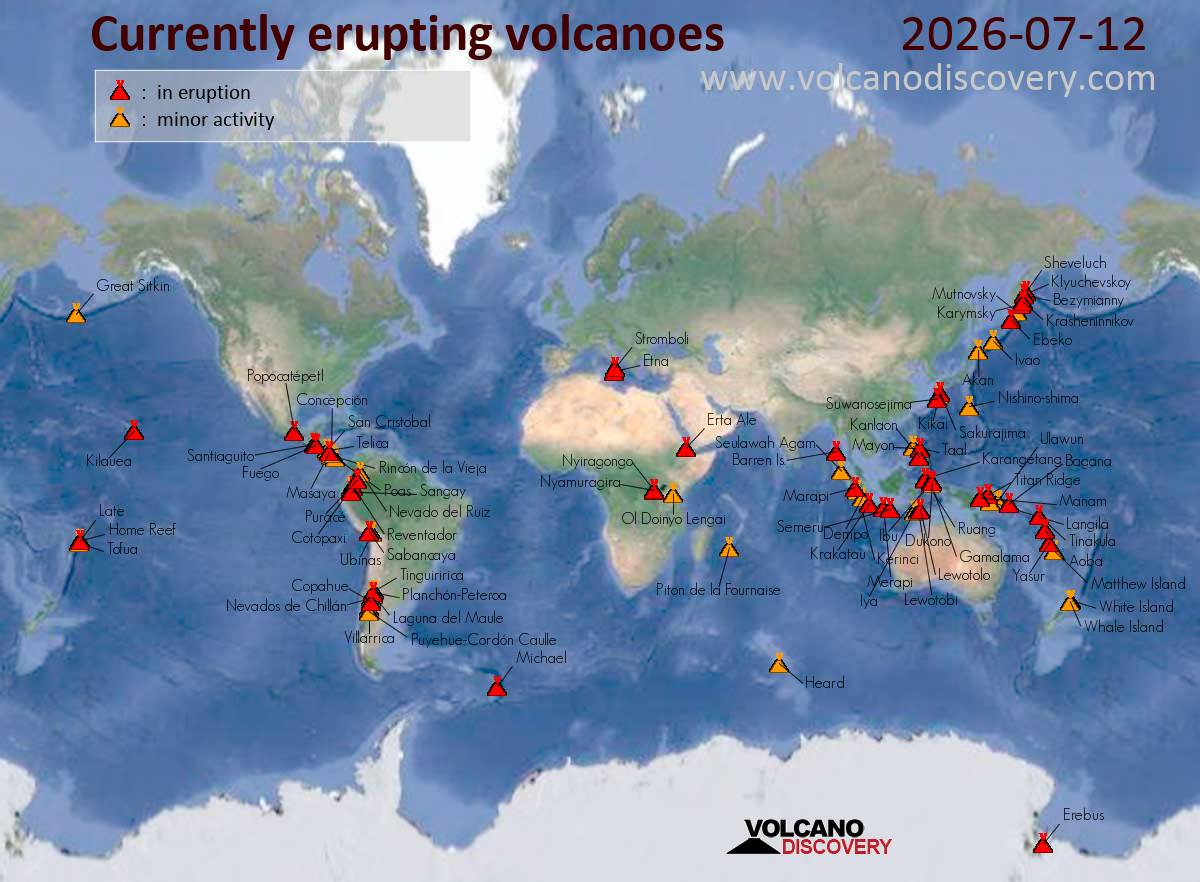
Krasheninnikov (Kamchatka, Russia): (12 Jul) Explosive activity continues. Volcanic Ash Advisory Center (VAAC) Tokyo warned about a volcanic ash plume that rose up to estimated 8000 ft (2400 m) altitude or flight level 080 and is moving at 20 kts in SE direction. The full report is as follows: VA AT 20260712/0100Z FL080 EXTD SE OBS VA DTG:12/0100Z to 8000 ft (2400 m)
Sheveluch (Kamchatka): (11 Jul) Volcanic Ash Advisory Center Washington (VAAC) issued the following report: NO VA EMS OBSD
Krakatau (Sunda Strait, Indonesia): Explosive activity continues. Volcanic Ash Advisory Center (VAAC) Darwin warned about a volcanic ash plume that rose up to estimated 3000 ft (900 m) altitude or flight level 030 . The full report is as follows: VA TO FL030 OBS AT 12/1020Z, MOV E EST VA DTG:12/1740Z to 3000 ft (900 m)
Semeru (East Java, Indonesia): Explosive activity continues. Volcanic Ash Advisory Center (VAAC) Darwin warned about a volcanic ash plume that rose up to estimated 15000 ft (4600 m) altitude or flight level 150 and is moving at 10 kts in E direction. The full report is as follows: VA TO FL150 REP FM GND AT 12/0939Z EST VA DTG:12/1110Z to 15000 ft (4600 m)
Dukono (Halmahera): (12 Jul) Explosive activity continues. Volcanic Ash Advisory Center (VAAC) Darwin warned about a volcanic ash plume that rose up to estimated 7000 ft (2100 m) altitude or flight level 070 . The full report is as follows: VA TO FL070 OBS AT 12/0040Z MOV N OBS VA DTG:12/0040Z to 7000 ft (2100 m)
Popocatépetl (Central Mexico): Explosive activity continues. Volcanic Ash Advisory Center (VAAC) Washington warned about a volcanic ash plume that rose up to estimated 20000 ft (6100 m) altitude or flight level 200 and is moving at 20 kts in SW direction. The full report is as follows: DSCRT VA CLD OBSD to 20000 ft (6100 m)
Santiaguito (Guatemala): Volcanic Ash Advisory Center Washington (VAAC) issued the following report: PSBL VA EMS
Fuego (Guatemala): Volcanic Ash Advisory Center Washington (VAAC) issued the following report: POSS VA EM
Puracé (Colombia): Volcanic Ash Advisory Center Washington (VAAC) issued the following report: POSS VA
Reventador (Ecuador): Volcanic Ash Advisory Center Washington (VAAC) issued the following report: NO VA EMS OBSD
Sabancaya (Peru): Volcanic Ash Advisory Center Buenos Aires (VAAC) issued the following report: NO VA EMISSION
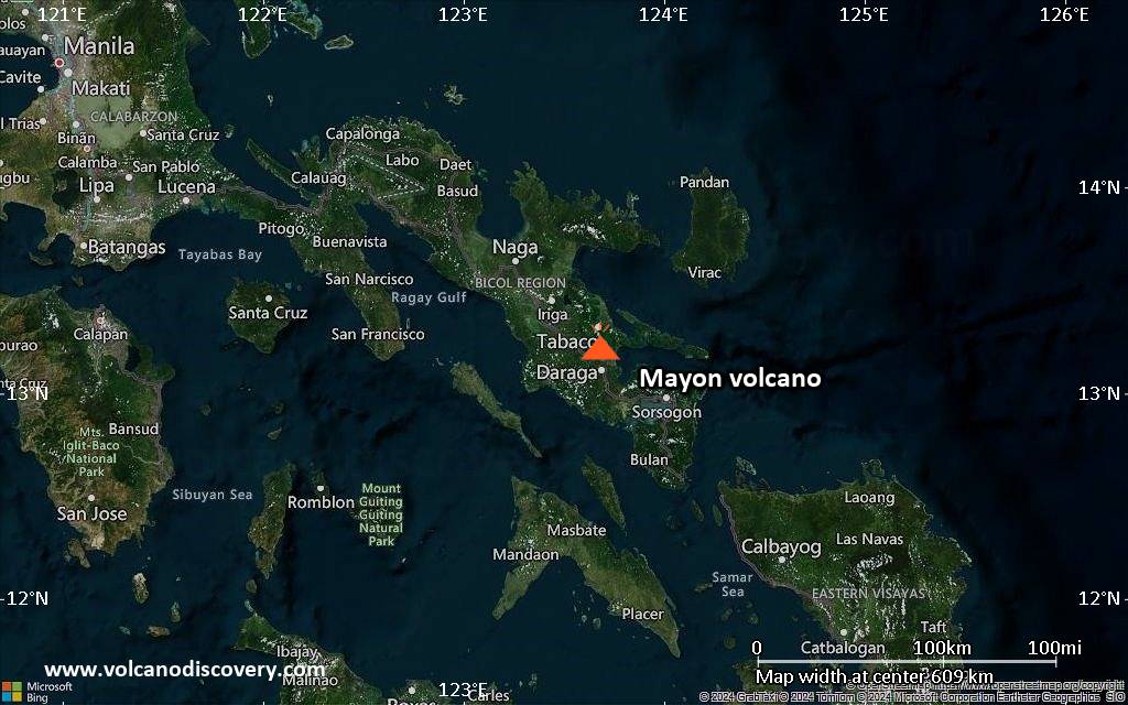
Volcanic Ash Advisory Center Tokyo (VAAC) issued the following report:
FVFE01 at 18:09 UTC, 12/07/26 from RJTD VA ADVISORY DTG: 20260712/1809Z VAAC: TOKYO VOLCANO: MAYON 273030 PSN: N1315 E12341 AREA: PHILIPPINES SOURCE ELEV: 2462M AMSL ADVISORY NR: 2026/727 INFO SOURCE: HIMAWARI-9 PHIVOLCS ERUPTION DETAILS: ERUPTION AT 20260712/1753Z VA CLD UNKNOWN REPORTED OBS VA DTG: 12/1750Z OBS VA CLD: VA NOT IDENTIFIABLE FM SATELLITE DATA WIND FL180 160/2KT FCST VA CLD +6 HR: NOT AVBL FCST VA CLD +12 HR: NOT AVBL FCST VA CLD +18 HR: NOT AVBL RMK: WE WILL ISSUE FURTHER ADVISORY IF VA IS DETECTED IN SATELLITE IMAGERY. NXT ADVISORY: NO FURTHER ADVISORIES=