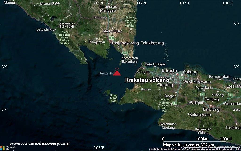
Explosive activity continues. Volcanic Ash Advisory Center (VAAC) Darwin warned about a volcanic ash plume that rose up to estimated 2000 ft (600 m) altitude or flight level 020 .
The full report is as follows:
FVAU06 at 07:35 UTC, 08/07/26 from ADRM
VA ADVISORY
DTG: 20260708/0740Z
VAAC: DARWIN
VOLCANO: KRAKATAU 262000
PSN: S0606 E10525
AREA: INDONESIA
SOURCE ELEV: 155M AMSL
ADVISORY NR: 2026/31
INFO SOURCE: HIMAWARI-9
ERUPTION DETAILS: VA TO FL020 OBS AT 08/720Z MOV NW
OBS VA DTG: 08/0720Z
OBS VA CLD: SFC/FL020 S0615 E10527 – S0608 E10511 – S0551
E10511 – S0545 E10528 – S0601 E10538 MOV NW 05KT
FCST VA CLD +6 HR: 08/1320Z SFC/FL020 S0612 E10522 – S0556
E10515 – S0546 E10528 – S0553 E10538 – S0603 E10539
FCST VA CLD +12 HR: 08/1920Z SFC/FL020 S0611 E10521 – S0557
E10517 – S0544 E10528 – S0553 E10547 – S0612 E10536
FCST VA CLD +18 HR: 09/0120Z SFC/FL020 S0613 E10523 – S0603
E10513 – S0547 E10524 – S0553 E10541 – S0613 E10537
RMK: VA OBS ON SATELLITE IMG MOV NW. CONTINUING GROUND
REPORTS INDICATE ERUPTIONS ARE ONGOING. HEIGHT AND FCST
BASED ON SATELLITE OBS AND MODEL GUIDANCE.
NXT ADVISORY: NO LATER THAN 20260708/1340Z=