INGV’s weekly Stromboli bulletin reports ordinary Strombolian activity at both crater areas during 20–26 July 2026.
Explosions occurred from both the North and the Central-South crater area, and were sometimes associated with spattering in the North crater area. The overall explosive activity combining both crater areas was at a medium-high level. The North crater area produced mainly coarse material with medium explosion frequency and mostly high intensity, while the Central-South crater area showed medium-low frequency and generally medium-low intensity in the detailed camera analysis.
Seismic and deformation parameters showed no significant changes; soil CO2 degassing remained elevated to high, and satellite thermal anomalies were mostly low.
Main monitoring indicators
- Volcanology: Ordinary Strombolian activity at both crater areas; occasional spattering in the North crater area. The overall explosion frequency was medium-high.
- Seismology: Monitored seismic parameters showed no significant changes.
- Ground deformation: GNSS and tiltmeter data showed no significant volcanic variations during the week.
- Geochemistry: SO2 flux was at a medium level; soil CO2 flux was elevated at Pizzo and high at San Bartolo; the plume CO2/SO2 ratio was at medium to medium-low values.
- Satellite observations: Summit thermal activity was generally low, with a few isolated moderate anomalies.
Volcanological observations (visual)
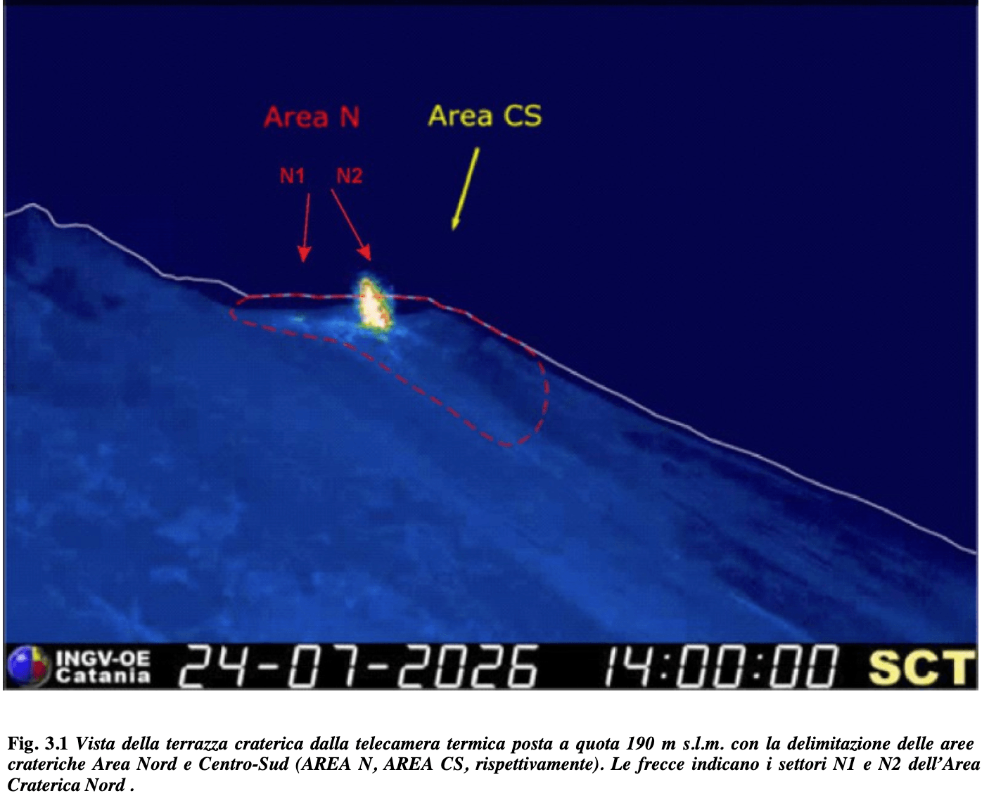
INGV assessed the eruptive activity from surveillance cameras operated by INGV-OE at 190 m above sea level and at Punta dei Corvi. The observations distinguish between the North crater area, known as Area N, and the Central-South crater area, known as Area CS.
At the North crater area, explosions mainly produced coarse material, including bombs and lapilli. The average explosion frequency was at medium values, while explosion intensity remained mostly high. Occasional spattering was also observed in this crater area. Spattering is the ejection of still-molten lava fragments around a vent.
At the Central-South crater area, explosions produced mainly fine material mixed with coarser fragments. The detailed camera analysis reported medium-low average explosion frequency and generally medium-low explosive intensity. This differs from the bulletin summary, which classified Central-South intensity as medium-high.
Considering both crater areas together, the daily mean hourly explosion frequency reached a medium-high level during the reference week.
Seismology
The tremor amplitude was generally at medium values during the week. Volcanic tremor is a continuous seismic signal commonly associated with movement of gas, magma or hydrothermal fluids in the volcanic system.
The occurrence rate of VLP events was between 15 and 17 events per hour. VLP, or very-long-period, events are low-frequency seismic signals often linked to fluid movement within a volcano. VLP amplitudes were low, with some medium-amplitude events on 20 July.
EQ event amplitudes were low, with some medium-amplitude events on 20 and 24 July. No earthquakes with local magnitude ML≥1.0 were located in the Stromboli island area during the reference week.
Technical problems prevented INGV from estimating the location and polarization of the VLP signals. Strain data from the SVO dilatometer showed no significant changes during the week.
Ground deformation
Signals from the GNSS network did not show significant changes during the reference week. GNSS stations measure precise ground movements that can indicate inflation, deflation or other deformation of a volcanic edifice.
The recently installed tiltmeters at Punta Labronzo and at the helipad near Pizzo also showed no significant variations. A slight change recorded at Punta Labronzo on 21 July 2026 was not attributed to volcanic phenomena.
Geochemistry
The average daily SO2 flux from the northern and southern crater areas increased toward a medium level. INGV noted that the measurement frequency was lower than usual because of technical problems.
At Pizzo, the STR02 soil CO2 station could not provide a continuous data series during the previous month because of station problems. The latest validated value, measured on 25 July, indicated elevated degassing at 11,994 g/m²/day.
The plume CO2/SO2 ratio showed a decreasing trend in daily averages during the week. The latest validated value, from 27 July, was 2.75, corresponding to medium-low values.
There was no update for the helium isotope ratio, expressed as R/Ra, in the thermal aquifer. The latest available measurement, from 11 June 2026, was close to the threshold of very high values at R/Ra = 4.48. INGV reported that a new measurement and sampling campaign was under way.
At San Bartolo, the soil CO2 flux recorded at the Mofete site and corrected for environmental parameters showed a modest decrease during the week, but remained at elevated degassing values.
Satellite observations
Satellite monitoring used several image types with different temporal, spatial and spectral resolutions. INGV noted that real-time satellite data are available through the Volc@Hazard platform of the Osservatorio Etneo.
Summit thermal activity observed from satellite was generally low, with a few isolated moderate anomalies. The maximum thermal flux was about 16 MW, detected by SLSTR on 25 July at 20:44 UTC.
The latest recorded thermal flux value, measured on 28 July 2026 at 08:40 UTC by FCI, was about 7 MW and remained at a low level. INGV cautioned that poor visibility during the week may have affected satellite-image analysis.
Expected scenarios and uncertainty
INGV listed the expected scenario as persistent ordinary Strombolian activity, possibly coupled with lava flows along the Sciara del Fuoco caused by lava overflowing from the craters. Such activity may be accompanied by rockfalls or debris avalanches on the Sciara del Fuoco.
If lava reaches the sea, hydro-magmatic explosions may occur through interaction between lava and seawater. INGV notes that these events could throw blocks up to a few hundred metres from the coast and disperse volcanic gas and/or ash.
Explosions stronger than ordinary activity cannot be excluded. INGV also stresses that changes in monitored parameters could lead to a different evolution of the hazard scenarios, and that some phenomena at Stromboli can occur without warning or evolve rapidly. The hazard level is therefore never zero.
Source: INGV weekly Stromboli bulletin, issued 28 July 2026 (INGV Catania)