Despite limited direct observations in recent weeks, webcam images from Whakatāne and Te Kaha continue to show a rise in ash content within a steam and gas plume at Whakaari/White Island. Similarly, the MetService has detected small amounts of ash in the plume using satellite imagery. From the coast, this appears as a hazy trail extending downwind from the volcano. These signs point to a gradual increase in eruptive activity, prompting the Volcanic Alert Level to be raised to Level 3.
Recent observation and gas measurement flights, along with satellite data, confirm this gradual rise in ash emissions. Although the emissions remain minor, northerly winds can carry the gas and ash plume toward the coast, where residents may notice sulphur-like odours. At this time, ash fall is not expected to impact the Bay of Plenty coastline.
Observation flights have also revealed impact craters on the floor of the main crater, indicating that more explosive activity has occurred at times, with rocks being ejected several hundred metres from the vent. These types of explosive events are typical at Whakaari, often resulting from growing vents becoming temporarily blocked or experiencing increased gas pressure.
Monitoring data, including gas flight results, thermal infrared temperature readings, and sulfur dioxide (SO₂) levels observed via satellite, all show slight upward trends. These are consistent with increasing volcanic activity and more frequent ash emissions.
Steam, gas, and ash emissions remain variable, as they have for several months. Due to limited on-island monitoring, short-duration eruptions may be occurring unnoticed. Nonetheless, the recent activity aligns with low-level eruptive behavior, warranting the elevation of the Volcanic Alert Level to Level 3. The continued ash emissions mean the Aviation Colour Code remains at Orange, reflecting both the increased activity and the heightened uncertainty.
Source: Geonet New Zealand volcano activity update 17 April 2025
Volcanic activity worldwide 16 Apr 2025: Santiaguito volcano, Popocatépetl, Semeru, Ibu, Dukono, Ma…

Map of today’s active volcanoes
Ibu (Halmahera, Indonesia): Explosive activity continues. Volcanic Ash Advisory Center (VAAC) Darwin warned about a volcanic ash plume that rose up to estimated 7000 ft (2100 m) altitude or flight level 070 and is moving at 05 kts in SW direction.
The full report is as follows: VA TO FL070 REPORTED AT 16/0852Z EST VA DTG:16/1100Z to 7000 ft (2100 m)
Lewotobi (Flores): Explosive activity continues. Volcanic Ash Advisory Center (VAAC) Darwin warned about a volcanic ash plume that rose up to estimated 10000 ft (3000 m) altitude or flight level 100 and is moving at 10 kts in SE direction.
The full report is as follows: VA TO FL100 LAST REPORTED AT 16/1235Z EST VA DTG:16/1840Z to 10000 ft (3000 m)
Semeru (East Java, Indonesia): Volcanic Ash Advisory Center Darwin (VAAC) issued the following report: DISCRETE VA ERUPTION LAST REP AT 16/1801Z EST VA DTG:16/1900Z
Marapi (Western Sumatra, Indonesia): (16 Apr) Volcanic Ash Advisory Center Darwin (VAAC) issued the following report: VA REPORTED TO FL120 AT 16/0427Z EST VA DTG:16/0510Z
Dukono (Halmahera): Explosive activity continues. Volcanic Ash Advisory Center (VAAC) Darwin warned about a volcanic ash plume that rose up to estimated 8000 ft (2400 m) altitude or flight level 080 and is moving at 05 kts in SW direction.
The full report is as follows: VA TO FL080 LAST REP AT 16/0028Z EST VA DTG:16/2000Z to 8000 ft (2400 m)
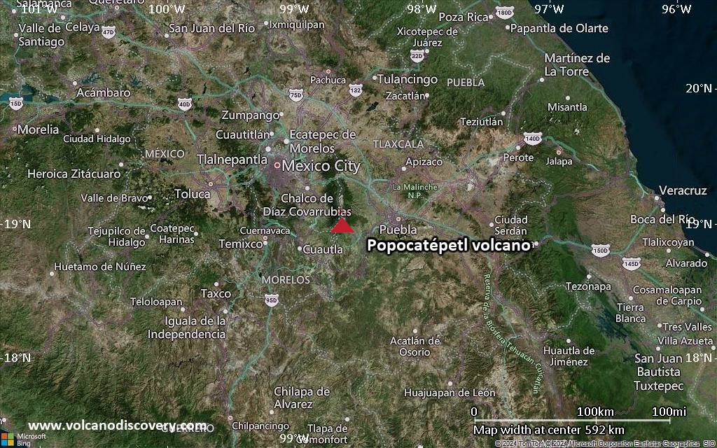
Popocatépetl (Central Mexico): Explosive activity continues. Volcanic Ash Advisory Center (VAAC) Washington warned about a volcanic ash plume that rose up to estimated 20000 ft (6100 m) altitude or flight level 200 .
The full report is as follows: CLEAR VA EM to 20000 ft (6100 m)
Santiaguito (Guatemala): Explosive activity continues. Volcanic Ash Advisory Center (VAAC) Washington warned about a volcanic ash plume that rose up to estimated 13000 ft (4000 m) altitude or flight level 130 and is moving at 5 kts in NW direction.
The full report is as follows: VA EM DTCTD to 13000 ft (4000 m)
Nevado del Ruiz (Colombia): (16 Apr) Explosive activity continues. Volcanic Ash Advisory Center (VAAC) Washington warned about a volcanic ash plume that rose up to estimated 19000 ft (5800 m) altitude or flight level 190 .
The full report is as follows: PSBL VA EM to 19000 ft (5800 m)
Sangay (Ecuador): Explosive activity continues. Volcanic Ash Advisory Center (VAAC) Washington warned about a volcanic ash plume that rose up to estimated 24000 ft (7300 m) altitude or flight level 240 .
The full report is as follows: CONT VA EM to 24000 ft (7300 m)
Reventador (Ecuador): Explosive activity continues. Volcanic Ash Advisory Center (VAAC) Washington warned about a volcanic ash plume that rose up to estimated 15000 ft (4600 m) altitude or flight level 150 .
The full report is as follows: OCNL VA EM to 15000 ft (4600 m)
Volcano Activity Summary for 16 Apr 2025:

Satellite image of Ibu volcano on 16 Apr 2025