Volcanic activity worldwide 13 Nov 2025: Fuego volcano, Popocatépetl, Semeru, Ibu, Reventador, Nyam…

Map of today's active volcanoes

Map of today’s active volcanoes

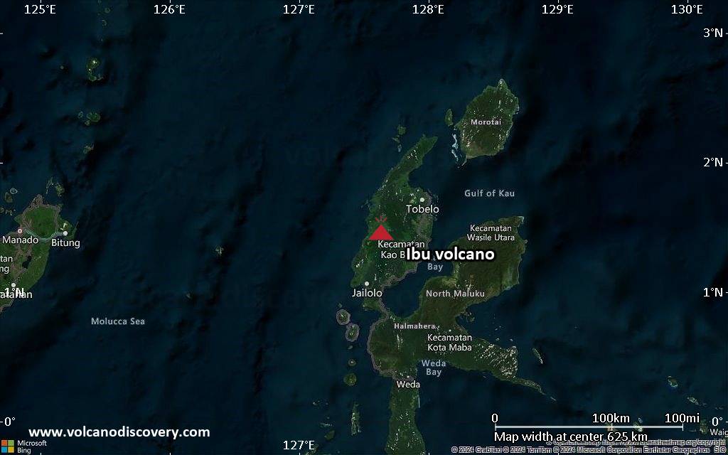
Ibu (Halmahera, Indonesia): Explosive activity continues. Volcanic Ash Advisory Center (VAAC) Darwin warned about a volcanic ash plume that rose up to estimated 6000 ft (1800 m) altitude or flight level 060 .
The full report is as follows: VA TO FL060 REP AT 12/2218Z MOV SE EST VA DTG:13/1500Z to 6000 ft (1800 m)

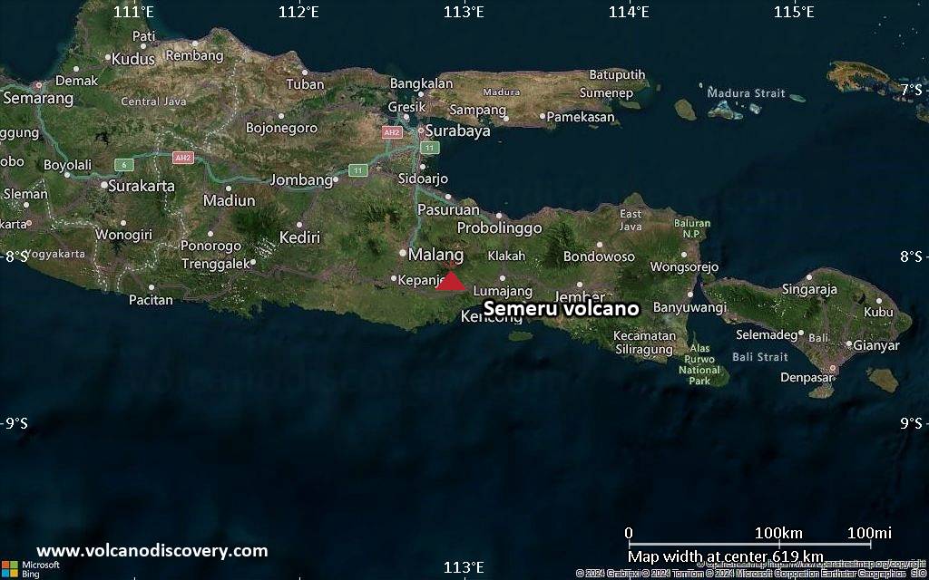
Semeru (East Java, Indonesia): Volcanic Ash Advisory Center Darwin (VAAC) issued the following report: VA ERUPTION LAST REP AT 13/1600Z EST VA DTG:13/1910Z

Popocatépetl (Central Mexico): Volcanic Ash Advisory Center Washington (VAAC) issued the following report: NO VA EMS OBSD

Fuego (Guatemala): Volcanic Ash Advisory Center Washington (VAAC) issued the following report: FRQNT VA EM

Sangay (Ecuador): Volcanic Ash Advisory Center Washington (VAAC) issued the following report: VONA RPTD VA EMS

Reventador (Ecuador): Explosive activity continues. Volcanic Ash Advisory Center (VAAC) Washington warned about a volcanic ash plume that rose up to estimated 15000 ft (4600 m) altitude or flight level 150 .
The full report is as follows: ONGOING VA EMS to 15000 ft (4600 m)

Planchón-Peteroa (Central Chile and Argentina): Explosive activity continues. Volcanic Ash Advisory Center (VAAC) Buenos Aires warned about a volcanic ash plume that rose up to estimated 15000 ft (4600 m) altitude or flight level 150 .
The full report is as follows: ongoing ash emissions to 15000 ft (4600 m)

Nyamuragira (DRCongo): (13 Nov) The effusive eruption at the volcano continues at elevated levels.
The latest Sentinel-2 thermal imagery acquisition from 12 November revealed that the lava from the active lava lake overflowed the northern caldera rim and continues to spill out along the northwestern flank, currently about 6,5 km long.
Whether the lava will ooze out towards the western flank, as previous lava flow eruptions indicate, is unclear yet and we need to wait for upcoming satellite updates.
Ibu Volcano Volcanic Ash Advisory: VA TO FL060 REP AT 12/2218Z MOV SE EST VA DTG: 13/1500Z to 6000 ft (1800 m)

Explosive activity continues. Volcanic Ash Advisory Center (VAAC) Darwin warned about a volcanic ash plume that rose up to estimated 6000 ft (1800 m) altitude or flight level 060 .
The full report is as follows:

FVAU01 at 15:16 UTC, 13/11/25 from ADRM
VA ADVISORY
DTG: 20251113/1520Z
VAAC: DARWIN
VOLCANO: IBU 268030
PSN: N0129 E12738
AREA: INDONESIA
SUMMIT ELEV: 1325M
ADVISORY NR: 2025/1274
INFO SOURCE: CVGHM, HIMAWARI-8
AVIATION COLOUR CODE: ORANGE
ERUPTION DETAILS: VA TO FL060 REP AT 12/2218Z MOV SE
EST VA DTG: 13/1500Z
EST VA CLD: SFC/FL060 N0129 E12735 – N0133 E12737 – N0125
E12808 – N0113 E12808 – N0109 E12800 MOV SE 10KT
FCST VA CLD +6 HR: 13/2100Z SFC/FL060 N0129 E12735 – N0133
E12737 – N0130 E12806 – N0122 E12809 – N0116 E12804
FCST VA CLD +12 HR: 14/0300Z SFC/FL060 N0129 E12735 – N0133
E12737 – N0131 E12807 – N0121 E12812 – N0114 E12804
FCST VA CLD +18 HR: 14/0900Z SFC/FL060 N0129 E12735 – N0133
E12737 – N0131 E12807 – N0121 E12812 – N0114 E12804
RMK: VA NOT IDENTIFIABLE ON SAT IMG DUE TO MET CLOUD,
HOWEVER GROUND REPORTS INDICATE INTERMITTENT DISCRETE
ERUPTIONS ARE ONGOING. VA HEIGHT AND FCST BASED ON
HIMAWARI-8 SAT IMG, MODEL GUIDANCE AND GROUND REPORTS.
NXT ADVISORY: NO LATER THAN 20251113/2120Z=

Nyamuragira volcano (DRCongo): lava overflowed caldera rim and advances further northwest

The lava extended beyond the northern caldera rim and continues to advance towards the northwest (image: Sentinel-2)

The lava extended beyond the northern caldera rim and continues to advance towards the northwest (image: Sentinel-2)

The effusive eruption at the volcano continues at elevated levels.

The latest Sentinel-2 thermal imagery acquisition from 12 November revealed that the lava from the active lava lake overflowed the northern caldera rim and continues to spill out along the northwestern flank, currently about 6,5 km long.

Whether the lava will ooze out towards the western flank, as previous lava flow eruptions indicate, is unclear yet and we need to wait for upcoming satellite updates.

The SAR animation of the activity between 27 October and 8 November (image: Sentinel-1)

Semeru Volcano Volcanic Ash Advisory: VA ERUPTION LAST REP AT 12/2327Z EST VA DTG: 13/0710Z

Volcanic Ash Advisory Center Darwin (VAAC) issued the following report:

FVAU02 at 07:29 UTC, 13/11/25 from ADRM
VA ADVISORY
DTG: 20251113/0730Z
VAAC: DARWIN
VOLCANO: SEMERU 263300
PSN: S0806 E11255
AREA: INDONESIA
SUMMIT ELEV: 3657M
ADVISORY NR: 2025/1292
INFO SOURCE: CVGHM, HIMAWARI-8, WEBCAM
AVIATION COLOUR CODE: ORANGE
ERUPTION DETAILS: VA ERUPTION LAST REP AT 12/2327Z
EST VA DTG: 13/0710Z
EST VA CLD: SFC/FL150 S0805 E11253 – S0759 E11311 – S0804
E11316 – S0810 E11314 – S0809 E11253 MOV NE 05KT
FCST VA CLD +6 HR: 13/1310Z SFC/FL150 S0805 E11252 – S0756
E11311 – S0802 E11317 – S0809 E11314 – S0809 E11254
FCST VA CLD +12 HR: 13/1910Z SFC/FL150 S0805 E11252 – S0755
E11310 – S0800 E11315 – S0807 E11314 – S0809 E11254
FCST VA CLD +18 HR: 14/0110Z SFC/FL150 S0805 E11252 – S0756
E11311 – S0802 E11316 – S0808 E11314 – S0809 E11254
RMK: VA NOT IDENTIFIABLE ON SATELLITE IMAGERY DUE TO MET
CLOUD, HOWEVER GROUND REPORTS INDICATE INTERMITTENT DISCRETE
ERUPTIONS ARE ONGOING. HEIGHT AND MOVEMENT BASED ON RECENT
ERUPTIVE BEHAVIOUR AND MODEL GUIDANCE.
NXT ADVISORY: NO LATER THAN 20251113/1330Z=

Ibu Volcano Volcanic Ash Advisory: VA TO FL060 REP AT 12/2337Z MOV SE EST VA DTG: 13/0300Z to 6000 ft (1800 m)

Satellite image of Ibu volcano on 13 Nov 2025

Explosive activity continues. Volcanic Ash Advisory Center (VAAC) Darwin warned about a volcanic ash plume that rose up to estimated 6000 ft (1800 m) altitude or flight level 060 .
The full report is as follows:

FVAU01 at 03:20 UTC, 13/11/25 from ADRM
VA ADVISORY
DTG: 20251113/0320Z
VAAC: DARWIN
VOLCANO: IBU 268030
PSN: N0129 E12738
AREA: INDONESIA
SUMMIT ELEV: 1325M
ADVISORY NR: 2025/1272
INFO SOURCE: CVGHM, HIMAWARI-8
AVIATION COLOUR CODE: ORANGE
ERUPTION DETAILS: VA TO FL060 REP AT 12/2337Z MOV SE
EST VA DTG: 13/0300Z
EST VA CLD: SFC/FL060 N0129 E12736 – N0132 E12738 – N0123
E12757 – N0112 E12758 – N0111 E12748 MOV SE 15KT
FCST VA CLD +6 HR: 13/0900Z SFC/FL060 N0129 E12736 – N0132
E12738 – N0124 E12803 – N0111 E12809 – N0110 E12756
FCST VA CLD +12 HR: 13/1500Z SFC/FL060 N0128 E12736 – N0132
E12738 – N0123 E12805 – N0113 E12808 – N0109 E12800
FCST VA CLD +18 HR: 13/2100Z SFC/FL060 N0128 E12736 – N0131
E12737 – N0129 E12805 – N0123 E12808 – N0118 E12804
RMK: VA NOT IDENTIFIABLE ON SAT IMG DUE TO MET CLOUD,
HOWEVER GROUND REPORTS INDICATE INTERMITTENT DISCRETE
ERUPTIONS ARE ONGOING. VA HEIGHT AND FCST BASED ON
HIMAWARI-8 SAT IMG, MODEL GUIDANCE AND GROUND REPORTS.
NXT ADVISORY: NO LATER THAN 20251113/0920Z=