Puracé Volcano Volcanic Ash Advisory: NO VA OBS

Volcanic Ash Advisory Center Washington (VAAC) issued the following report:

FVXX24 at 19:14 UTC, 08/12/25 from KNES
VA ADVISORY
DTG: 20251208/1912Z

VAAC: WASHINGTON

VOLCANO: PURACE 351060
PSN: N0219 W07624

AREA: COLOMBIA

SOURCE ELEV: 15256 FT AMSL

ADVISORY NR: 2025/060

INFO SOURCE: GOES-19. WEBCAM. NWP MODELS.

ERUPTION DETAILS: NO VA OBS

OBS VA DTG: 08/1840Z

OBS VA CLD: VA NOT IDENTIFIABLE FROM SATELLITE
DATA.

FCST VA CLD +6HR: 09/0030Z NO VA EXP

FCST VA CLD +12HR: 09/0630Z NO VA EXP

FCST VA CLD +18HR: 09/1230Z NO VA EXP

RMK: NO RCNT VA OBS IN STLT IMAGERY OR WEBCAM. NO
RCNT RPRTS OF VA RCVD. …COVERDALE

NXT ADVISORY: NO FURTHER ADVISORIES

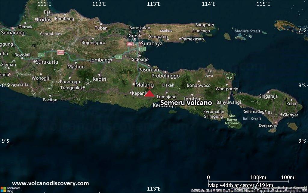
Semeru Volcano Volcanic Ash Advisory: VA TO FL150 LAST REPORTED AT 08/1424Z EST VA DTG: 08/1430Z to 15000 ft (4600 m)

Explosive activity continues. Volcanic Ash Advisory Center (VAAC) Darwin warned about a volcanic ash plume that rose up to estimated 15000 ft (4600 m) altitude or flight level 150 and is moving at 10 kts in NW direction.
The full report is as follows:

FVAU02 at 14:45 UTC, 08/12/25 from ADRM
VA ADVISORY
DTG: 20251208/1450Z
VAAC: DARWIN
VOLCANO: SEMERU 263300
PSN: S0806 E11255
AREA: INDONESIA
SOURCE ELEV: 3657M AMSL
ADVISORY NR: 2025/1401
INFO SOURCE: CVGHM, HIMAWARI-9, WEBCAM
ERUPTION DETAILS: VA TO FL150 LAST REPORTED AT 08/1424Z
EST VA DTG: 08/1430Z
EST VA CLD: SFC/FL150 S0805 E11259 – S0810 E11256 – S0807
E11230 – S0755 E11223 – S0748 E11236 MOV NW 10KT
FCST VA CLD +6 HR: 08/2030Z SFC/FL150 S0806 E11259 – S0810
E11257 – S0808 E11226 – S0755 E11222 – S0747 E11236
FCST VA CLD +12 HR: 09/0230Z SFC/FL150 S0805 E11259 – S0810
E11256 – S0809 E11226 – S0754 E11221 – S0747 E11236
FCST VA CLD +18 HR: 09/0830Z SFC/FL150 S0805 E11259 – S0810
E11257 – S0810 E11224 – S0758 E11217 – S0749 E11228
RMK: VA NOT IDENTIFIABLE ON LATEST SATELLITE IMAGERY DUE TO
MET CLOUD COVER. CVGHM GROUND REPORTS INDICATE INTERMITTENT
DISCRETE EMISSIONS REMAIN ONGOING. HEIGHT AND MOVEMENT BASED
ON GROUND REPORTS AND MODEL GUIDANCE
NXT ADVISORY: NO LATER THAN 20251208/2050Z=

Kilauea volcano (Hawai’i): report on the 38th lava fountaining episode

The latest lava-fountaining episode at the volcano was one of the most intense of the series and remarkable in several ways. Here’s the official observatory report:

„Episode 38 of the ongoing Halemaʻumaʻu eruption ended abruptly at 8:52 p.m. HST on December 6 after 12.1 hours of continuous lava fountaining.

The south vent stopped erupting at approximately 8:52 p.m. HST, marking the end of the episode. The dual north vents stopped erupting much earlier at approximately 11:50 a.m. Lava fountains reached heights of up to 1,000-1,200 ft (300-370 m) during episode 38. Fountains were down to about 400 feet (120 meters) high just before the abrupt end of the eruption. Lava fountaining lasted for 12.1 hours and produced an estimated 16 million cubic yards (12 million cubic meters) of lava. The combined average eruption rate was over 250 cubic yards per second (190 cubic meters per second) from the lava fountains.

Sustained lava fountains began erupting from two vents located within the north cone at 8:45 a.m. HST on December 6 after just over 5 hours of precursory lava overflows. The south vent then began fountaining at 8:49 a.m. By 9:15 a.m. a rare triple fountain event was underway with the two north vents and the south vent all erupting together at heights of about 500 feet (150 meters). By 9:40 a.m. the south vent fountain grew to about twice as high as the north vent fountains. The highest peak or instantaneous effusion rate of 1,300 cubic yards per second (1,000 cubic meters per second) occurred just before 10 a.m. when the south vent exploded. The enlarged south vent produced an inclined fountain over 1,000 feet (300 meters) tall that sprayed the south wall of Halemaʻumaʻu crater. Hot pumice and molten spatter from this fountain destroyed the HVO „V3“ streaming camera site.

Lava flows from this episode’s fountains covered 50-60% of the floor of Halemaʻumaʻu crater. Lava flows near the vents and on the floor of Halemaʻumaʻu within the southern part of Kaluapele (Kīlauea caldera) may continue to exhibit slow movement or incandescence as they cool and solidify over the coming days.

Volcanic gas emissions have greatly decreased with the end of the eruption. Earlier today the gas plume reached over 20,000 feet (6000 meters) above sea level. Tephra including Pele’s hair and fine ash carried in lower levels of the plume fell in the town of Pahala and other communities southwest of the vents. Satellite imagery showed the upper regions of the gas and ash cloud moved due east of the summit across lower Puna and well out to sea before turning south. Reticulite pieces up to the size of a baseball fell along Chain of Craters Road east of Kīlaueaʻs summit transported by the high eastern plume. The extremely high effusion rates early in the eruption provided the gas and heat that drove this enormous plume.

The Uēkahuna tiltmeter (UWD) recorded about 33.1 microradians of deflationary tilt during this episode. The end of the eruption was coincident with a rapid change from deflation to inflation at the summit and a decrease in seismic tremor intensity.“

Source: HVO / USGS

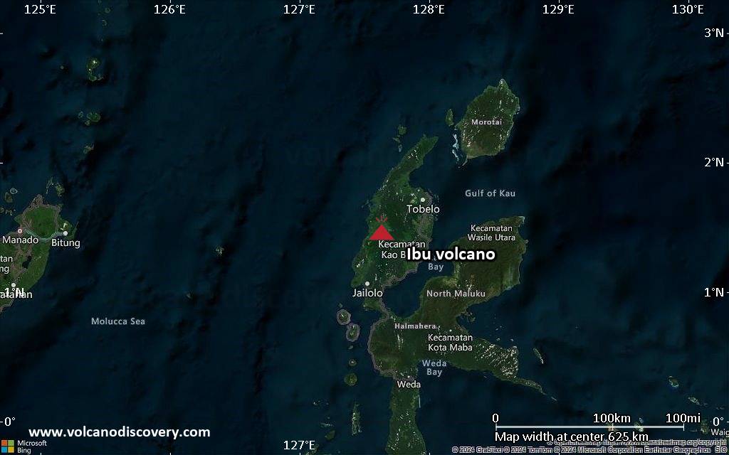
Ibu Volcano Volcanic Ash Advisory: VA TO FL060 MOV SE LAST REPORTED AT 08/0728Z to 6000 ft (1800 m)

Explosive activity continues. Volcanic Ash Advisory Center (VAAC) Darwin warned about a volcanic ash plume that rose up to estimated 6000 ft (1800 m) altitude or flight level 060 .
The full report is as follows:

FVAU01 at 07:49 UTC, 08/12/25 from ADRM
VA ADVISORY
DTG: 20251208/0750Z
VAAC: DARWIN
VOLCANO: IBU 268030
PSN: N0129 E12738
AREA: INDONESIA
SOURCE ELEV: 1325M AMSL
ADVISORY NR: 2025/1371
INFO SOURCE: CVGHM, HIMAWARI-9
ERUPTION DETAILS: VA TO FL060 MOV SE LAST REPORTED AT
08/0728Z
EST VA DTG: 08/0730Z
EST VA CLD: SFC/FL060 N0129 E12732 – N0134 E12735 – N0130
E12759 – N0116 E12753 MOV SE 15KT
FCST VA CLD +6 HR: 08/1330Z NO VA EXP
FCST VA CLD +12 HR: 08/1930Z NO VA EXP
FCST VA CLD +18 HR: 09/0130Z NO VA EXP
RMK: CVGHM REPORT ERUPTION TO UNKNOWN HEIGHT. VA NOT
IDENTIFIABLE ON SAT IMAGERY DUE TO MET CLOUD. VA LIKELY TO
DISSIPATE WITHIN 6 HRS. HEIGHT AND MOVEMENT ESTIMATED FROM
SATELLITE IMAGERY, MODEL GUIDANCE AND GROUND REPORTS.
NXT ADVISORY: NO LATER THAN 20251208/1350Z=

Semeru Volcano Volcanic Ash Advisory: VA TO FL150 MOV SW LAST REPORTED AT 08/0213Z to 15000 ft (4600 m)

Explosive activity continues. Volcanic Ash Advisory Center (VAAC) Darwin warned about a volcanic ash plume that rose up to estimated 15000 ft (4600 m) altitude or flight level 150 .
The full report is as follows:

FVAU02 at 02:44 UTC, 08/12/25 from ADRM
VA ADVISORY
DTG: 20251208/0250Z
VAAC: DARWIN
VOLCANO: SEMERU 263300
PSN: S0806 E11255
AREA: INDONESIA
SOURCE ELEV: 3657M AMSL
ADVISORY NR: 2025/1399
INFO SOURCE: CVGHM, HIMAWARI-9
ERUPTION DETAILS: VA TO FL150 MOV SW LAST REPORTED AT
08/0213Z
EST VA DTG: 08/0230Z
EST VA CLD: SFC/FL150 S0803 E11258 – S0807 E11259 – S0818
E11238 – S0809 E11226 – S0755 E11234 MOV SW 05KT
FCST VA CLD +6 HR: 08/0830Z SFC/FL150 S0808 E11259 – S0818
E11237 – S0809 E11226 – S0755 E11234 – S0803 E11258
FCST VA CLD +12 HR: 08/1430Z SFC/FL150 S0803 E11258 – S0808
E11259 – S0818 E11238 – S0809 E11226 – S0755 E11234
FCST VA CLD +18 HR: 08/2030Z SFC/FL150 S0810 E11257 – S0810
E11229 – S0758 E11224 – S0750 E11235 – S0806 E11259
RMK: VA NOT IDENTIFIABLE ON LATEST SAT IMAGERY DUE TO MET
CLOUD COVER. RECENT H9 SAT IMAGERY AND CVGHM GROUND REPORTS
INDICATE INTERMITTENT DISCRETE EMISSIONS REMAIN ONGOING.
HEIGHT AND MOVEMENT BASED ON SAT IMAGERY, GROUND REPORTS AND
MODEL GUIDANCE
NXT ADVISORY: NO LATER THAN 20251208/0850Z=