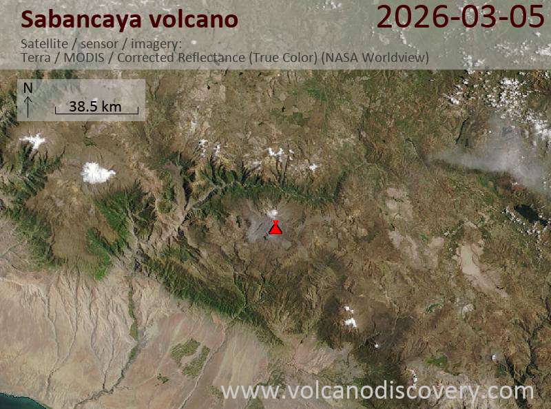
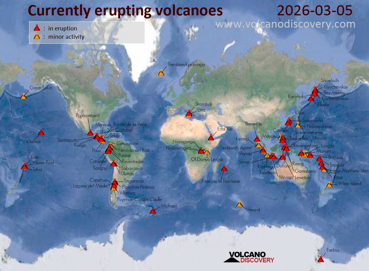
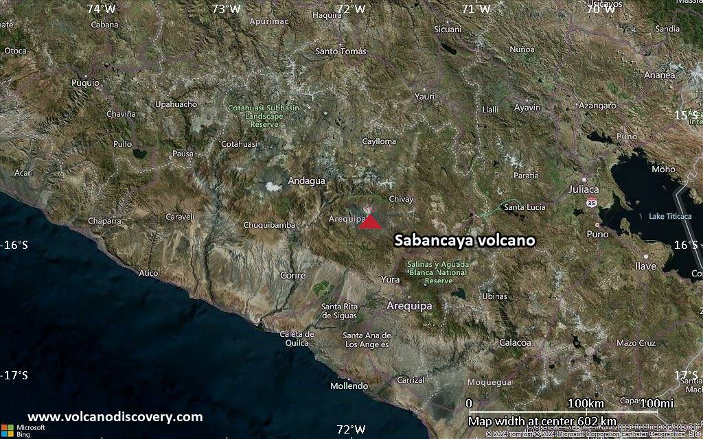
Satellite image of Sabancaya volcano on 5 Mar 2026
Explosive activity continues. Volcanic Ash Advisory Center (VAAC) Buenos Aires warned about a volcanic ash plume that rose up to estimated 25000 ft (7600 m) altitude or flight level 250 and is moving at 10 kts in SW direction. The full report is as follows:
FVAG01 at 23:29 UTC, 05/03/26 from SABM VA ADVISORY DTG: 20260305/2340Z
Yake-dake (Honshu): The Japan Meteorological Agency (JMA) reported that unrest continued at Yakedake between 2 March 2026 (local) and 4 March 2026 (local). The alert level was lowered to „Level 1 – Potential for increased activity“ (on a 5-level scale) on 4 March 2026 at 1400 by JMA because volcanic earthquakes, which increased on 25 January 2026, subsequently decreased and remained low, and no ground deformation (tilt) was observed afterward. Source: Japan Meteorological Agency (JMA) … [read more] … [show less] Current Alerts: Observatory alert level: „Level 1 – Potential for increased activity“ (on a 5-level scale)
Kusatsu-Shirane (Honshu): The Japan Meteorological Agency (JMA) reported that unrest continued at Kusatsu-Shiranesan between 2 March 2026 (local) and 4 March 2026 (local). The alert level remained at „Level 2 – Restriction on proximity to the crater“ (on a 5-level scale). Source: Japan Meteorological Agency (JMA) … [read more] … [show less] Current Alerts: Observatory alert level: „Level 2 – Restriction on proximity to the crater“ (on a 5-level scale)
Canlaon (Central Philippines): The Philippine Institute of Volcanology and Seismology (PHIVOLCS) reported that the eruption continued at Kanlaon on 4 March 2026 (local). Plume(s) rose to a maximum of 75 m (246 ft) above the vent. The alert level remained at „2 – Moderate Level of Volcanic Unrest“ (on a 0–5 level scale). Source: Philippine Institute of Volcanology and Seismology (PHIVOLCS) … [read more] … [show less] Current Alerts: Observatory alert level: „2 – Moderate Level of Volcanic Unrest“ (on a 0–5 level scale)
Taal (Luzon, Philippines): The Philippine Institute of Volcanology and Seismology (PHIVOLCS) reported that the eruption continued at Taal on 4 March 2026 (local). Plume(s) were reported. The alert level remained at „1 – Low-Level Unrest“ (on a 0–5 level scale). Source: Philippine Institute of Volcanology and Seismology (PHIVOLCS) … [read more] … [show less] Current Alerts: Observatory alert level: „1 – Low-Level Unrest“ (on a 0–5 level scale)
Mayon (Luzon Island, Philippines): Volcanic Ash Advisory Center Tokyo (VAAC) issued the following report: ERUPTION AT 20260305/1317Z VA CLD UNKNOWN REPORTED OBS VA DTG:05/1330Z …5 Mar: The Philippine Institute of Volcanology and Seismology (PHIVOLCS) reported that the eruption continued at Mayon on 4 March 2026 (local). Lava effusion continued from the summit crater. As of 4 March, lava flow lengths remained at 3.8 km in the Basud Gully (E flank), 2.7 km in the Bonga Gully (SE flank), and 1.3 km in the Mi-isi Gully (S flank). Minor Strombolian activity was observed at 2033 on 4 March. Ash plume(s) rose to a maximum of 850 m (2,789 ft) above the vent. There were 246 seismically detected rockfalls. Crater glow was visible to the naked eye. Sulfur dioxide (SO₂) emissions averaged 2,458 tonnes per day on 4 March. The alert level remained at „3 – Increased Tendency Towards Hazardous Eruption“ (on a 0–5 level scale). Activity also included: inflationary deformation, seismically detected pyroclastic density current(s) (PDCs), volcanic seismicity. Source: Philippine Institute of Volcanology and Seismology (PHIVOLCS) … [read more] … [show less] Current Alerts: Observatory alert level: „3 – Increased Tendency Towards Hazardous Eruption“ (on a 0–5 level scale)
Telong (northern Sumatra, Indonesia): The Center for Volcanology and Geological Hazard/Pusat Vulkanologi dan Mitigasi Bencana Geologi (CVGHM/PVMBG) reported that unrest continued at Telong, Bur ni on 4 March 2026 (local). The alert level remained at „Level 2 – Alert“ (on a 4-level scale). Source: Center for Volcanology and Geological Hazard/Pusat Vulkanologi dan Mitigasi Bencana Geologi (CVGHM/PVMBG) … [read more] … [show less] Current Alerts: Observatory alert level: „Level 2 – Alert“ (on a 4-level scale)
Karangetang (Siau Island, Sangihe Islands, Indonesia): The Center for Volcanology and Geological Hazard/Pusat Vulkanologi dan Mitigasi Bencana Geologi (CVGHM/PVMBG) reported that unrest continued at Karangetang on 4 March 2026 (local). Gas and vapor plume(s) rose to a maximum of 20 m (66 ft) above the vent. Audible rumbles were reported at night. The alert level remained at „Level 2 – Alert“ (on a 4-level scale). Source: Center for Volcanology and Geological Hazard/Pusat Vulkanologi dan Mitigasi Bencana Geologi (CVGHM/PVMBG) … [read more] … [show less] Current Alerts: Observatory alert level: „Level 2 – Alert“ (on a 4-level scale)
Raung (East Java): The Center for Volcanology and Geological Hazard/Pusat Vulkanologi dan Mitigasi Bencana Geologi (CVGHM/PVMBG) reported that unrest continued at Raung on 4 March 2026 (local). The alert level remained at „Level 2 – Alert“ (on a 4-level scale). Source: Center for Volcanology and Geological Hazard/Pusat Vulkanologi dan Mitigasi Bencana Geologi (CVGHM/PVMBG) … [read more] … [show less] Current Alerts: Observatory alert level: „Level 2 – Alert“ (on a 4-level scale)
Ibu (Halmahera, Indonesia): Explosive activity continues. Volcanic Ash Advisory Center (VAAC) Darwin warned about a volcanic ash plume that rose up to estimated 7000 ft (2100 m) altitude or flight level 070 and is moving at 10 kts in SW direction. The full report is as follows: VA TO FL070 REPORTED AT 05/0323Z EST VA DTG:05/1440Z to 7000 ft (2100 m) …5 Mar: The Center for Volcanology and Geological Hazard/Pusat Vulkanologi dan Mitigasi Bencana Geologi (CVGHM/PVMBG) reported that the eruption continued at Ibu on 4 March 2026 (local). Gas and vapor plume(s) rose to a maximum of 200 m (656 ft) above the vent. There were 121 seismically detected explosions reported. The alert level remained at „Level 2 – Alert“ (on a 4-level scale). Source: Center for Volcanology and Geological Hazard/Pusat Vulkanologi dan Mitigasi Bencana Geologi (CVGHM/PVMBG) … [read more] … [show less] Current Alerts: Observatory alert level: „Level 2 – Alert“ (on a 4-level scale)
Tangkubanparahu (West Java): The Center for Volcanology and Geological Hazard/Pusat Vulkanologi dan Mitigasi Bencana Geologi (CVGHM/PVMBG) issued a report for Tangkuban Parahu on 4 March 2026 (local). Gas and vapor plume(s) rose to a maximum of 100 m (328 ft) above the vent. The alert level remained at „Level 1 – Normal“ (on a 4-level scale). Source: Center for Volcanology and Geological Hazard/Pusat Vulkanologi dan Mitigasi Bencana Geologi (CVGHM/PVMBG) … [read more] … [show less] Current Alerts: Observatory alert level: „Level 1 – Normal“ (on a 4-level scale)
Sangeang Api (Flores Sea, Indonesia): The Center for Volcanology and Geological Hazard/Pusat Vulkanologi dan Mitigasi Bencana Geologi (CVGHM/PVMBG) reported on activity at Sangeang Api on 4 March 2026 (local). The alert level remained at „Level 2 – Alert“ (on a 4-level scale). Source: Center for Volcanology and Geological Hazard/Pusat Vulkanologi dan Mitigasi Bencana Geologi (CVGHM/PVMBG) … [read more] … [show less] Current Alerts: Observatory alert level: „Level 2 – Alert“ (on a 4-level scale)
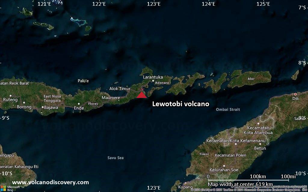
Lewotobi (Flores): Explosive activity continues. Volcanic Ash Advisory Center (VAAC) Darwin warned about a volcanic ash plume that rose up to estimated 9000 ft (2700 m) altitude or flight level 090 . The full report is as follows: VA TO FL090 MOV E REPORTED AT 05/0845Z EST VA DTG:05/1640Z to 9000 ft (2700 m) …5 Mar: The Center for Volcanology and Geological Hazard/Pusat Vulkanologi dan Mitigasi Bencana Geologi (CVGHM/PVMBG) reported that the eruption continued at Lewotobi (Laki-Laki) on 4 March 2026 (local). There were 2 explosions reported, with plumes rising to a maximum of 800 m (2,625 ft) above the vent. The alert level remained at „Level 2 – Alert“ (on a 4-level scale). Source: Center for Volcanology and Geological Hazard/Pusat Vulkanologi dan Mitigasi Bencana Geologi (CVGHM/PVMBG) … [read more] … [show less] Current Alerts: Observatory alert level: „Level 2 – Alert“ (on a 4-level scale)
Soputan (North Sulawesi, Indonesia): The Center for Volcanology and Geological Hazard/Pusat Vulkanologi dan Mitigasi Bencana Geologi (CVGHM/PVMBG) reported that unrest continued at Soputan on 4 March 2026 (local). The alert level remained at „Level 2 – Alert“ (on a 4-level scale). Source: Center for Volcanology and Geological Hazard/Pusat Vulkanologi dan Mitigasi Bencana Geologi (CVGHM/PVMBG) … [read more] … [show less] Current Alerts: Observatory alert level: „Level 2 – Alert“ (on a 4-level scale)
Lewotolo (Lesser Sunda Islands): The Center for Volcanology and Geological Hazard/Pusat Vulkanologi dan Mitigasi Bencana Geologi (CVGHM/PVMBG) reported that the eruption continued at Lewotolok on 4 March 2026 (local). There were 33 seismically detected explosions reported. The alert level remained at „Level 2 – Alert“ (on a 4-level scale). Source: Center for Volcanology and Geological Hazard/Pusat Vulkanologi dan Mitigasi Bencana Geologi (CVGHM/PVMBG) … [read more] … [show less] Current Alerts: Observatory alert level: „Level 2 – Alert“ (on a 4-level scale)
Merapi (Central Java, Indonesia): The Center for Volcanology and Geological Hazard/Pusat Vulkanologi dan Mitigasi Bencana Geologi (CVGHM/PVMBG) reported that the eruption continued at Merapi on 4 March 2026 (local). The alert level remained at „Level 3 – Standby“ (on a 4-level scale). Source: Center for Volcanology and Geological Hazard/Pusat Vulkanologi dan Mitigasi Bencana Geologi (CVGHM/PVMBG) … [read more] … [show less] Current Alerts: Observatory alert level: „Level 3 – Standby“ (on a 4-level scale)
Semeru (East Java, Indonesia): The Center for Volcanology and Geological Hazard/Pusat Vulkanologi dan Mitigasi Bencana Geologi (CVGHM/PVMBG) reported that the eruption continued at Semeru on 4 March 2026 (local). There were 64 seismically detected explosions reported. There were 3 seismically detected rockfalls. The alert level remained at „Level 3 – Standby“ (on a 4-level scale). Activity also included: seismically detected flowage event(s). Source: Center for Volcanology and Geological Hazard/Pusat Vulkanologi dan Mitigasi Bencana Geologi (CVGHM/PVMBG) … [read more] … [show less] Current Alerts: Observatory alert level: „Level 3 – Standby“ (on a 4-level scale)
Marapi (Western Sumatra, Indonesia): The Center for Volcanology and Geological Hazard/Pusat Vulkanologi dan Mitigasi Bencana Geologi (CVGHM/PVMBG) reported that the eruption continued at Marapi on 4 March 2026 (local). The alert level remained at „Level 2 – Alert“ (on a 4-level scale). Source: Center for Volcanology and Geological Hazard/Pusat Vulkanologi dan Mitigasi Bencana Geologi (CVGHM/PVMBG) … [read more] … [show less] Current Alerts: Observatory alert level: „Level 2 – Alert“ (on a 4-level scale)
Dukono (Halmahera): The Center for Volcanology and Geological Hazard/Pusat Vulkanologi dan Mitigasi Bencana Geologi (CVGHM/PVMBG) reported that the eruption continued at Dukono on 4 March 2026 (local). Ash and gas plume(s) rose to a maximum of 200 m (656 ft) above the vent. The seismograph malfunctioned. The alert level remained at „Level 2 – Alert“ (on a 4-level scale). Source: Center for Volcanology and Geological Hazard/Pusat Vulkanologi dan Mitigasi Bencana Geologi (CVGHM/PVMBG) … [read more] … [show less] Current Alerts: Observatory alert level: „Level 2 – Alert“ (on a 4-level scale)
Awu (Sulawesi & Sangihe Islands): The Center for Volcanology and Geological Hazard/Pusat Vulkanologi dan Mitigasi Bencana Geologi (CVGHM/PVMBG) reported that unrest continued at Awu on 4 March 2026 (local). Gas and vapor plume(s) rose to a maximum of 10 m (33 ft) above the vent. The alert level remained at „Level 2 – Alert“ (on a 4-level scale). Source: Center for Volcanology and Geological Hazard/Pusat Vulkanologi dan Mitigasi Bencana Geologi (CVGHM/PVMBG) … [read more] … [show less] Current Alerts: Observatory alert level: „Level 2 – Alert“ (on a 4-level scale)
Kerinci (Sumatra): The Center for Volcanology and Geological Hazard/Pusat Vulkanologi dan Mitigasi Bencana Geologi (CVGHM/PVMBG) reported that unrest continued at Kerinci on 4 March 2026 (local). The alert level remained at „Level 2 – Alert“ (on a 4-level scale). Source: Center for Volcanology and Geological Hazard/Pusat Vulkanologi dan Mitigasi Bencana Geologi (CVGHM/PVMBG) … [read more] … [show less] Current Alerts: Observatory alert level: „Level 2 – Alert“ (on a 4-level scale)
Lokon-Empung (North Sulawesi, Indonesia): The Center for Volcanology and Geological Hazard/Pusat Vulkanologi dan Mitigasi Bencana Geologi (CVGHM/PVMBG) reported that unrest continued at Lokon-Empung on 4 March 2026 (local). The alert level remained at „Level 2 – Alert“ (on a 4-level scale). Source: Center for Volcanology and Geological Hazard/Pusat Vulkanologi dan Mitigasi Bencana Geologi (CVGHM/PVMBG) … [read more] … [show less] Current Alerts: Observatory alert level: „Level 2 – Alert“ (on a 4-level scale)
Aoba (Vanuatu): Explosive activity continues. Volcanic Ash Advisory Center (VAAC) Wellington warned about a volcanic ash plume that rose up to estimated 15000 ft (4600 m) altitude or flight level 150 and is moving at 10 kts in W direction. The full report is as follows: ERUPTION AT 20260304/0230Z CONTINUOUS LOW LEVEL ERUPTION to 15000 ft (4600 m)
Kilauea (Hawai’i): The United States Geological Survey – Hawaiian Volcano Observatory (USGS-HVO) reported that there was a pause in eruptive activity at Kilauea between 3 March 2026 (local) and 4 March 2026 (local). Intermittent glow was observed from the north and south vents throughout the night. The alert level remained at „Watch“ (level 3 on a 4-level scale). The aviation alert level remained at „Orange“ (level 3 on a 4-level scale). Source: United States Geological Survey – Hawaiian Volcano Observatory (USGS-HVO) … [read more] … [show less] Current Alerts: Observatory alert level: „Watch“ (level 3 on a 4-level scale)
Shishaldin (Aleutian Islands, Alaska): The United States Geological Survey – Alaska Volcano Observatory (USGS-AVO) reported that unrest continued at Shishaldin between 3 March 2026 (local) and 4 March 2026 (local). The alert level remained at „Advisory“ (level 2 on a 4-level scale). The aviation alert level remained at „Yellow“ (level 2 on a 4-level scale). Source: United States Geological Survey – Alaska Volcano Observatory (USGS-AVO) … [read more] … [show less] Current Alerts: Observatory alert level: „Advisory“ (level 2 on a 4-level scale)
Great Sitkin (United States, Aleutian Islands): The United States Geological Survey – Alaska Volcano Observatory (USGS-AVO) reported that the eruption continued at Great Sitkin between 3 March 2026 (local) and 4 March 2026 (local). Lava continued to slowly erupt in the summit crater. The alert level remained at „Watch“ (level 3 on a 4-level scale). The aviation alert level remained at „Orange“ (level 3 on a 4-level scale). Source: United States Geological Survey – Alaska Volcano Observatory (USGS-AVO) … [read more] … [show less] Current Alerts: Observatory alert level: „Watch“ (level 3 on a 4-level scale)
Popocatépetl (Central Mexico): The Centro Nacional de Prevención de Desastres (CENAPRED) reported that the eruption continued at Popocatépetl between 3 March 2026 (local) and 4 March 2026 (local). Ash, gas, and vapor plume(s) were reported. The alert level remained at „Yellow Alert – Phase 2“ (level 4 on a 7-level scale). Source: Centro Nacional de Prevención de Desastres (CENAPRED) … [read more] … [show less] Current Alerts: Observatory alert level: „Yellow Alert – Phase 2“ (level 4 on a 7-level scale)
Santiaguito (Guatemala): The Instituto Nacional de Sismología, Vulcanología, Meteorología e Hidrología (INSIVUMEH) reported that the eruption continued at Santa María between 3 March 2026 (local) and 4 March 2026 (local). There were explosions reported, occurring at a rate of up to 2 per hour, with plumes rising to a maximum of 600 m (1,969 ft) above the vent. Source: Instituto Nacional de Sismología, Vulcanología, Meteorología e Hidrología (INSIVUMEH) … [read more] … [show less] Current Alerts: Observatory alert level: unavailable or not collected
Pacaya (Guatemala): The Instituto Nacional de Sismología, Vulcanología, Meteorología e Hidrología (INSIVUMEH) reported that unrest continued at Pacaya between 3 March 2026 (local) and 4 March 2026 (local). Gas and vapor plume(s) were reported. Source: Instituto Nacional de Sismología, Vulcanología, Meteorología e Hidrología (INSIVUMEH) … [read more] … [show less] Current Alerts: Observatory alert level: unavailable or not collected
Fuego (Guatemala): Volcanic Ash Advisory Center Washington (VAAC) issued the following report: OCNL VA EMS …5 Mar: The Instituto Nacional de Sismología, Vulcanología, Meteorología e Hidrología (INSIVUMEH) reported that the eruption continued at Fuego between 3 March 2026 (local) and 4 March 2026 (local). There were explosions reported, occurring at a rate of up to 10 per hour, with plumes rising to a maximum of 1,037 m (3,402 ft) above the vent. Some explosions ejected incandescent material up to 200 m above the vent. Activity also included: audible sounds (e.g., booms, rumbling), shockwave. Source: Instituto Nacional de Sismología, Vulcanología, Meteorología e Hidrología (INSIVUMEH) … [read more] … [show less] Current Alerts: Observatory alert level: unavailable or not collected
Turrialba (Costa Rica): The Observatorio Vulcanológico y Sismológico de Costa Rica – Universidad Nacional (OVSICORI-UNA) reported that unrest continued at Turrialba between 2 March 2026 (local) and 4 March 2026 (local). Gas and vapor plume(s) were reported. The alert level remained at „Level 2 – Warning“ (on a 0–4 level scale). Source: Observatorio Vulcanológico y Sismológico de Costa Rica – Universidad Nacional (OVSICORI-UNA) … [read more] … [show less] Current Alerts: Observatory alert level: „Level 2 – Warning“ (on a 0–4 level scale)
Rincón de la Vieja (Costa Rica): The Observatorio Vulcanológico y Sismológico de Costa Rica – Universidad Nacional (OVSICORI-UNA) reported that unrest continued at Rincón de la Vieja between 2 March 2026 (local) and 4 March 2026 (local). The alert level remained at „Level 2 – Warning“ (on a 0–4 level scale). The aviation alert level remained at „Yellow“ (level 2 on a 4-level scale). Source: Observatorio Vulcanológico y Sismológico de Costa Rica – Universidad Nacional (OVSICORI-UNA) … [read more] … [show less] Current Alerts: Observatory alert level: „Level 2 – Warning“ (on a 0–4 level scale)
Poas (Costa Rica): The Observatorio Vulcanológico y Sismológico de Costa Rica – Universidad Nacional (OVSICORI-UNA) reported that the eruption continued at Poás between 2 March 2026 (local) and 4 March 2026 (local). The alert level remained at „Level 2 – Warning“ (on a 0–4 level scale). The aviation alert level remained at „Yellow“ (level 2 on a 4-level scale). Source: Observatorio Vulcanológico y Sismológico de Costa Rica – Universidad Nacional (OVSICORI-UNA) … [read more] … [show less] Current Alerts: Observatory alert level: „Level 2 – Warning“ (on a 0–4 level scale)
Sangay (Ecuador): The Instituto Geofísico-Escuela Politécnica Nacional (IG-EPN) reported that the eruption continued at Sangay between 3 March 2026 (local) and 4 March 2026 (local). There were 347 seismically detected explosions reported. Ash and gas plume(s) rose to a maximum of 1,500 m (4,921 ft) above the vent. Crater glow was observed at around 0140 on 4 March. The alert level remained at „2 – Yellow“ (on a 4-level scale). Activity also included: thermal anomaly(ies). Source: Instituto Geofísico-Escuela Politécnica Nacional (IG-EPN) … [read more] … [show less] Current Alerts: Observatory alert level: „2 – Yellow“ (on a 4-level scale)
Reventador (Ecuador): Volcanic Ash Advisory Center Washington (VAAC) issued the following report: PSBL VA EMS …5 Mar: The Instituto Geofísico-Escuela Politécnica Nacional (IG-EPN) reported that the eruption continued at Reventador between 3 March 2026 (local) and 4 March 2026 (local). There were 78 seismically detected explosions reported. Ash and gas plume(s) rose to a maximum of 1,000 m (3,281 ft) above the vent. The alert level remained at „3 – Orange“ (on a 4-level scale). Activity also included: thermal anomaly(ies). Source: Instituto Geofísico-Escuela Politécnica Nacional (IG-EPN) … [read more] … [show less] Current Alerts: Observatory alert level: „3 – Orange“ (on a 4-level scale)
Sabancaya (Peru): Explosive activity continues. Volcanic Ash Advisory Center (VAAC) Buenos Aires warned about a volcanic ash plume that rose up to estimated 23000 ft (7000 m) altitude or flight level 230 and is moving at 10 kts in NW direction. The full report is as follows: PUFF EMS to 23000 ft (7000 m) …5 Mar: The Centro Vulcanológico Nacional del Instituto Geofísico del Perú (CENVUL-IGP) reported that the eruption continued at Sabancaya between 3 March 2026 (local) and 4 March 2026 (local). A total of 2 explosions were recorded; the most significant occurred at 1015 on 4 March, generating a plume that rose 2,000 m above the vent. A total of 27 earthquakes related to the movement of magma and gases were recorded. The alert level remained at „Orange“ (level 3 on a 4-level scale). Source: Centro Vulcanológico Nacional del Instituto Geofísico del Perú (CENVUL-IGP) … [read more] … [show less] Current Alerts: Observatory alert level: „Orange“ (level 3 on a 4-level scale)
Piton de la Fournaise (La Réunion): The Institut de Physique du Globe de Paris – Observatoire volcanologique du Piton de la Fournaise (IPGP-OVPF) reported that the eruption continued at Fournaise, Piton de la on 4 March 2026 (local). The alert level remained at „Alert 2-1“ (level 2 on a 0–4 level scale). Source: Institut de Physique du Globe de Paris – Observatoire volcanologique du Piton de la Fournaise (IPGP-OVPF) … [read more] … [show less] Current Alerts: Observatory alert level: „Alert 2-1“ (level 2 on a 0–4 level scale)
Explosive activity continues. Volcanic Ash Advisory Center (VAAC) Darwin warned about a volcanic ash plume that rose up to estimated 9000 ft (2700 m) altitude or flight level 090 . The full report is as follows:
FVAU04 at 17:02 UTC, 05/03/26 from ADRM VA ADVISORY DTG: 20260305/1700Z VAAC: DARWIN VOLCANO: LEWOTOBI 264180 PSN: S0833 E12246 AREA: INDONESIA SOURCE ELEV: 1703M AMSL ADVISORY NR: 2026/11 INFO SOURCE: HIMAWARI-9, CVGHM ERUPTION DETAILS: VA TO FL090 MOV E REPORTED AT 05/0845Z EST VA DTG: 05/1640Z EST VA CLD: SFC/FL090 S0834 E12244 – S0830 E12244 – S0826 E12337 – S0840 E12343 – S0850 E12332 MOV E 30KT FCST VA CLD +6 HR: 05/2240Z SFC/FL090 S0834 E12243 – S0830 E12244 – S0827 E12337 – S0841 E12341 – S0851 E12332 FCST VA CLD +12 HR: 06/0440Z SFC/FL090 S0834 E12244 – S0830 E12244 – S0825 E12336 – S0838 E12343 – S0849 E12332 FCST VA CLD +18 HR: 06/1040Z SFC/FL090 S0834 E12244 – S0830 E12244 – S0826 E12337 – S0839 E12343 – S0851 E12332 RMK: VA NOT IDENTIFIABLE ON LATEST SAT IMAGERY DUE TO MET CLOUD. VA HEIGHT BASED ON RECENT CVGHM VONA GROUND REPORTS. VA MOVEMENT BASED ON MODEL GUIDANCE. NXT ADVISORY: NO LATER THAN 20260305/2300Z=
Explosive activity continues. Volcanic Ash Advisory Center (VAAC) Buenos Aires warned about a volcanic ash plume that rose up to estimated 23000 ft (7000 m) altitude or flight level 230 and is moving at 10 kts in NW direction. The full report is as follows:
FVAG01 at 11:35 UTC, 05/03/26 from SABM VA ADVISORY DTG: 20260305/1145Z
Explosive activity continues. Volcanic Ash Advisory Center (VAAC) Buenos Aires warned about a volcanic ash plume that rose up to estimated 28000 ft (8500 m) altitude or flight level 280 and is moving at 15 kts in NW direction. The full report is as follows:
FVAG01 at 05:34 UTC, 05/03/26 from SABM VA ADVISORY DTG: 20260305/0545Z