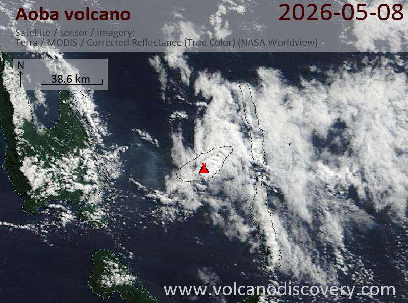
Explosive activity continues. Volcanic Ash Advisory Center (VAAC) Wellington warned about a volcanic ash plume that rose up to estimated 7000 ft (2100 m) altitude or flight level 070 and is moving at 10 kts in SW direction. The full report is as follows:
FVPS01 at 04:33 UTC, 08/05/26 from NZKL VA ADVISORY DTG: 20260508/0433Z VAAC: WELLINGTON VOLCANO: AMBAE 257030 PSN: S1523 E16750 AREA: VANUATU SOURCE ELEV: 1496M AMSL ADVISORY NR: 2026/172 INFO SOURCE: H9 AND GOES W SATELLITE ERUPTION DETAILS: ERUPTION AT 20260508/0400Z LOW LEVEL ERUPTION HAS BEGUN AGAIN OBS VA DTG: 08/0433Z OBS VA CLD: SFC/FL070 S1519 E16751 – S1525 E16756 – S1543 E16739 – S1531 E16730 MOV SW 10KT FCST VA CLD +6 HR: 08/1033Z SFC/FL070 S1519 E16751 – S1525 E16756 – S1550 E16732 – S1530 E16720 FCST VA CLD +12 HR: 08/1633Z SFC/FL070 S1519 E16751 – S1525 E16756 – S1555 E16727 – S1526 E16713 FCST VA CLD +18 HR: 08/2233Z SFC/FL070 S1519 E16751 – S1525 E16756 – S1558 E16721 – S1524 E16704 RMK: LOW LEVEL ERUPTION HAS RESUMED, ASH CAN BE SEEN IN THE SATELLITE RGB PRODUCTS. PLUME HEIGHT ESTIMATED FROM MODEL SOUNDING AND WINDS NXT ADVISORY: NO LATER THAN 20260508/1033Z=
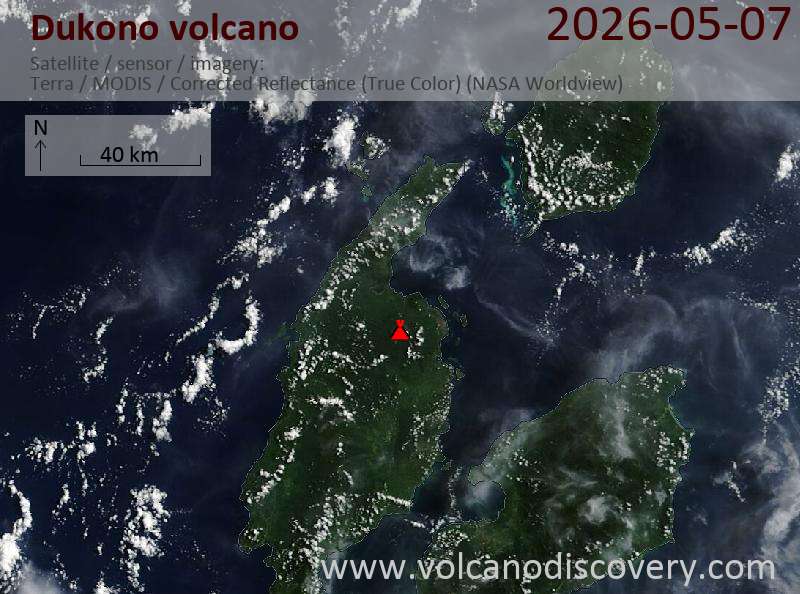
Explosive activity continues. Volcanic Ash Advisory Center (VAAC) Darwin warned about a volcanic ash plume that rose up to estimated 40000 ft (12200 m) altitude or flight level 400 and is moving at 10 kts in N direction. The full report is as follows:
FVAU03 at 23:29 UTC, 07/05/26 from ADRM VA ADVISORY DTG: 20260507/2329Z VAAC: DARWIN VOLCANO: DUKONO 268010 PSN: N0142 E12754 AREA: INDONESIA SOURCE ELEV: 1229M AMSL ADVISORY NR: 2026/214 INFO SOURCE: HIMWARI-9, CVGHM GROUND REPORT ERUPTION DETAILS: VA TO FL400 OBS VA DTG: 07/2300Z OBS VA CLD: SFC/FL400 N0141 E12755 – N0138 E12754 – N0135 E12748 – N0146 E12742 – N0149 E12747 – N0150 E12757 – N0146 E12757 MOV N 10KT FCST VA CLD +6 HR: 08/0500Z NOT AVBL FCST VA CLD +12 HR: 08/1100Z NOT AVBL FCST VA CLD +18 HR: 08/1700Z NOT AVBL RMK: A HIGH LEVEL ERUPTION TO FL400 EVIDENT AT THE SUMMIT. A MORE DETAILED ADVISORY TO FOLLOW. NXT ADVISORY: NO LATER THAN 20260507/2345Z=
Stromboli (Eolian Islands, Italy): The Instituto Nazionale di Geofisica e Vulcanologia-Osservatorio Etneo (INGV-Osservatorio Etneo) reported that the eruption continued at Stromboli between 4 May 2026 (local) and 6 May 2026 (local). There were Strombolian explosions reported. There were rockfalls. The alert level remained at „Yellow“ (level 2 on a 4-level scale). The aviation alert level remained at „Orange“ (level 3 on a 4-level scale). Activity also included: effusive eruptive activity, incandescent ejecta, lava flow(s), tremor. Source: Instituto Nazionale di Geofisica e Vulcanologia-Osservatorio Etneo (INGV-Osservatorio Etneo) … [read more] … [show less] Current Alerts: Observatory alert level: „Yellow“ (level 2 on a 4-level scale)
…7 May: The National Institute of Geophysics and Volcanology, Etnean Observatory (INGV) reported that a new lava flow erupted from the North Crater area onto the mid Sciara del Fuoco flank. Frequent glowing rockfalls from the lava flow front tumble down the slope and reach the coastline. … [read more] … [show less] At the same time, intense spattering and strombolian explosions continue from the North and Central-South crater areas.
…7 May: Intense activity has been causing a new lava overflow on the upper Sciara del Fuoco. Our group on location observed vigorous strombolian activity and spattering from multiple vents and an active lava flow that traveled from the crater area about half way down to the sea.
Canlaon (Central Philippines): The Philippine Institute of Volcanology and Seismology (PHIVOLCS) reported that the eruption continued at Kanlaon on 6 May 2026 (local). A total of 7 ash emission events, each lasting between 7 and 70 minutes, were recorded. Ash plumes rose 600 m above the vent and drifted SW and W. Tremor episodes were recorded 15 times. Volcanic seismicity was recorded 19 times. Sulfur dioxide (SO₂) emissions averaged 1,891 tonnes per day on 6 May. The alert level remained at „2 – Moderate Level of Volcanic Unrest“ (on a 0–5 level scale). Activity also included: inflationary deformation, tremor, volcanic seismicity. Source: Philippine Institute of Volcanology and Seismology (PHIVOLCS) … [read more] … [show less] Current Alerts: Observatory alert level: „2 – Moderate Level of Volcanic Unrest“ (on a 0–5 level scale)
Taal (Luzon, Philippines): The Philippine Institute of Volcanology and Seismology (PHIVOLCS) reported that the eruption continued at Taal on 6 May 2026 (local). Plume(s) were reported. Volcanic seismicity was recorded 2 times. The alert level remained at „1 – Low-Level Unrest“ (on a 0–5 level scale). Activity also included: inflationary deformation, volcanic seismicity. Source: Philippine Institute of Volcanology and Seismology (PHIVOLCS) … [read more] … [show less] Current Alerts: Observatory alert level: „1 – Low-Level Unrest“ (on a 0–5 level scale)
Mayon (Luzon Island, Philippines): Volcanic Ash Advisory Center Tokyo (VAAC) issued the following report: ERUPTION AT 20260507/1530Z VA CLD UNKNOWN REPORTED OBS VA DTG:07/1530Z …7 May: The Philippine Institute of Volcanology and Seismology (PHIVOLCS) reported that the eruption continued at Mayon on 6 May 2026 (local). Lava effusion continued from the summit crater. As of 6 May, lava flow lengths remained at 3.8 km in the Basud Gully (E flank), 3.2 km in the Bonga Gully (SE flank), and 1.6 km in the Mi-isi Gully (S flank). Minor episodic Strombolian activity was observed. Plume(s) rose to a maximum of 300 m (984 ft) above the vent. Volcanic seismicity was recorded 10 times. Tremor episodes were recorded 6 times. There were 297 seismically detected rockfalls. Seismicity related to pyroclastic density currents was recorded 2 times. Crater glow was visible to the naked eye. Ground deformation indicated short-term deflation across the volcanic edifice, with shorter-term inflation localized on the NE flank. The alert level remained at „3 – Increased Tendency Towards Hazardous Eruption“ (on a 0–5 level scale). Activity also included: seismically detected pyroclastic density current(s) (PDCs), tremor, volcanic seismicity. Source: Philippine Institute of Volcanology and Seismology (PHIVOLCS) … [read more] … [show less] Current Alerts: Observatory alert level: „3 – Increased Tendency Towards Hazardous Eruption“ (on a 0–5 level scale)
Bulusan (Luzon Island, Philippines): The Philippine Institute of Volcanology and Seismology (PHIVOLCS) reported that unrest continued at Bulusan on 6 May 2026 (local). Plume(s) rose to a maximum of 100 m (328 ft) above the vent. Volcanic seismicity was recorded 10 times. The alert level remained at „1 – Low Level of Volcanic Unrest“ (on a 0–5 level scale). Activity also included: inflationary deformation, volcanic seismicity. Source: Philippine Institute of Volcanology and Seismology (PHIVOLCS) … [read more] … [show less] Current Alerts: Observatory alert level: „1 – Low Level of Volcanic Unrest“ (on a 0–5 level scale)
Telong (northern Sumatra, Indonesia): The Center for Volcanology and Geological Hazard/Pusat Vulkanologi dan Mitigasi Bencana Geologi (CVGHM/PVMBG) reported that unrest continued at Telong, Bur ni on 6 May 2026 (local). The alert level remained at „Level 2 – Alert“ (on a 4-level scale). Source: Center for Volcanology and Geological Hazard/Pusat Vulkanologi dan Mitigasi Bencana Geologi (CVGHM/PVMBG) … [read more] … [show less] Current Alerts: Observatory alert level: „Level 2 – Alert“ (on a 4-level scale)
Karangetang (Siau Island, Sangihe Islands, Indonesia): The Center for Volcanology and Geological Hazard/Pusat Vulkanologi dan Mitigasi Bencana Geologi (CVGHM/PVMBG) reported that unrest continued at Karangetang on 6 May 2026 (local). Gas and vapor plume(s) rose to a maximum of 700 m (2,297 ft) above the vent. Gas emission seismicity was recorded 6 times. The alert level remained at „Level 2 – Alert“ (on a 4-level scale). Activity also included: gas emission seismicity. Source: Center for Volcanology and Geological Hazard/Pusat Vulkanologi dan Mitigasi Bencana Geologi (CVGHM/PVMBG) … [read more] … [show less] Current Alerts: Observatory alert level: „Level 2 – Alert“ (on a 4-level scale)
Raung (East Java): The Center for Volcanology and Geological Hazard/Pusat Vulkanologi dan Mitigasi Bencana Geologi (CVGHM/PVMBG) reported that unrest continued at Raung on 6 May 2026 (local). The alert level remained at „Level 2 – Alert“ (on a 4-level scale). Source: Center for Volcanology and Geological Hazard/Pusat Vulkanologi dan Mitigasi Bencana Geologi (CVGHM/PVMBG) … [read more] … [show less] Current Alerts: Observatory alert level: „Level 2 – Alert“ (on a 4-level scale)
Gamalama (Halmahera): The Center for Volcanology and Geological Hazard/Pusat Vulkanologi dan Mitigasi Bencana Geologi (CVGHM/PVMBG) reported that unrest continued at Gamalama on 6 May 2026 (local). The alert level remained at „Level 2 – Alert“ (on a 4-level scale). Source: Center for Volcanology and Geological Hazard/Pusat Vulkanologi dan Mitigasi Bencana Geologi (CVGHM/PVMBG) … [read more] … [show less] Current Alerts: Observatory alert level: „Level 2 – Alert“ (on a 4-level scale)
Slamet (Central Java, Indonesia): The Center for Volcanology and Geological Hazard/Pusat Vulkanologi dan Mitigasi Bencana Geologi (CVGHM/PVMBG) reported that unrest continued at Slamet on 6 May 2026 (local). The alert level remained at „Level 2 – Alert“ (on a 4-level scale). Source: Center for Volcanology and Geological Hazard/Pusat Vulkanologi dan Mitigasi Bencana Geologi (CVGHM/PVMBG) … [read more] … [show less] Current Alerts: Observatory alert level: „Level 2 – Alert“ (on a 4-level scale)
Ibu (Halmahera, Indonesia): The Center for Volcanology and Geological Hazard/Pusat Vulkanologi dan Mitigasi Bencana Geologi (CVGHM/PVMBG) reported that the eruption continued at Ibu on 6 May 2026 (local). Gas and vapor plume(s) rose to a maximum of 200 m (656 ft) above the vent. There were 126 explosions reported, with plumes rising to a maximum of 600 m (1,969 ft) above the vent. The alert level remained at „Level 2 – Alert“ (on a 4-level scale). Source: Center for Volcanology and Geological Hazard/Pusat Vulkanologi dan Mitigasi Bencana Geologi (CVGHM/PVMBG) … [read more] … [show less] Current Alerts: Observatory alert level: „Level 2 – Alert“ (on a 4-level scale)
Tangkubanparahu (West Java): The Center for Volcanology and Geological Hazard/Pusat Vulkanologi dan Mitigasi Bencana Geologi (CVGHM/PVMBG) issued a report for Tangkuban Parahu on 6 May 2026 (local). Gas and vapor plume(s) were reported. The alert level remained at „Level 1 – Normal“ (on a 4-level scale). Source: Center for Volcanology and Geological Hazard/Pusat Vulkanologi dan Mitigasi Bencana Geologi (CVGHM/PVMBG) … [read more] … [show less] Current Alerts: Observatory alert level: „Level 1 – Normal“ (on a 4-level scale)
Sangeang Api (Flores Sea, Indonesia): The Center for Volcanology and Geological Hazard/Pusat Vulkanologi dan Mitigasi Bencana Geologi (CVGHM/PVMBG) reported that unrest continued at Sangeang Api on 6 May 2026 (local). The alert level remained at „Level 2 – Alert“ (on a 4-level scale). Source: Center for Volcanology and Geological Hazard/Pusat Vulkanologi dan Mitigasi Bencana Geologi (CVGHM/PVMBG) … [read more] … [show less] Current Alerts: Observatory alert level: „Level 2 – Alert“ (on a 4-level scale)
Lewotobi (Flores): The Center for Volcanology and Geological Hazard/Pusat Vulkanologi dan Mitigasi Bencana Geologi (CVGHM/PVMBG) reported that the eruption continued at Lewotobi (Laki-Laki) on 6 May 2026 (local). Gas and vapor plume(s) rose to a maximum of 100 m (328 ft) above the vent. There was 1 seismically detected rockfall. Low-frequency (LF) earthquakes were detected 1 times. Gas emission seismicity was recorded 1 times. The alert level remained at „Level 2 – Alert“ (on a 4-level scale). Activity also included: gas emission seismicity, low-frequency (LF) seismicity. Source: Center for Volcanology and Geological Hazard/Pusat Vulkanologi dan Mitigasi Bencana Geologi (CVGHM/PVMBG) … [read more] … [show less] Current Alerts: Observatory alert level: „Level 2 – Alert“ (on a 4-level scale)
Soputan (North Sulawesi, Indonesia): The Center for Volcanology and Geological Hazard/Pusat Vulkanologi dan Mitigasi Bencana Geologi (CVGHM/PVMBG) reported that unrest continued at Soputan on 6 May 2026 (local). Gas and vapor plume(s) rose to a maximum of 20 m (66 ft) above the vent. The alert level remained at „Level 2 – Alert“ (on a 4-level scale). Source: Center for Volcanology and Geological Hazard/Pusat Vulkanologi dan Mitigasi Bencana Geologi (CVGHM/PVMBG) … [read more] … [show less] Current Alerts: Observatory alert level: „Level 2 – Alert“ (on a 4-level scale)
Lewotolo (Lesser Sunda Islands): The Center for Volcanology and Geological Hazard/Pusat Vulkanologi dan Mitigasi Bencana Geologi (CVGHM/PVMBG) reported that the eruption continued at Lewotolok on 6 May 2026 (local). Gas and vapor plume(s) rose to a maximum of 100 m (328 ft) above the vent. There were 50 seismically detected rockfalls. The alert level remained at „Level 2 – Alert“ (on a 4-level scale). Source: Center for Volcanology and Geological Hazard/Pusat Vulkanologi dan Mitigasi Bencana Geologi (CVGHM/PVMBG) … [read more] … [show less] Current Alerts: Observatory alert level: „Level 2 – Alert“ (on a 4-level scale)
Sorikmarapi (Sumatra): The Center for Volcanology and Geological Hazard/Pusat Vulkanologi dan Mitigasi Bencana Geologi (CVGHM/PVMBG) reported that unrest continued at Sorikmarapi on 6 May 2026 (local). Gas and vapor plume(s) rose to a maximum of 30 m (98 ft) above the vent. The alert level remained at „Level 2 – Alert“ (on a 4-level scale). Source: Center for Volcanology and Geological Hazard/Pusat Vulkanologi dan Mitigasi Bencana Geologi (CVGHM/PVMBG) … [read more] … [show less] Current Alerts: Observatory alert level: „Level 2 – Alert“ (on a 4-level scale)
Krakatau (Sunda Strait, Indonesia): The Center for Volcanology and Geological Hazard/Pusat Vulkanologi dan Mitigasi Bencana Geologi (CVGHM/PVMBG) reported that unrest continued at Krakatau on 6 May 2026 (local). The alert level remained at „Level 2 – Alert“ (on a 4-level scale). Source: Center for Volcanology and Geological Hazard/Pusat Vulkanologi dan Mitigasi Bencana Geologi (CVGHM/PVMBG) … [read more] … [show less] Current Alerts: Observatory alert level: „Level 2 – Alert“ (on a 4-level scale)
Merapi (Central Java, Indonesia): The Center for Volcanology and Geological Hazard/Pusat Vulkanologi dan Mitigasi Bencana Geologi (CVGHM/PVMBG) reported that the eruption continued at Merapi on 6 May 2026 (local). There were 4 hot rockfalls, traveling up to 2,000 m. There were 121 seismically detected rockfalls. The alert level remained at „Level 3 – Standby“ (on a 4-level scale). Source: Center for Volcanology and Geological Hazard/Pusat Vulkanologi dan Mitigasi Bencana Geologi (CVGHM/PVMBG) … [read more] … [show less] Current Alerts: Observatory alert level: „Level 3 – Standby“ (on a 4-level scale)
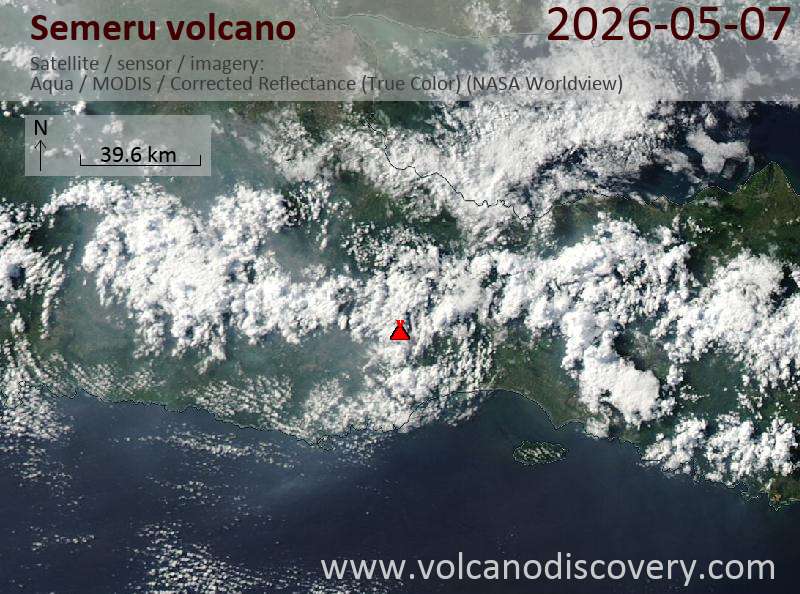
Semeru (East Java, Indonesia): Explosive activity continues. Volcanic Ash Advisory Center (VAAC) Darwin warned about a volcanic ash plume that rose up to estimated 15000 ft (4600 m) altitude or flight level 150 . The full report is as follows: VA OBS TO FL150 AT 07/1630Z MOV N OBS VA DTG:07/1630Z to 15000 ft (4600 m) …7 May: The Center for Volcanology and Geological Hazard/Pusat Vulkanologi dan Mitigasi Bencana Geologi (CVGHM/PVMBG) reported that the eruption continued at Semeru on 6 May 2026 (local). Ash and gas plume(s) rose to a maximum of 200 m (656 ft) above the vent. There were 74 explosions reported, with plumes rising to a maximum of 800 m (2,625 ft) above the vent. There were 5 seismically detected rockfalls. The alert level remained at „Level 3 – Standby“ (on a 4-level scale). Source: Center for Volcanology and Geological Hazard/Pusat Vulkanologi dan Mitigasi Bencana Geologi (CVGHM/PVMBG) … [read more] … [show less] Current Alerts: Observatory alert level: „Level 3 – Standby“ (on a 4-level scale)
Ijen (East Java, Indonesia): The Center for Volcanology and Geological Hazard/Pusat Vulkanologi dan Mitigasi Bencana Geologi (CVGHM/PVMBG) issued a report for Ijen on 6 May 2026 (local). Gas and vapor plume(s) rose to a maximum of 100 m (328 ft) above the vent. The alert level remained at „Level 1 – Normal“ (on a 4-level scale). Source: Center for Volcanology and Geological Hazard/Pusat Vulkanologi dan Mitigasi Bencana Geologi (CVGHM/PVMBG) … [read more] … [show less] Current Alerts: Observatory alert level: „Level 1 – Normal“ (on a 4-level scale)
Marapi (Western Sumatra, Indonesia): The Center for Volcanology and Geological Hazard/Pusat Vulkanologi dan Mitigasi Bencana Geologi (CVGHM/PVMBG) reported that the eruption continued at Marapi on 6 May 2026 (local). There were 2 seismically detected explosions reported. The alert level remained at „Level 2 – Alert“ (on a 4-level scale). Source: Center for Volcanology and Geological Hazard/Pusat Vulkanologi dan Mitigasi Bencana Geologi (CVGHM/PVMBG) … [read more] … [show less] Current Alerts: Observatory alert level: „Level 2 – Alert“ (on a 4-level scale)
Dempo (Sumatra): The Center for Volcanology and Geological Hazard/Pusat Vulkanologi dan Mitigasi Bencana Geologi (CVGHM/PVMBG) reported that unrest continued at Dempo on 6 May 2026 (local). The alert level remained at „Level 2 – Alert“ (on a 4-level scale). Source: Center for Volcanology and Geological Hazard/Pusat Vulkanologi dan Mitigasi Bencana Geologi (CVGHM/PVMBG) … [read more] … [show less] Current Alerts: Observatory alert level: „Level 2 – Alert“ (on a 4-level scale)
Dukono (Halmahera): The Center for Volcanology and Geological Hazard/Pusat Vulkanologi dan Mitigasi Bencana Geologi (CVGHM/PVMBG) reported that the eruption continued at Dukono on 6 May 2026 (local). There were 82 explosions reported, with plumes rising to a maximum of 1,500 m (4,921 ft) above the vent. The alert level remained at „Level 2 – Alert“ (on a 4-level scale). Source: Center for Volcanology and Geological Hazard/Pusat Vulkanologi dan Mitigasi Bencana Geologi (CVGHM/PVMBG) … [read more] … [show less] Current Alerts: Observatory alert level: „Level 2 – Alert“ (on a 4-level scale)
Awu (Sulawesi & Sangihe Islands): The Center for Volcanology and Geological Hazard/Pusat Vulkanologi dan Mitigasi Bencana Geologi (CVGHM/PVMBG) reported that unrest continued at Awu on 6 May 2026 (local). Gas and vapor plume(s) rose to a maximum of 100 m (328 ft) above the vent. The alert level remained at „Level 2 – Alert“ (on a 4-level scale). Source: Center for Volcanology and Geological Hazard/Pusat Vulkanologi dan Mitigasi Bencana Geologi (CVGHM/PVMBG) … [read more] … [show less] Current Alerts: Observatory alert level: „Level 2 – Alert“ (on a 4-level scale)
Kerinci (Sumatra): The Center for Volcanology and Geological Hazard/Pusat Vulkanologi dan Mitigasi Bencana Geologi (CVGHM/PVMBG) reported that unrest continued at Kerinci on 6 May 2026 (local). The alert level remained at „Level 2 – Alert“ (on a 4-level scale). Source: Center for Volcanology and Geological Hazard/Pusat Vulkanologi dan Mitigasi Bencana Geologi (CVGHM/PVMBG) … [read more] … [show less] Current Alerts: Observatory alert level: „Level 2 – Alert“ (on a 4-level scale)
Lokon-Empung (North Sulawesi, Indonesia): The Center for Volcanology and Geological Hazard/Pusat Vulkanologi dan Mitigasi Bencana Geologi (CVGHM/PVMBG) reported that unrest continued at Lokon-Empung on 6 May 2026 (local). Gas and vapor plume(s) rose to a maximum of 25 m (82 ft) above the vent. The alert level remained at „Level 2 – Alert“ (on a 4-level scale). Source: Center for Volcanology and Geological Hazard/Pusat Vulkanologi dan Mitigasi Bencana Geologi (CVGHM/PVMBG) … [read more] … [show less] Current Alerts: Observatory alert level: „Level 2 – Alert“ (on a 4-level scale)
Aoba (Vanuatu): Explosive activity continues. Volcanic Ash Advisory Center (VAAC) Wellington warned about a volcanic ash plume that rose up to estimated 10000 ft (3000 m) altitude or flight level 100 and is moving at 10 kts in W direction. The full report is as follows: ERUPTION AT 20260506/0913Z INTERMITTENT LOW-LEVEL ERUPTION to 10000 ft (3000 m)
Kilauea (Hawai’i): The United States Geological Survey – Hawaiian Volcano Observatory (USGS-HVO) reported that there was a pause in eruptive activity at Kilauea between 5 May 2026 (local) and 6 May 2026 (local). Glow was observed overnight from both the north and south vents. The lava flows on the crater floor remained incandescent. The south vent produced occasional flames. The lava flows on the crater floor continued to slowly advance E and slowed down overnight into 6 May. The alert level remained at „Advisory“ (level 2 on a 4-level scale). The aviation alert level remained at „Yellow“ (level 2 on a 4-level scale). Source: United States Geological Survey – Hawaiian Volcano Observatory (USGS-HVO) … [read more] … [show less] Current Alerts: Observatory alert level: „Advisory“ (level 2 on a 4-level scale)
Shishaldin (Aleutian Islands, Alaska): The Observatorio Argentino de Vigilancia Volcánica (OAVV) reported that unrest continued at Shishaldin between 5 May 2026 (local) and 6 May 2026 (local). Vapor plume(s) were reported. The alert level remained at „Advisory“ (level 2 on a 4-level scale). The aviation alert level remained at „Yellow“ (level 2 on a 4-level scale). Activity also included: SO2 degassing, thermal anomaly(ies). Source: Observatorio Argentino de Vigilancia Volcánica (OAVV) … [read more] … [show less] Current Alerts: Observatory alert level: „Advisory“ (level 2 on a 4-level scale)
Great Sitkin (United States, Aleutian Islands): The Observatorio Argentino de Vigilancia Volcánica (OAVV) reported that the eruption continued at Great Sitkin between 5 May 2026 (local) and 6 May 2026 (local). A webcam image showed weak steaming from the active lava flow. Lava continued to slowly erupt in the summit crater. Rockfalls generated by the growing lava dome were seismically recorded. The alert level remained at „Watch“ (level 3 on a 4-level scale). The aviation alert level remained at „Orange“ (level 3 on a 4-level scale). Source: Observatorio Argentino de Vigilancia Volcánica (OAVV) … [read more] … [show less] Current Alerts: Observatory alert level: „Watch“ (level 3 on a 4-level scale)
Popocatépetl (Central Mexico): The Centro Nacional de Prevención de Desastres (CENAPRED) reported that the eruption continued at Popocatépetl between 5 May 2026 (local) and 6 May 2026 (local). Ash, gas, and vapor plume(s) were reported. At 2018 on 5 May, a M1.5 volcano-tectonic (VT) earthquake was recorded. The alert level remained at „Orange“ (level 3 on a 4-level scale). Source: Centro Nacional de Prevención de Desastres (CENAPRED) … [read more] … [show less] Current Alerts: Observatory alert level: „Orange“ (level 3 on a 4-level scale)
Santiaguito (Guatemala): The Instituto Nacional de Sismología, Vulcanología, Meteorología e Hidrología (INSIVUMEH) reported that the eruption continued at Santa María between 5 May 2026 (local) and 6 May 2026 (local). There were explosions reported, occurring at a rate of up to 2 per hour, with plumes rising to a maximum of 800 m (2,625 ft) above the vent. Glow was observed from the crater of the Caliente Dome. There were incandescent rockfalls. Gas and vapor plume(s) rose to a maximum of 600 m (1,969 ft) above the vent. Source: Instituto Nacional de Sismología, Vulcanología, Meteorología e Hidrología (INSIVUMEH) … [read more] … [show less] Current Alerts: Observatory alert level: unavailable or not collected
Fuego (Guatemala): Volcanic Ash Advisory Center Washington (VAAC) issued the following report: ONGOING VA EMS …7 May: The Instituto Nacional de Sismología, Vulcanología, Meteorología e Hidrología (INSIVUMEH) reported that the eruption continued at Fuego between 5 May 2026 (local) and 6 May 2026 (local). There were explosions reported, occurring at a rate of up to 13 per hour, with plumes rising to a maximum of 937 m (3,074 ft) above the vent. Incandescent material was ejected in pulses up to 300 m above the vent. There were incandescent rockfalls. Gas and vapor plume(s) rose to a maximum of 200 m (656 ft) above the vent. Activity also included: audible sounds (e.g., booms, rumbling), shockwave. Source: Instituto Nacional de Sismología, Vulcanología, Meteorología e Hidrología (INSIVUMEH) … [read more] … [show less] Current Alerts: Observatory alert level: unavailable or not collected
Turrialba (Costa Rica): The Observatorio Vulcanológico y Sismológico de Costa Rica – Universidad Nacional (OVSICORI-UNA) reported that unrest continued at Turrialba between 5 May 2026 (local) and 6 May 2026 (local). The alert level remained at „Level 2 – Warning“ (on a 0–4 level scale). The aviation alert level remained at „Yellow“ (level 2 on a 4-level scale). Source: Observatorio Vulcanológico y Sismológico de Costa Rica – Universidad Nacional (OVSICORI-UNA) … [read more] … [show less] Current Alerts: Observatory alert level: „Level 2 – Warning“ (on a 0–4 level scale)
Rincón de la Vieja (Costa Rica): The Observatorio Vulcanológico y Sismológico de Costa Rica – Universidad Nacional (OVSICORI-UNA) reported that unrest continued at Rincón de la Vieja between 5 May 2026 (local) and 6 May 2026 (local). The alert level remained at „Level 2 – Warning“ (on a 0–4 level scale). The aviation alert level remained at „Yellow“ (level 2 on a 4-level scale). Source: Observatorio Vulcanológico y Sismológico de Costa Rica – Universidad Nacional (OVSICORI-UNA) … [read more] … [show less] Current Alerts: Observatory alert level: „Level 2 – Warning“ (on a 0–4 level scale)
Poas (Costa Rica): The Observatorio Vulcanológico y Sismológico de Costa Rica – Universidad Nacional (OVSICORI-UNA) reported that the eruption continued at Poás between 5 May 2026 (local) and 6 May 2026 (local). Plume(s) were reported. The alert level remained at „Level 2 – Warning“ (on a 0–4 level scale). The aviation alert level remained at „Yellow“ (level 2 on a 4-level scale). Activity also included: fumarolic activity. Source: Observatorio Vulcanológico y Sismológico de Costa Rica – Universidad Nacional (OVSICORI-UNA) … [read more] … [show less] Current Alerts: Observatory alert level: „Level 2 – Warning“ (on a 0–4 level scale)
Sangay (Ecuador): The Instituto Geofísico-Escuela Politécnica Nacional (IG-EPN) reported that the eruption continued at Sangay between 5 May 2026 (local) and 6 May 2026 (local). There were 161 seismically detected explosions reported. Ash and gas plume(s) rose to a maximum of 800 m (2,625 ft) above the vent. There were incandescent rockfalls, descending 200 m below the crater. The alert level remained at „2 – Yellow“ (on a 4-level scale). Activity also included: SO2 degassing, thermal anomaly(ies). Source: Instituto Geofísico-Escuela Politécnica Nacional (IG-EPN) … [read more] … [show less] Current Alerts: Observatory alert level: „2 – Yellow“ (on a 4-level scale)
Reventador (Ecuador): Volcanic Ash Advisory Center Washington (VAAC) issued the following report: ONGOING VA EMS …7 May: The Instituto Geofísico-Escuela Politécnica Nacional (IG-EPN) reported that the eruption continued at Reventador between 5 May 2026 (local) and 6 May 2026 (local). There were 98 seismically detected explosions reported. Ash and gas plume(s) rose to a maximum of 1,000 m (3,281 ft) above the vent. There were incandescent rockfalls, descending 1,000 m below the crater. The alert level remained at „3 – Orange“ (on a 4-level scale). Activity also included: SO2 degassing, thermal anomaly(ies). Source: Instituto Geofísico-Escuela Politécnica Nacional (IG-EPN) … [read more] … [show less] Current Alerts: Observatory alert level: „3 – Orange“ (on a 4-level scale)
Sabancaya (Peru): Explosive activity continues. Volcanic Ash Advisory Center (VAAC) Buenos Aires warned about a volcanic ash plume that rose up to estimated 24000 ft (7300 m) altitude or flight level 240 and is moving at 15 kts in NE direction. The full report is as follows: continuous ash emissions to 24000 ft (7300 m) …7 May: The Centro Vulcanológico Nacional del Instituto Geofísico del Perú (CENVUL-IGP) reported that the eruption continued at Sabancaya between 5 May 2026 (local) and 6 May 2026 (local). Ash, gas, and vapor plume(s) rose to a maximum of 1,200 m (3,937 ft) above the vent. A total of 10 earthquakes related to the movement of magma and gases were recorded. Thermal anomalies were detected 3 times. The alert level remained at „Orange“ (level 3 on a 4-level scale). Activity also included: thermal anomaly(ies). Source: Centro Vulcanológico Nacional del Instituto Geofísico del Perú (CENVUL-IGP) … [read more] … [show less] Current Alerts: Observatory alert level: „Orange“ (level 3 on a 4-level scale)
Explosive activity continues. Volcanic Ash Advisory Center (VAAC) Darwin warned about a volcanic ash plume that rose up to estimated 15000 ft (4600 m) altitude or flight level 150 . The full report is as follows:
FVAU02 at 16:46 UTC, 07/05/26 from ADRM VA ADVISORY DTG: 20260507/1650Z VAAC: DARWIN VOLCANO: SEMERU 263300 PSN: S0806 E11255 AREA: INDONESIA SOURCE ELEV: 3657M AMSL ADVISORY NR: 2026/520 INFO SOURCE: HIMAWARI-9, CVGHM ERUPTION DETAILS: VA OBS TO FL150 AT 07/1630Z MOV N OBS VA DTG: 07/1630Z OBS VA CLD: SFC/FL150 S0813 E11249 – S0756 E11222 – S0730 E11247 – S0744 E11317 – S0812 E11303 MOV N 05KT FCST VA CLD +6 HR: 07/2230Z SFC/FL150 S0814 E11249 – S0751 E11224 – S0729 E11251 – S0743 E11318 – S0812 E11304 FCST VA CLD +12 HR: 08/0430Z SFC/FL150 S0812 E11248 – S0744 E11228 – S0730 E11300 – S0744 E11324 – S0813 E11304 FCST VA CLD +18 HR: 08/1030Z SFC/FL150 S0813 E11250 – S0744 E11228 – S0730 E11300 – S0746 E11325 – S0812 E11303 RMK: VA IDENTIFIABLE ON LATEST SATELLITE IMAGERY MOVING TO N. RECENT GROUND REPORTS INDICATE DISCRETE VA EMISSIONS ARE ONGOING. VA HEIGHT AND MOVEMENT BASED ON SATELLITE IMAGERY, GROUND REPORTS AND MODEL GUIDANCE. NXT ADVISORY: NO LATER THAN 20260507/2250Z=
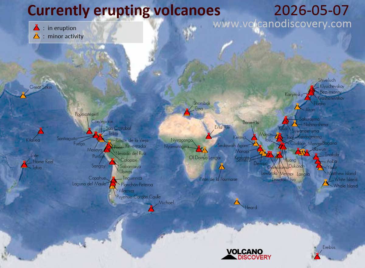
Frequent explosive activity in Indonesia and Guatemala stood out today, while Hawaii’s Kilauea slipped into a pause. Popocatepetl’s ground alert shifted to Orange, and Italy’s Stromboli showed both Strombolian bursts and effusive lava.
United States Great Sitkin (Watch / Aviation ORANGE) kept slow lava effusion inside the summit crater with weak steaming; rockfalls from the growing dome were detected. At Kilauea (Advisory / Aviation YELLOW), eruptive activity paused, but glow persisted at vents and the crater-floor flows stayed incandescent. Unrest at Shishaldin (Advisory / Aviation YELLOW) produced vapor plumes, SO2 degassing, and intermittent thermal anomalies.
Indonesia Halmahera’s Dukono and Ibu were notably noisy, with 82 and 126 explosions respectively; ash rose up to 1.5 km at Dukono and to 600 m at Ibu. Farther south, Semeru tallied 74 explosions with ash to 800 m, while Merapi shed hot avalanches reaching 2 km and Marapi produced two explosions. On Flores and Lembata, Lewotobi and Lewotolok emitted low gas plumes and minor rockfalls. Several others were in unrest at Indonesia’s Level 2 Alert, including Krakatau, Kerinci, Raung, and more.
Philippines At Mayon (Alert Level 3), lava effusion kept three flows active at 3.8 km (Basud), 3.2 km (Bonga), and 1.6 km (Mi-isi), with minor Strombolian bursts and numerous rockfalls; occasional PDC-related signals were recorded. Nearby, Kanlaon logged seven ash emissions with plumes to 600 m and SO2 at 1,891 t/d. Low-level unrest persisted at Taal (Alert Level 1) and Bulusan (Alert Level 1), with diffuse plumes, minor seismicity, and ongoing inflation.
Mexico Popocatepetl shifted to an Orange alert as ash-and-gas emissions continued; a M1.5 volcano-tectonic quake was recorded.
South America In Ecuador, Reventador and Sangay produced frequent explosions and ash plumes (to 1 km and 800 m, respectively), along with incandescent rockfalls. Peru’s Sabancaya sent ash-and-gas up to 1.2 km and showed occasional thermal anomalies.
Europe Italy’s Stromboli (Aviation ORANGE) featured classic Strombolian bursts alongside effusive lava, with rockfalls and tremor.
Other In Guatemala, Fuego averaged up to 13 explosions per hour, lofting ash to 937 m and throwing incandescent material with accompanying rockfalls, while Santa Maria produced up to two explosions per hour with ash to 800 m and persistent dome glow. In Costa Rica, degassing persisted at Poas, while Rincon de la Vieja and Turrialba remained at Level 2 (Warning) with Aviation Yellow.