Explosive activity continues. Volcanic Ash Advisory Center (VAAC) Darwin warned about a volcanic ash plume that rose up to estimated 15000 ft (4600 m) altitude or flight level 150 and is moving at 05 kts in S direction. The full report is as follows:
FVAU02 at 13:40 UTC, 21/05/26 from ADRM VA ADVISORY DTG: 20260521/1350Z VAAC: DARWIN VOLCANO: SEMERU 263300 PSN: S0806 E11255 AREA: INDONESIA SOURCE ELEV: 3657M AMSL ADVISORY NR: 2026/576 INFO SOURCE: HIMAWARI-9, CVGHM ERUPTION DETAILS: VA TO FL150 LAST REP AT 21/1053Z EST VA DTG: 21/1330Z EST VA CLD: SFC/FL150 S0759 E11258 – S0837 E11326 – S0846 E11241 – S0801 E11249 MOV S 05KT FCST VA CLD +6 HR: 21/1930Z SFC/FL150 S0802 E11249 – S0759 E11257 – S0805 E11317 – S0836 E11330 – S0841 E11246 FCST VA CLD +12 HR: 22/0130Z SFC/FL150 S0820 E11246 – S0804 E11237 – S0751 E11239 – S0748 E11252 – S0748 E11308 – S0800 E11317 – S0818 E11315 FCST VA CLD +18 HR: 22/0730Z SFC/FL150 S0814 E11247 – S0755 E11230 – S0738 E11241 – S0741 E11314 – S0759 E11314 – S0813 E11304 RMK: VA NOT IDENTIFIABLE ON SATELLITE IMAGERY DUE TO MET CLOUD OBSCURATION. HOWEVER, INTERMITTENT DISCRETE ERUPTION EXPECTED TO BE ONGOING. HEIGHT AND MOVEMENT BASED ON SATELLITE IMAGERY, GROUND REPORTS AND MODEL GUIDANCE. NXT ADVISORY: NO LATER THAN 20260521/1950Z=
Volcanic Ash Advisory Center Tokyo (VAAC) issued the following report:
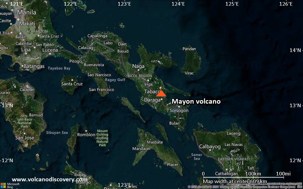
FVFE01 at 08:14 UTC, 21/05/26 from RJTD VA ADVISORY DTG: 20260521/0814Z VAAC: TOKYO VOLCANO: MAYON 273030 PSN: N1315 E12341 AREA: PHILIPPINES SOURCE ELEV: 2462M AMSL ADVISORY NR: 2026/638 INFO SOURCE: HIMAWARI-9 PHIVOLCS ERUPTION DETAILS: ERUPTION AT 20260521/0753Z FL090 EXTD SW REPORTED OBS VA DTG: 21/0800Z OBS VA CLD: VA NOT IDENTIFIABLE FM SATELLITE DATA WIND FL090 080/12KT
FCST VA CLD +6 HR: NOT AVBL FCST VA CLD +12 HR: NOT AVBL FCST VA CLD +18 HR: NOT AVBL RMK: WE WILL ISSUE FURTHER ADVISORY IF VA IS DETECTED IN SATELLITE IMAGERY. NXT ADVISORY: NO FURTHER ADVISORIES=
Satellite image of Shiveluch volcano on 21 May 2026
Explosive activity continues. Volcanic Ash Advisory Center (VAAC) Anchorage warned about a volcanic ash plume that rose up to estimated 32000 ft (9800 m) altitude or flight level 320 and is moving at 40 kts in SE direction. The full report is as follows:
FVAK21 at 04:06 UTC, 21/05/26 from PAWU VAAAK1 VA ADVISORY
RMK: VA EM SEEN IN WEBCAM. VOL ACTIVITY SEEN IN STLT IMG THO DRCT VA NOT SEEN DUE TO MET CLD CVR. EXP SW MOVNT THRU T+18 HRS. FL BSD ON PAST ACTIVITY. FCST BSD ON NWP MDLS. …LINER
Shiveluch (Kamchatka): Explosive activity continues. Volcanic Ash Advisory Center (VAAC) Tokyo warned about a volcanic ash plume that rose up to estimated 32000 ft (9800 m) altitude or flight level 320 and is moving at 30 kts in SE direction. The full report is as follows: VA CONTINUOUSLY OBS IN SATELLITE IMAGERY OBS VA DTG:20/1720Z to 32000 ft (9800 m)
Bezymianny (Kamchatka): Explosive activity continues. Volcanic Ash Advisory Center (VAAC) Tokyo warned about a volcanic ash plume that rose up to estimated 28000 ft (8500 m) altitude or flight level 280 and is moving at 10 kts in SE direction. The full report is as follows: VA CONTINUOUSLY OBS IN SATELLITE IMAGERY OBS VA DTG:20/1720Z to 28000 ft (8500 m)
Canlaon (Central Philippines): Volcanic Ash Advisory Center Tokyo (VAAC) issued the following report: ERUPTION AT 20260520/1219Z FL090 EXTD SW REPORTED OBS VA DTG:20/1210Z …20 May: The Philippine Institute of Volcanology and Seismology (PHIVOLCS) reported that the eruption continued at Kanlaon on 19 May 2026 (local). The alert level remained at „2 – Moderate Level of Volcanic Unrest“ (on a 0–5 level scale). Source: Philippine Institute of Volcanology and Seismology (PHIVOLCS) … [read more] … [show less] Current Alerts: Observatory alert level: „2 – Moderate Level of Volcanic Unrest“ (on a 0–5 level scale)
Taal (Luzon, Philippines): The Philippine Institute of Volcanology and Seismology (PHIVOLCS) reported that the eruption continued at Taal on 19 May 2026 (local). The alert level remained at „1 – Low-Level Unrest“ (on a 0–5 level scale). Source: Philippine Institute of Volcanology and Seismology (PHIVOLCS) … [read more] … [show less] Current Alerts: Observatory alert level: „1 – Low-Level Unrest“ (on a 0–5 level scale)
Mayon (Luzon Island, Philippines): The Philippine Institute of Volcanology and Seismology (PHIVOLCS) reported that the eruption continued at Mayon on 19 May 2026 (local). Plume(s) rose to a maximum of 400 m (1,312 ft) above the vent. Volcanic seismicity was recorded 26 times. Tremor episodes were recorded 15 times. There were 326 seismically detected rockfalls. Seismicity related to pyroclastic density currents was recorded 3 times. Crater glow was visible to the naked eye. Sulfur dioxide (SO₂) emissions averaged 658 tonnes per day on 19 May. Ground deformation indicated short-term deflation across the volcanic edifice, with shorter-term inflation localized on the NE flank. The alert level remained at „3 – Increased Tendency Towards Hazardous Eruption“ (on a 0–5 level scale). Activity also included: seismically detected pyroclastic density current(s) (PDCs), tremor, volcanic seismicity. Source: Philippine Institute of Volcanology and Seismology (PHIVOLCS) … [read more] … [show less] Current Alerts: Observatory alert level: „3 – Increased Tendency Towards Hazardous Eruption“ (on a 0–5 level scale)
Bulusan (Luzon Island, Philippines): The Philippine Institute of Volcanology and Seismology (PHIVOLCS) reported that unrest continued at Bulusan on 19 May 2026 (local). Plume(s) rose to a maximum of 100 m (328 ft) above the vent. Volcanic seismicity was recorded 252 times. The alert level remained at „1 – Low Level of Volcanic Unrest“ (on a 0–5 level scale). Activity also included: inflationary deformation, volcanic seismicity. Source: Philippine Institute of Volcanology and Seismology (PHIVOLCS) … [read more] … [show less] Current Alerts: Observatory alert level: „1 – Low Level of Volcanic Unrest“ (on a 0–5 level scale)
Telong (northern Sumatra, Indonesia): The Center for Volcanology and Geological Hazard/Pusat Vulkanologi dan Mitigasi Bencana Geologi (CVGHM/PVMBG) reported that unrest continued at Telong, Bur ni on 19 May 2026 (local). The alert level remained at „Level 2 – Alert“ (on a 4-level scale). Source: Center for Volcanology and Geological Hazard/Pusat Vulkanologi dan Mitigasi Bencana Geologi (CVGHM/PVMBG) … [read more] … [show less] Current Alerts: Observatory alert level: „Level 2 – Alert“ (on a 4-level scale)
Raung (East Java): The Center for Volcanology and Geological Hazard/Pusat Vulkanologi dan Mitigasi Bencana Geologi (CVGHM/PVMBG) reported that unrest continued at Raung on 19 May 2026 (local). The alert level remained at „Level 2 – Alert“ (on a 4-level scale). Source: Center for Volcanology and Geological Hazard/Pusat Vulkanologi dan Mitigasi Bencana Geologi (CVGHM/PVMBG) … [read more] … [show less] Current Alerts: Observatory alert level: „Level 2 – Alert“ (on a 4-level scale)
Gamalama (Halmahera): The Center for Volcanology and Geological Hazard/Pusat Vulkanologi dan Mitigasi Bencana Geologi (CVGHM/PVMBG) reported that unrest continued at Gamalama on 19 May 2026 (local). Gas and vapor plume(s) rose to a maximum of 500 m (1,640 ft) above the vent. The alert level remained at „Level 2 – Alert“ (on a 4-level scale). Source: Center for Volcanology and Geological Hazard/Pusat Vulkanologi dan Mitigasi Bencana Geologi (CVGHM/PVMBG) … [read more] … [show less] Current Alerts: Observatory alert level: „Level 2 – Alert“ (on a 4-level scale)
Slamet (Central Java, Indonesia): The Center for Volcanology and Geological Hazard/Pusat Vulkanologi dan Mitigasi Bencana Geologi (CVGHM/PVMBG) reported that unrest continued at Slamet on 19 May 2026 (local). The alert level remained at „Level 2 – Alert“ (on a 4-level scale). Source: Center for Volcanology and Geological Hazard/Pusat Vulkanologi dan Mitigasi Bencana Geologi (CVGHM/PVMBG) … [read more] … [show less] Current Alerts: Observatory alert level: „Level 2 – Alert“ (on a 4-level scale)
Ibu (Halmahera, Indonesia): Explosive activity continues. Volcanic Ash Advisory Center (VAAC) Darwin warned about a volcanic ash plume that rose up to estimated 8000 ft (2400 m) altitude or flight level 080 and is moving at 05 kts in NE direction. The full report is as follows: VA TO FL080 REP AT 20/1251Z EST VA DTG:20/1740Z to 8000 ft (2400 m) …20 May: The Center for Volcanology and Geological Hazard/Pusat Vulkanologi dan Mitigasi Bencana Geologi (CVGHM/PVMBG) reported that the eruption continued at Ibu on 19 May 2026 (local). Gas and vapor plume(s) rose to a maximum of 200 m (656 ft) above the vent. There were 119 explosions reported, with plumes rising to a maximum of 800 m (2,625 ft) above the vent. The alert level remained at „Level 2 – Alert“ (on a 4-level scale). Source: Center for Volcanology and Geological Hazard/Pusat Vulkanologi dan Mitigasi Bencana Geologi (CVGHM/PVMBG) … [read more] … [show less] Current Alerts: Observatory alert level: „Level 2 – Alert“ (on a 4-level scale)
Tangkubanparahu (West Java): The Center for Volcanology and Geological Hazard/Pusat Vulkanologi dan Mitigasi Bencana Geologi (CVGHM/PVMBG) issued a report for Tangkuban Parahu on 19 May 2026 (local). The alert level remained at „Level 1 – Normal“ (on a 4-level scale). Source: Center for Volcanology and Geological Hazard/Pusat Vulkanologi dan Mitigasi Bencana Geologi (CVGHM/PVMBG) … [read more] … [show less] Current Alerts: Observatory alert level: „Level 1 – Normal“ (on a 4-level scale)
Sangeang Api (Flores Sea, Indonesia): The Center for Volcanology and Geological Hazard/Pusat Vulkanologi dan Mitigasi Bencana Geologi (CVGHM/PVMBG) reported that unrest continued at Sangeang Api on 19 May 2026 (local). The alert level remained at „Level 2 – Alert“ (on a 4-level scale). Source: Center for Volcanology and Geological Hazard/Pusat Vulkanologi dan Mitigasi Bencana Geologi (CVGHM/PVMBG) … [read more] … [show less] Current Alerts: Observatory alert level: „Level 2 – Alert“ (on a 4-level scale)
Tambora (Sumbawa): The Center for Volcanology and Geological Hazard/Pusat Vulkanologi dan Mitigasi Bencana Geologi (CVGHM/PVMBG) reported that unrest continued at Tambora on 19 May 2026 (local). The alert level remained at „Level 2 – Alert“ (on a 4-level scale). Source: Center for Volcanology and Geological Hazard/Pusat Vulkanologi dan Mitigasi Bencana Geologi (CVGHM/PVMBG) … [read more] … [show less] Current Alerts: Observatory alert level: „Level 2 – Alert“ (on a 4-level scale)
Lewotobi (Flores): The Center for Volcanology and Geological Hazard/Pusat Vulkanologi dan Mitigasi Bencana Geologi (CVGHM/PVMBG) reported that the eruption continued at Lewotobi (Laki-Laki) on 19 May 2026 (local). Gas and vapor plume(s) rose to a maximum of 200 m (656 ft) above the vent. Low-frequency (LF) earthquakes were detected 6 times. Gas emission seismicity was recorded 4 times. The alert level remained at „Level 3 – Standby“ (on a 4-level scale). Activity also included: gas emission seismicity, low-frequency (LF) seismicity. Source: Center for Volcanology and Geological Hazard/Pusat Vulkanologi dan Mitigasi Bencana Geologi (CVGHM/PVMBG) … [read more] … [show less] Current Alerts: Observatory alert level: „Level 3 – Standby“ (on a 4-level scale)
Soputan (North Sulawesi, Indonesia): The Center for Volcanology and Geological Hazard/Pusat Vulkanologi dan Mitigasi Bencana Geologi (CVGHM/PVMBG) reported that unrest continued at Soputan on 19 May 2026 (local). The alert level remained at „Level 2 – Alert“ (on a 4-level scale). Source: Center for Volcanology and Geological Hazard/Pusat Vulkanologi dan Mitigasi Bencana Geologi (CVGHM/PVMBG) … [read more] … [show less] Current Alerts: Observatory alert level: „Level 2 – Alert“ (on a 4-level scale)
Lewotolo (Lesser Sunda Islands): The Center for Volcanology and Geological Hazard/Pusat Vulkanologi dan Mitigasi Bencana Geologi (CVGHM/PVMBG) reported that the eruption continued at Lewotolok on 19 May 2026 (local). There were 2 seismically detected rockfalls. The alert level remained at „Level 2 – Alert“ (on a 4-level scale). Source: Center for Volcanology and Geological Hazard/Pusat Vulkanologi dan Mitigasi Bencana Geologi (CVGHM/PVMBG) … [read more] … [show less] Current Alerts: Observatory alert level: „Level 2 – Alert“ (on a 4-level scale)
Sorikmarapi (Sumatra): The Center for Volcanology and Geological Hazard/Pusat Vulkanologi dan Mitigasi Bencana Geologi (CVGHM/PVMBG) reported that unrest continued at Sorikmarapi on 19 May 2026 (local). The alert level remained at „Level 2 – Alert“ (on a 4-level scale). Source: Center for Volcanology and Geological Hazard/Pusat Vulkanologi dan Mitigasi Bencana Geologi (CVGHM/PVMBG) … [read more] … [show less] Current Alerts: Observatory alert level: „Level 2 – Alert“ (on a 4-level scale)
Krakatau (Sunda Strait, Indonesia): The Center for Volcanology and Geological Hazard/Pusat Vulkanologi dan Mitigasi Bencana Geologi (CVGHM/PVMBG) reported that unrest continued at Krakatau on 19 May 2026 (local). Gas and vapor plume(s) rose to a maximum of 5 m (16 ft) above the vent. The alert level remained at „Level 2 – Alert“ (on a 4-level scale). Source: Center for Volcanology and Geological Hazard/Pusat Vulkanologi dan Mitigasi Bencana Geologi (CVGHM/PVMBG) … [read more] … [show less] Current Alerts: Observatory alert level: „Level 2 – Alert“ (on a 4-level scale)
Merapi (Central Java, Indonesia): The Center for Volcanology and Geological Hazard/Pusat Vulkanologi dan Mitigasi Bencana Geologi (CVGHM/PVMBG) reported that the eruption continued at Merapi on 19 May 2026 (local). Gas and vapor plume(s) rose to a maximum of 10 m (33 ft) above the vent. Seismicity related to pyroclastic density currents was recorded 1 times. There were 6 hot rockfalls, traveling up to 1,700 m. There were 138 seismically detected rockfalls. The alert level remained at „Level 3 – Standby“ (on a 4-level scale). Activity also included: seismically detected pyroclastic density current(s) (PDCs). Source: Center for Volcanology and Geological Hazard/Pusat Vulkanologi dan Mitigasi Bencana Geologi (CVGHM/PVMBG) … [read more] … [show less] Current Alerts: Observatory alert level: „Level 3 – Standby“ (on a 4-level scale)
Semeru (East Java, Indonesia): Explosive activity continues. Volcanic Ash Advisory Center (VAAC) Darwin warned about a volcanic ash plume that rose up to estimated 15000 ft (4600 m) altitude or flight level 150 . The full report is as follows: VA TO FL150 OBS AT 20/1330Z MOV SE OBS VA DTG:20/1330Z to 15000 ft (4600 m) …20 May: The Center for Volcanology and Geological Hazard/Pusat Vulkanologi dan Mitigasi Bencana Geologi (CVGHM/PVMBG) reported that the eruption continued at Semeru on 19 May 2026 (local). There were 53 explosions reported, with plumes rising to a maximum of 1,000 m (3,281 ft) above the vent. There were 3 seismically detected rockfalls. The alert level remained at „Level 3 – Standby“ (on a 4-level scale). Source: Center for Volcanology and Geological Hazard/Pusat Vulkanologi dan Mitigasi Bencana Geologi (CVGHM/PVMBG) … [read more] … [show less] Current Alerts: Observatory alert level: „Level 3 – Standby“ (on a 4-level scale)
Ijen (East Java, Indonesia): The Center for Volcanology and Geological Hazard/Pusat Vulkanologi dan Mitigasi Bencana Geologi (CVGHM/PVMBG) issued a report for Ijen on 19 May 2026 (local). The alert level remained at „Level 1 – Normal“ (on a 4-level scale). Source: Center for Volcanology and Geological Hazard/Pusat Vulkanologi dan Mitigasi Bencana Geologi (CVGHM/PVMBG) … [read more] … [show less] Current Alerts: Observatory alert level: „Level 1 – Normal“ (on a 4-level scale)
Marapi (Western Sumatra, Indonesia): The Center for Volcanology and Geological Hazard/Pusat Vulkanologi dan Mitigasi Bencana Geologi (CVGHM/PVMBG) reported that the eruption continued at Marapi on 19 May 2026 (local). The alert level remained at „Level 2 – Alert“ (on a 4-level scale). Source: Center for Volcanology and Geological Hazard/Pusat Vulkanologi dan Mitigasi Bencana Geologi (CVGHM/PVMBG) … [read more] … [show less] Current Alerts: Observatory alert level: „Level 2 – Alert“ (on a 4-level scale)
Dempo (Sumatra): The Center for Volcanology and Geological Hazard/Pusat Vulkanologi dan Mitigasi Bencana Geologi (CVGHM/PVMBG) reported that unrest continued at Dempo on 19 May 2026 (local). The alert level remained at „Level 2 – Alert“ (on a 4-level scale). Source: Center for Volcanology and Geological Hazard/Pusat Vulkanologi dan Mitigasi Bencana Geologi (CVGHM/PVMBG) … [read more] … [show less] Current Alerts: Observatory alert level: „Level 2 – Alert“ (on a 4-level scale)
Dukono (Halmahera): Explosive activity continues. Volcanic Ash Advisory Center (VAAC) Darwin warned about a volcanic ash plume that rose up to estimated 10000 ft (3000 m) altitude or flight level 100 and is moving at 05 kts in NE direction. The full report is as follows: VA TO FL100 LAST REPORTED AT 20/0814Z EST VA DTG:20/1020Z to 10000 ft (3000 m) …20 May: The Center for Volcanology and Geological Hazard/Pusat Vulkanologi dan Mitigasi Bencana Geologi (CVGHM/PVMBG) reported that the eruption continued at Dukono on 19 May 2026 (local). There were 190 explosions reported, with plumes rising to a maximum of 3,000 m (9,843 ft) above the vent. The alert level remained at „Level 2 – Alert“ (on a 4-level scale). Source: Center for Volcanology and Geological Hazard/Pusat Vulkanologi dan Mitigasi Bencana Geologi (CVGHM/PVMBG) … [read more] … [show less] Current Alerts: Observatory alert level: „Level 2 – Alert“ (on a 4-level scale)
Awu (Sulawesi & Sangihe Islands): The Center for Volcanology and Geological Hazard/Pusat Vulkanologi dan Mitigasi Bencana Geologi (CVGHM/PVMBG) reported that unrest activity increased at Awu on 19 May 2026 (local). The alert level was raised to „Level 3 – Standby“ (on a 4-level scale) on 19 May 2026 at 0000 by CVGHM/PVMBG. Source: Center for Volcanology and Geological Hazard/Pusat Vulkanologi dan Mitigasi Bencana Geologi (CVGHM/PVMBG) … [read more] … [show less] Current Alerts: Observatory alert level: „Level 3 – Standby“ (on a 4-level scale)
Kerinci (Sumatra): The Center for Volcanology and Geological Hazard/Pusat Vulkanologi dan Mitigasi Bencana Geologi (CVGHM/PVMBG) reported that unrest continued at Kerinci on 19 May 2026 (local). The alert level remained at „Level 2 – Alert“ (on a 4-level scale). Source: Center for Volcanology and Geological Hazard/Pusat Vulkanologi dan Mitigasi Bencana Geologi (CVGHM/PVMBG) … [read more] … [show less] Current Alerts: Observatory alert level: „Level 2 – Alert“ (on a 4-level scale)
Iya (Flores): The Center for Volcanology and Geological Hazard/Pusat Vulkanologi dan Mitigasi Bencana Geologi (CVGHM/PVMBG) reported that unrest continued at Iya on 19 May 2026 (local). The alert level remained at „Level 2 – Alert“ (on a 4-level scale). Source: Center for Volcanology and Geological Hazard/Pusat Vulkanologi dan Mitigasi Bencana Geologi (CVGHM/PVMBG) … [read more] … [show less] Current Alerts: Observatory alert level: „Level 2 – Alert“ (on a 4-level scale)
Lokon-Empung (North Sulawesi, Indonesia): The Center for Volcanology and Geological Hazard/Pusat Vulkanologi dan Mitigasi Bencana Geologi (CVGHM/PVMBG) reported that unrest continued at Lokon-Empung on 19 May 2026 (local). The alert level remained at „Level 2 – Alert“ (on a 4-level scale). Source: Center for Volcanology and Geological Hazard/Pusat Vulkanologi dan Mitigasi Bencana Geologi (CVGHM/PVMBG) … [read more] … [show less] Current Alerts: Observatory alert level: „Level 2 – Alert“ (on a 4-level scale)
Kilauea (Hawai’i): The United States Geological Survey – Hawaiian Volcano Observatory (USGS-HVO) reported that there was a pause in eruptive activity at Kilauea between 18 May 2026 (local) and 19 May 2026 (local). The alert level remained at „Advisory“ (level 2 on a 4-level scale). The aviation alert level remained at „Yellow“ (level 2 on a 4-level scale). Source: United States Geological Survey – Hawaiian Volcano Observatory (USGS-HVO) … [read more] … [show less] Current Alerts: Observatory alert level: „Advisory“ (level 2 on a 4-level scale)
Shishaldin (Aleutian Islands, Alaska): The United States Geological Survey – Alaska Volcano Observatory (USGS-AVO) reported that unrest continued at Shishaldin between 18 May 2026 (local) and 19 May 2026 (local). The alert level remained at „Advisory“ (level 2 on a 4-level scale). The aviation alert level remained at „Yellow“ (level 2 on a 4-level scale). Source: United States Geological Survey – Alaska Volcano Observatory (USGS-AVO) … [read more] … [show less] Current Alerts: Observatory alert level: „Advisory“ (level 2 on a 4-level scale)
Great Sitkin (United States, Aleutian Islands): The United States Geological Survey – Alaska Volcano Observatory (USGS-AVO) reported that the eruption continued at Great Sitkin between 18 May 2026 (local) and 19 May 2026 (local). The alert level remained at „Watch“ (level 3 on a 4-level scale). The aviation alert level remained at „Orange“ (level 3 on a 4-level scale). Source: United States Geological Survey – Alaska Volcano Observatory (USGS-AVO) … [read more] … [show less] Current Alerts: Observatory alert level: „Watch“ (level 3 on a 4-level scale)
Kupreanof (United States, Alaska Peninsula): The United States Geological Survey – Alaska Volcano Observatory (USGS-AVO) reported that unrest continued at Kupreanof between 18 May 2026 (local) and 19 May 2026 (local). The alert level remained at „Advisory“ (level 2 on a 4-level scale). The aviation alert level remained at „Yellow“ (level 2 on a 4-level scale). Source: United States Geological Survey – Alaska Volcano Observatory (USGS-AVO) … [read more] … [show less] Current Alerts: Observatory alert level: „Advisory“ (level 2 on a 4-level scale)
Popocatépetl (Central Mexico): The Centro Nacional de Prevención de Desastres (CENAPRED) reported that the eruption continued at Popocatépetl between 18 May 2026 (local) and 19 May 2026 (local). Ash, gas, and vapor plume(s) were reported. A total of 198 low-intensity exhalations were recorded, along with 6.5 minutes of high-frequency tremor. At 0109 on 19 May, a M1.6 volcano-tectonic (VT) earthquake was recorded. The alert level remained at „Yellow Alert – Phase 2“ (level 4 on a 7-level scale). Source: Centro Nacional de Prevención de Desastres (CENAPRED) … [read more] … [show less] Current Alerts: Observatory alert level: „Yellow Alert – Phase 2“ (level 4 on a 7-level scale)
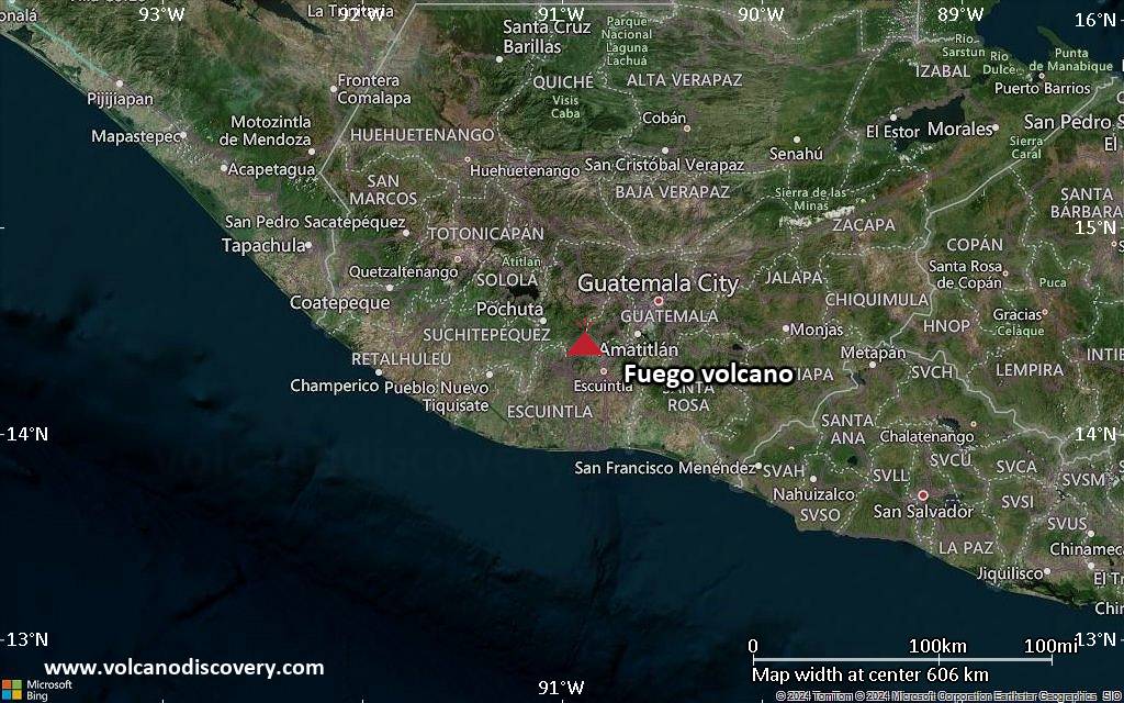
Fuego (Guatemala): Volcanic Ash Advisory Center Washington (VAAC) issued the following report: FRQT EMS ON WEBCAM
Puracé (Colombia): Volcanic Ash Advisory Center Washington (VAAC) issued the following report: VONA RPRTS EMS
Sangay (Ecuador): Explosive activity continues. Volcanic Ash Advisory Center (VAAC) Washington warned about a volcanic ash plume that rose up to estimated 20500 ft (6200 m) altitude or flight level 205 . The full report is as follows: VA EM DETECTED to 20500 ft (6200 m) …20 May: The Instituto Geofísico-Escuela Politécnica Nacional (IG-EPN) reported that the eruption continued at Sangay between 18 May 2026 (local) and 19 May 2026 (local). The alert level remained at „2 – Yellow“ (on a 4-level scale). Source: Instituto Geofísico-Escuela Politécnica Nacional (IG-EPN) … [read more] … [show less] Current Alerts: Observatory alert level: „2 – Yellow“ (on a 4-level scale)
Reventador (Ecuador): Explosive activity continues. Volcanic Ash Advisory Center (VAAC) Washington warned about a volcanic ash plume that rose up to estimated 14000 ft (4300 m) altitude or flight level 140 . The full report is as follows: VA EM DETECTED to 14000 ft (4300 m) …20 May: The Instituto Geofísico-Escuela Politécnica Nacional (IG-EPN) reported that the eruption continued at Reventador between 18 May 2026 (local) and 19 May 2026 (local). The alert level remained at „3 – Orange“ (on a 4-level scale). Source: Instituto Geofísico-Escuela Politécnica Nacional (IG-EPN) … [read more] … [show less] Current Alerts: Observatory alert level: „3 – Orange“ (on a 4-level scale)
Sabancaya (Peru): The Centro Vulcanológico Nacional del Instituto Geofísico del Perú (CENVUL-IGP) reported that the eruption continued at Sabancaya between 18 May 2026 (local) and 19 May 2026 (local). Ash, gas, and vapor plume(s) rose to a maximum of 600 m (1,969 ft) above the vent. Thermal anomalies were detected 6 times. A total of 5 earthquakes related to the movement of magma and gases were recorded. Ground deformation data indicated minor inflation centered on the N sector of the volcano complex (nevado Hualca Hualca, located approximately 7 km N). The alert level remained at „Orange“ (level 3 on a 4-level scale). Activity also included: thermal anomaly(ies). Source: Centro Vulcanológico Nacional del Instituto Geofísico del Perú (CENVUL-IGP) … [read more] … [show less] Current Alerts: Observatory alert level: „Orange“ (level 3 on a 4-level scale)