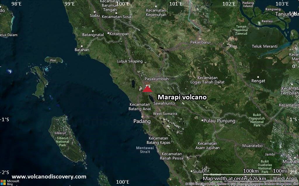
Marapi Volcano Volcanic Ash Advisory: ERUPTION REPORTED AT 02/1256Z WITH NO HEIGHT INDICATED

Volcanic Ash Advisory Center Darwin (VAAC) issued the following report:

FVAU05 at 13:26 UTC, 02/06/26 from ADRM
VA ADVISORY
DTG: 20260602/1326Z
VAAC: DARWIN
VOLCANO: MARAPI 261140
PSN: S0023 E10028
AREA: INDONESIA
SOURCE ELEV: 2885M AMSL
ADVISORY NR: 2026/69
INFO SOURCE: CVGHM
ERUPTION DETAILS: ERUPTION REPORTED AT 02/1256Z WITH NO
HEIGHT INDICATED
EST VA DTG: 02/1310Z
EST VA CLD: SFC/FL120 S0027 E10019 – S0017 E10019 – S0015
E10041 – S0035 E10042 MOV N 05KT
FCST VA CLD +6 HR: 02/1910Z SFC/FL120 S0029 E10017 – S0016
E10017 – S0008 E10141 – S0053 E10143
FCST VA CLD +12 HR: 03/0110Z NO VA EXP
FCST VA CLD +18 HR: 03/0710Z NO VA EXP
RMK: VA NOT IDENTIFIABLE FROM SATELLITE. VA EXPECTED TO
DISSIPATE WITHIN 6-9 HOURS. HEIGHT AND FORECAST DERIVED FROM
RECENT ERUPTIVE BEHAVIOUR AND MODEL GUIDANCE.
NXT ADVISORY: NO LATER THAN 20260602/1926Z=

Ibu Volcano Volcanic Ash Advisory: VA TO FL060 LAST REPORTED AT 02/1000Z MOV NE to 6000 ft (1800 m)

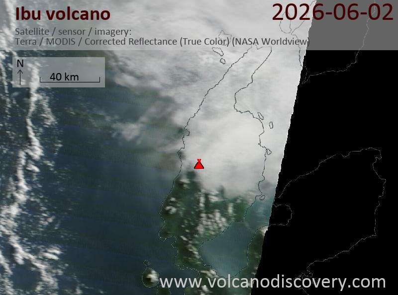
Satellite image of Ibu volcano on 2 Jun 2026

Explosive activity continues. Volcanic Ash Advisory Center (VAAC) Darwin warned about a volcanic ash plume that rose up to estimated 6000 ft (1800 m) altitude or flight level 060 and is moving at 05 kts in NE direction.
The full report is as follows:

FVAU01 at 10:56 UTC, 02/06/26 from ADRM
VA ADVISORY
DTG: 20260602/1100Z
VAAC: DARWIN
VOLCANO: IBU 268030
PSN: N0129 E12738
AREA: INDONESIA
SOURCE ELEV: 1325M AMSL
ADVISORY NR: 2026/621
INFO SOURCE: HIMAWARI-9, CVGHM
ERUPTION DETAILS: VA TO FL060 LAST REPORTED AT 02/1000Z MOV
NE
EST VA DTG: 02/1040Z
EST VA CLD: SFC/FL060 N0126 E12740 – N0128 E12734 – N0147
E12734 – N0150 E12750 – N0139 E12756 MOV NE 05KT
FCST VA CLD +6 HR: 02/1640Z SFC/FL060 N0128 E12735 – N0147
E12734 – N0151 E12746 – N0139 E12755 – N0126 E12740
FCST VA CLD +12 HR: 02/2240Z SFC/FL060 N0126 E12740 – N0128
E12734 – N0145 E12731 – N0148 E12748 – N0134 E12755
FCST VA CLD +18 HR: 03/0440Z SFC/FL060 N0126 E12740 – N0128
E12734 – N0146 E12731 – N0150 E12746 – N0139 E12755
RMK: DISCRETE VA EMISSIONS NOT IDENTIFIABLE ON SATELLITE
IMAGERY DUE TO MET CLOUD. INTERMITTENT EMISSIONS EXPECTED TO
BE ONGOING. VA HEIGHT AND FORECAST BASED ON REPORTS AND
MODEL GUIDANCE.
NXT ADVISORY: NO LATER THAN 20260602/1700Z=

Dukono Volcano Volcanic Ash Advisory: VA TO FL080 MOV E LAST REPORTED AT 02/0547Z to 8000 ft (2400 m)

Satellite image of Dukono volcano on 2 Jun 2026

Explosive activity continues. Volcanic Ash Advisory Center (VAAC) Darwin warned about a volcanic ash plume that rose up to estimated 8000 ft (2400 m) altitude or flight level 080 .
The full report is as follows:

FVAU03 at 07:23 UTC, 02/06/26 from ADRM
VA ADVISORY
DTG: 20260602/0720Z
VAAC: DARWIN
VOLCANO: DUKONO 268010
PSN: N0142 E12754
AREA: INDONESIA
SOURCE ELEV: 1229M AMSL
ADVISORY NR: 2026/322
INFO SOURCE: HIMAWARI-9, CVGHM
ERUPTION DETAILS: VA TO FL080 MOV E LAST REPORTED AT
02/0547Z
EST VA DTG: 02/0700Z
EST VA CLD: SFC/FL080 N0136 E12747 – N0148 E12746 – N0212
E12840 – N0142 E12901 – N0117 E12837 MOV E 05KT
FCST VA CLD +6 HR: 02/1300Z SFC/FL080 N0137 E12747 – N0149
E12746 – N0219 E12834 – N0150 E12900 – N0123 E12840
FCST VA CLD +12 HR: 02/1900Z SFC/FL080 N0135 E12747 – N0150
E12743 – N0230 E12819 – N0209 E12852 – N0131 E12846
FCST VA CLD +18 HR: 03/0100Z SFC/FL080 N0135 E12747 – N0149
E12742 – N0221 E12810 – N0205 E12835 – N0129 E12830
RMK: CONTINUOUS VA PARTIALLY IDENTIFIABLE ON EARLIER
SATELLITE IMAGERY MOVING E. HEIGHT AND MOVEMENT BASED ON
SATELLITE IMAGERY, GROUND REPORTS AND MODEL GUIDANCE.
NXT ADVISORY: NO LATER THAN 20260602/1320Z=

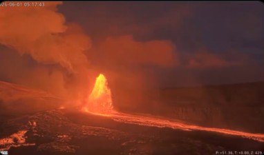
Kilauea volcano (Hawai’i): 48th lava fountaining episode

Impressive lava fountains from the north vent in Halema’uma’u crater during 48 episode (image: HVO/USGS))

A new lava fountaining episode 48 at Halemaʻumaʻu crater began at 4:40 a.m. HST on June 1 and ended abruptly at 1:37 p.m. the same day, lasting just under nine hours. The activity was confined to the north vent, which produced continuous fountaining until the final minute, when it transitioned to gas jetting. The south vent did not generate fountains during this episode, though it intermittently spattered and produced occasional jetting bursts.

The instantaneous effusion rate peaked at roughly 415 cubic yards (320 cubic meters) per second shortly before 6:00 a.m., with an average rate of about 245 cubic yards (185 cubic meters) per second over the full episode. In total, an estimated 7.3 million cubic yards (5.6 million cubic meters) of lava erupted, resurfacing approximately 40% of the Halemaʻumaʻu crater floor. The Uēkahuna tiltmeter (UWD) measured about 17.1 microradians of deflation during the event.

The vigorous north‑vent fountain generated intense heat and ash, feeding a plume that rose to about 25,000 feet (7,600 meters) above sea level, according to radar observations from the National Weather Service and the Washington VAAC. Early in the event, low‑level northeast trade winds carried most tephra southwest of Halemaʻumaʻu. As the plume expanded upward, southerly winds between 10,000 and 20,000 feet began pushing it northward, allowing ash and pumice to disperse around the rim of Kaluapele (Kīlauea caldera).

At 5:31 a.m., the National Weather Service issued an ashfall advisory for southeastern and northeastern areas of Hawaiʻi Island, including Hawaiʻi Volcanoes National Park. Sparse pumice up to 1–2 inches (2–5 cm) in diameter fell at Uēkahuna overlook, Nāmakanipaio campground, and along Highway 11 west to the 34‑mile marker. Fine ash and Peleʻs hair accumulated around Kīlauea Visitor Center and in communities northeast of the caldera—Mauna Loa Estates, ʻŌhia Estates, and Volcano Village—as well as west of the caldera between mile markers 34 and 36. Very light ashfall was reported as far away as Mountain View. A commercial pilot also reported a sulfur‑and‑ash cloud near Laupāhoehoe, prompting several morning flight cancellations and diversions to Hilo.

A small earthquake swarm on the southwest side of Halemaʻumaʻu began around 12:15 p.m., shortly before the episode ended, and continued sporadically for several hours afterward. About 15 earthquakes were large enough to locate, ranging from just under magnitude 1 to magnitude 2.2. Three events were magnitude 2 or greater, eight were between magnitude 1 and 2, and four were below magnitude 1. These earthquakes had no observable effect on the eruption or the crater.

Source: USGS Hawaiian Volcano Observatory volcano activity update 2 June 2026
Ibu Volcano Volcanic Ash Advisory: VA TO FL060 OBS MOV NE OBS VA DTG: 01/2240Z to 6000 ft (1800 m)

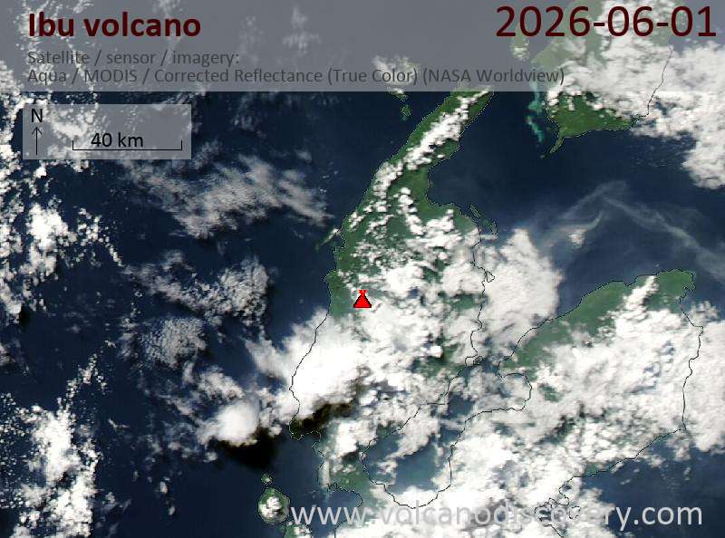
Satellite image of Ibu volcano on 1 Jun 2026

Explosive activity continues. Volcanic Ash Advisory Center (VAAC) Darwin warned about a volcanic ash plume that rose up to estimated 6000 ft (1800 m) altitude or flight level 060 .
The full report is as follows:

FVAU01 at 23:00 UTC, 01/06/26 from ADRM
VA ADVISORY
DTG: 20260601/2300Z
VAAC: DARWIN
VOLCANO: IBU 268030
PSN: N0129 E12738
AREA: INDONESIA
SOURCE ELEV: 1325M AMSL
ADVISORY NR: 2026/619
INFO SOURCE: HIMAWARI-9, CVGHM
ERUPTION DETAILS: VA TO FL060 OBS MOV NE
OBS VA DTG: 01/2240Z
OBS VA CLD: SFC/FL060 N0125 E12737 – N0129 E12734 – N0143
E12746 – N0137 E12755 – N0127 E12754 MOV NE 05KT
FCST VA CLD +6 HR: 02/0440Z SFC/FL060 N0124 E12734 – N0145
E12733 – N0146 E12745 – N0138 E12755 – N0129 E12753
FCST VA CLD +12 HR: 02/1040Z SFC/FL060 N0126 E12739 – N0128
E12733 – N0142 E12729 – N0144 E12742 – N0137 E12751
FCST VA CLD +18 HR: 02/1640Z SFC/FL060 N0126 E12738 – N0128
E12734 – N0142 E12730 – N0144 E12740 – N0134 E12751
RMK: DISCRETE VA EMISSIONS IDENTIFIABLE ON RECENT RGB
SATELLITE IMAGES MOVING NE. GROUND REPORTS INDICATE
INTERMITTENT EMISSIONS ARE ONGOING. VA HEIGHT AND MOV BASED
ON REPORTS AND MODEL GUIDANCE. LOW CONFIDENCE IN FORECAST
DUE TO LIGHT AND VRB WINDS.
NXT ADVISORY: NO LATER THAN 20260602/0500Z=